
Center of Expertise in Marine Mammalogy: Scientific Research Report 2009-2011
Table of Contents
3.0 Marine Mammal - Human Interactions
3.1 Harbour seals as indicators of food web contamination in Canada (Peter S. Ross, Michel Lebeuf)
Persistent organic pollutants (POPs) refer to chemicals that possess four key properties: they are persistent, bioaccumulative, toxic, and subject to long-range transport. Members of this class include the polychlorinated biphenyls (PCBs), dioxins (polychlorinated dibenzo-p-dioxins or PCDDs), and DDT. While most POPs have been regulated in Canada and are presently subject to the international Stockholm Convention of 2001, concerns linger owing to the persistence of these contaminants. The use of DDT as an insecticide led to complete reproductive failure of many fish-eating birds in North America and Europe. PCBs have been associated with reproductive failure, immunotoxicity and endocrine disruption in marine mammals. Dioxin-related compounds have been implicated in the failure of lake trout to reproduce in Lake Ontario during the period 1945-80.
Persistent organic pollutants are lipophilic and partition readily into the fatty tissues of biota. The metabolic recalcitrance of POPs results in their biomagnification from one trophic level to the next, with high trophic level species having up to 109 times higher concentrations than surrounding water. Ecotoxicological research and monitoring programs provide insight into conservation priorities for some marine mammal populations, but also into human health risks associated with the consumption of aquatic foods. Since POPs enter the environment from a combination of numerous point and non-point sources, marine mammal studies can provide an integrated signal of contaminants in food webs, and can inform regulations, mitigation, conservation and fisheries management. In addition to local and regional sources, long range transport via atmospheric processes and biological migrations bring contaminants into coastal regions.

Harbour seals haul out on intertidal rocks in the Strait of Georgia, British Columbia, Canada.
Photo: Peter S. Ross.
POPs of concern in Canada include the PCBs, dioxins, furans, organochlorine pesticides including DDT, as well as polybrominated diphenylethers (PBDEs). High levels of PCBs have been reported in British Columbia's resident and transient killer whales (Orcinus orca), and the St Lawrence estuary beluga whales (Delphinapterus leucas). For these Species at Risk Act (SARA)-listed cetaceans, POPs have been identified as conservation-level concerns, requiring scrutiny and action in the context of Recovery Strategies. While the 'legacy' POPs have declined in Canadian marine mammals since regulations were implemented in the 1970s, emerging contaminants include the PBDEs which saw a steady increase in marine mammals from the early 1980s prior to partial source controls in 2004.
Harbour seals (Phoca vitulina) are small pinnipeds that are widely distributed throughout the northern hemisphere. They are found on Canada's Pacific and Atlantic coasts, as well as in the Arctic and the St Lawrence estuary (Fig. 8). They are considered omnivorous but have a preference for small, lipid-rich prey including hake (Merluccius sp.), herring (Clupea sp.), and tomcod (Microgadus sp.). The harbour seal has become a useful 'sentinel' of marine food web contamination because of its abundance, distribution, high trophic level, non-migratory nature, and relative ease of handling.

Figure 8: Harbour seals (Phoca vitulina) are pinnipeds that are widely distributed along Canada's Pacific, Atlantic and Arctic coasts (shaded areas).
In an effort to characterize contaminant levels and risks in this sentinel species, harbour seal pups were live-captured from intertidal haul-out sites using a small craft and manual restraint. Skin/blubber biopsies, as well as blood samples, were collected under aseptic conditions. Samples stored until analysis for PCBs (n = 160) and PBDEs (n = 44) at the DFO Laboratory of Expertise for Aquatic Chemical Analyses (LEACA) in Sidney BC.
Results reveal that moderate concentrations of both PCBs and PBDEs are found in seals from all four study areas (Fig. 9). Despite regulations, PCBs are found at higher concentrations than the PBDEs. PCB levels were highest in seals from the St Lawrence estuary, reflecting their proximity to industrial sources in the region. On the other hand, PBDE concentrations were highest in seals from the Strait of Georgia, British Columbia, likely reflecting the proximity to major municipalities which are know to release PBDEs through sewage effluent (e.g. Vancouver). While the relatively low levels of both PCBs and PBDEs in seals from Newfoundland and Labrador likely indicate minimal local contributions, results nonetheless highlight the ubiquitous distribution of these POPs in coastal food webs.

Figure 9: Harbour seals from four areas in Canada reveal PCB and PBDE contamination of coastal food webs. PCBs continue to be found in high trophic level species, despite regulations enacted in the 1970s. PBDEs face current regulatory scrutiny following rapid increases in biota.
A divergent history of uses, emissions and regulations provide an asynchronous backdrop for PCB and PBDE concentrations in the marine environment, with consequences for adjacent food webs. Harbour seals provide an integrated measure of coastal food web contamination, thereby generating insight into contaminants of concern in the coastal environment. Results provide a backdrop for ecosystem-based management, and help to prioritize chemical regulations, conservation objectives and other management strategies.
3.2 Bowhead Whale Surveys and Satellite Tagging: Beaufort Sea, 2007-2010 (Lois Harwood)
Bowhead whales of the Bering Sea population (also known as the Bering-Chukchi-Beaufort population B-C-B) winter in the Bering Sea, and return annually to summer range in the Canadian Beaufort Sea and Amundsen Gulf. Some of the locations that feeding bowhead whales use in the Canadian Beaufort Sea include areas that have been subject to hydrocarbon exploration activity in the 1980's, and more recently, 2-D ad 3-D seismic surveys in 2001- 2002, 2006-2010. While there was no offshore seismic activity in the Beaufort Sea in 2011, at least two programs are envisaged for 2012. It is also of note that the bowhead whale fall migration route intersects areas of interest to the hydrocarbon industry in the Alaskan Beaufort Sea and in the central Chukchi Sea, including Lease 193 which is active at the present time.
During July, bowheads are widely distributed throughout the offshore Canadian Beaufort Sea, singly or in small (2-3 surfaced animals) groups. By early to mid-August, the whales aggregate to feed in specific, recurrent areas on the summer range. Bowhead feeding aggregations occur where oceanographic conditions favour the concentration of crustaceous zooplankton, their main prey item, and indeed they must seek out areas where prey are adequately concentrated in order to meet their annual energy requirements. Oceanographic features that lead to upwelling of nutrient rich waters are particularly important in determining zooplankton distribution. In the southeastern Beaufort Sea, sampling of plankton in close proximity to feeding bowhead whales revealed predominantly (76-92%) copepods (Limnocalanus macrurus, Calanus hyperboreus, Calanus glacialis), as well as gammariid and hyperiid amphipods, euphausiids, mysids and isopods as the major prey items.
Our bowhead survey and tagging studies were done to update our knowledge of bowhead distribution, habitat use and behaviour in the SE Beaufort Sea, the latter in cooperation with scientists and harvesters from Alaska. Additional outcomes of this work were the provision of real-time bowhead location and sighting data from the aerial survey to other scientists working on a concurrent oceanographic sampling project, and inclusion in a strategy for mitigation of the potential effects of seismic noise on bowheads in the southeast Beaufort Sea.
Strip-transect systematic aerial surveys were conducted over the Canadian Beaufort Sea in late August of 2007, 2008 and 2009 to examine the distribution of bowhead whales (Balaena mysticetus). A total of 24-26 N-S transect lines were flown in each survey, all under favourable survey conditions, along lines of longitude spaced at 15'. A total of 334 bowhead whales (244 sightings) including 10 calves, were observed on-transect by primary observers, mostly as individuals (76.6%) and groups of two (14.3%). The study area was subsequently divided into 20 km x 20 km grid cells, with the grid cell dimensions equal to the transect spacing. Extrapolation of visible, surfaced whale counts on transect segments to unsurveyed areas in each grid cell were summed to yield an estimated 1,320 (95% CI 1036 to 1603) bowheads visible at the surface during the 2007 survey. When an approximate correction for submerged whales was applied, an estimated 5,280 bowheads or at least half of the current estimate of stock size was estimated to have been in the study area at the time of the flying.
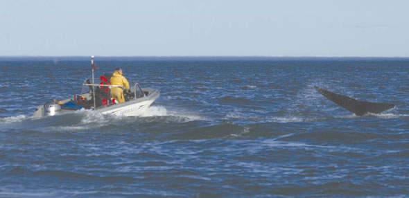
Bowhead tagging.
Photo: DFO
Bowheads aggregated in nine geographic locations within the study area in the 2007-2009 survey series. Not all of the nine areas were used in all years, and no more than six areas were used in any given year. The shallow, shelf waters offshore of the Tuktoyaktuk Peninsula were the most attractive to bowheads in all years of the 2007-2009 survey series, with 47.3 % of all whales sighted (66.5% of sightings). The other 8 areas where bowheads aggregated had from 1.5% to 6.3% of the total on-transect bowhead whales, and in total (28.1%) the importance of these areas to bowheads did not equal that of the Tuktoyaktuk Peninsula aggregation area, at least in terms of numbers sighted. The propensity of bowheads to aggregate, and a real-time knowledge of the aggregation areas they use in a given season, provides a framework for the establishment of mitigative measures relating to seismic surveys in the Beaufort Sea.
In 2005, the Alaska Department of Fish and Game began a cooperative research project to study movements and habitat use of the western Arctic stock of bowhead whales (Balaena mysticetus). In 2007-2010, DFO Science and whalers from Canada collaborated on this project to deploy satellite tags on bowhead whales in Canada, to compliment the concurrent deployment of tags in Alaska. In total, 59 satellite transmitters were placed on bowhead whales in Alaska and Canada between 2006 and 2010, 21 of these in Canadian waters. Tagging in consecutive years has allowed us to examine variability in movements, wintering areas, and the timing of migration among years. We have identified several areas of concentrated use throughout the range of bowhead whales, and have documented interactions with seismic activity in the offshore. More detailed analyses are underway, and will include bowhead movements relative to industrial activities and oceanographic factors that influence movements and bowhead foraging.
- Date modified: