
Hydrography data processing techniques
Learn how the Canadian Hydrographic Service (CHS) converts raw data, uses processing software and extracts information.
On this page
Converting raw data
The CHS converts raw data into a format that can be processed. This raw data includes:
- sonar readings
- depth soundings
- satellite imagery
Data processing involves:
- removing any systematic and accidental errors
- applying tide and other corrections so that all depths are referenced to an established vertical datum
- reviewing positioning and orientation information to locate depth soundings at their correct geographic coordinates
Processing software
Multibeam echosounders and other hydrography equipment can generate billions of high-resolution depth soundings.
To ensure the accuracy of the resulting navigational products, the CHS uses several techniques. The combined uncertainty and bathymetry estimator (CUBE) technique is able to process massive amounts of data rapidly. This creates statistically accurate models of the seabed.
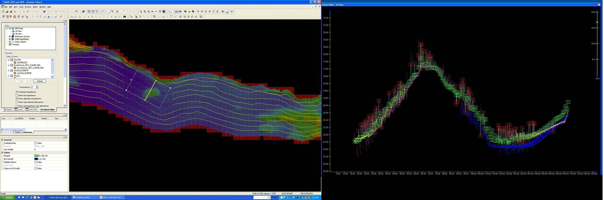
CHS utilizes CARIS Hydrographic Information Processing software to analyse multibeam echosounder datasets.
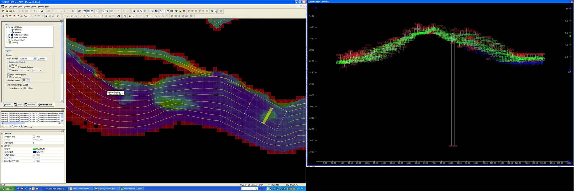
CHS hydrographers utilize complex statistical tools in which to identify navigational hazards in the multibeam datasets.
The software can then highlight mistakes that, depending on the specifications required for the product, can be:
- filtered by the software
- reviewed and edited by the hydrographer

Soundings without red or green boxes do not have any statistical weight and will not be considered at all.
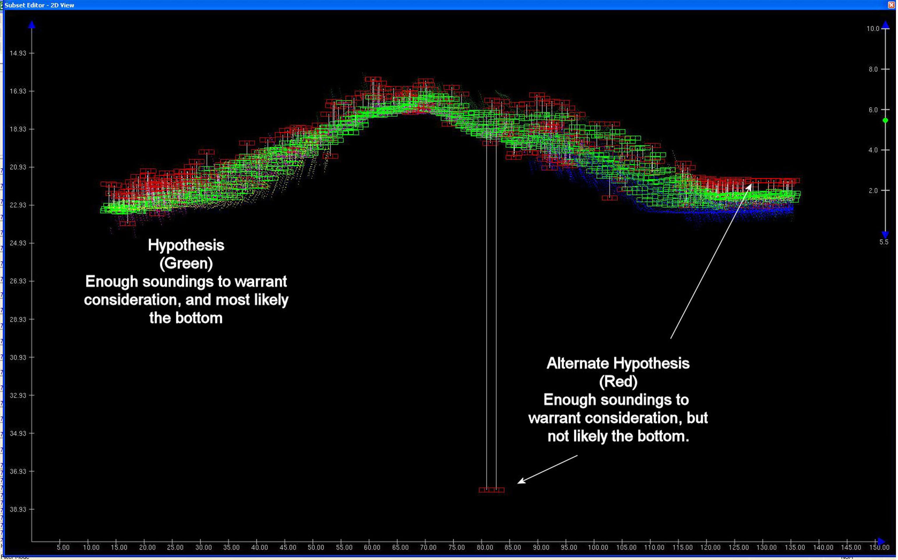
Hypothesis (Green): Enough soundings to warrant consideration, and most likely the bottom
Alternate Hypothsis (Red): Enough soundings to warrant consideration, but not likely the bottom.
Water with fewer features (or less roughosity) requires less intervention. Waters in confined waterways with more active seabeds require more attention and are typically processed with a more hands-on approach. This CUBE surface guides the hydrographer on which data to reject by showing them how statistically insignificant outliers (or mistakes) are.
Extracting information
Advanced hydrographic data processing uses a method called navigation surface to represent gridded bathymetric surfaces. Each surface represents the best estimate of the true depth of the water at precise locations across a survey area, or grid.
Using the navigation surface approach to populate a database enables hydrographers to produce or extract a variety of information products, such as:
- contours
- information on data quality
- selected soundings or depth areas
The suitability of the source data can be verified as appropriate for a particular product. Electronic navigational charts created from this data can be certified as the legal source of the bathymetric information for construction of nautical charts.
Related links
- Date modified: