
Tuvaijuittuq Marine Protected Area (MPA)
Note:
Charts, diagrams and contact information on this website are provided for information purposes only and should not be used for fishing, navigation nor other purposes. Please refer to the Marine Protected Area (MPA) Order or contact your regional Fisheries and Oceans Canada office, DFO.ArcticMPC-ArctiquePCM.MPO@dfo-mpo.gc.ca, for official coordinates.
Note:
Tuvaijuittuq was the first MPA to be designated by ministerial order under the Oceans Act in 2019.
A second ministerial order MPA under the Oceans Act was designated for Tuvaijuittuq on July 24, 2024. This order describes human activities that are allowed in the area for a period of up to 5 years while the Government of Canada works collaboratively with Inuit and northern partners to consider long-term protection priorities, including supporting an Inuit-led Protected and Conserved Area (IPCA).
On this page
- At-a-glance
- Ecosystem
- Management and conservation
- Research
- Designation report
- Publications
- Related links
At-a-glance

Map: Tuvaijuittuq Marine Protected Area
Dataset for all MPAs available.
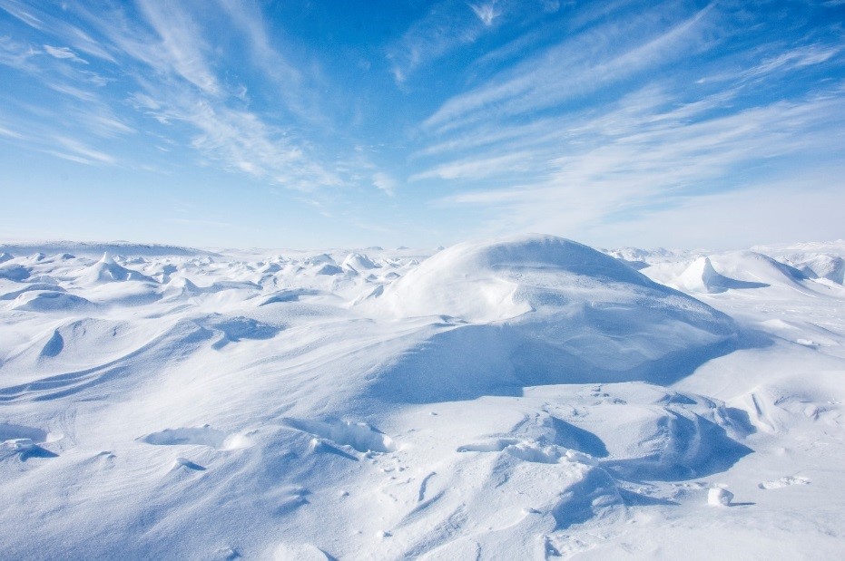
Multi-year ice in Tuvaijuittuq, 2018 © Pierre Coupel, DFO, MAP - Last Ice
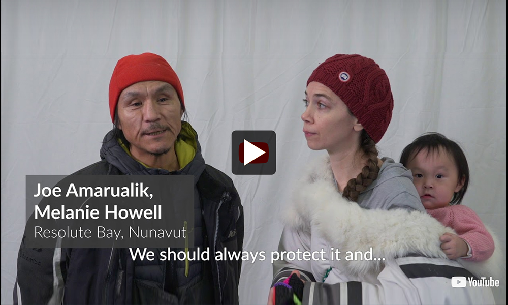
Video: Tuvaijuittuq Marine Protected Area
Location
- Includes the marine waters off the northwest coast of Ellesmere Island, Nunavut in the Arctic Ocean
- Starting from the low-water mark and extending to the outward boundary of Canada’s Exclusive Economic Zone
- Encompasses areas within the Arctic Basin and Arctic Archipelago Bioregions
Size (km2) contribution to Marine Conservation Targets
About 319,411 km2
% coverage contribution to Marine Conservation Targets
About 5.55%
Date of designation (by ministerial order)
August 2024
Conservation objective
To contribute to the conservation, protection and understanding of the natural diversity, productivity and dynamism of the High Arctic sea ice ecosystem.
Prohibitions
Under the order, no new or additional human activities will be allowed to occur in the area for a period of up to 5 years, with the following exceptions:
- the exercise of Inuit rights respecting wildlife harvesting as provided for under the Nunavut Agreement
- marine scientific research consistent with MPA conservation objectives
- safety, security and emergency activities
- certain activities carried out by a foreign national, entity, ship or state
Environmental context
Tuvaijuittuq, meaning “the place where the ice never melts” in Inuktut, is located in an area that has been used by Inuit for travel and harvesting. This culturally and historically significant marine area is considered globally, nationally and regionally unique due to the presence of multi-year pack ice.
This remote region has the oldest and thickest sea ice in the Arctic Ocean. As sea ice continues to decline in the Arctic due to climate change, the ice in this region is expected to last the longest of anywhere in the Canadian Arctic. This makes Tuvaijuittuq a unique and potentially important future summer habitat for ice-dependent species, including walrus, seals and polar bears.
Over the past 3 decades, the Arctic Ocean has lost an area of sea ice equivalent to the provinces of Manitoba, Quebec and Nova Scotia combined. This makes the Arctic more accessible to commercial activities, such as shipping, fisheries, tourism and mining. A better understanding of this region will be critical as climate change continues to result in the dramatic declines in sea ice. Although historically this area has been used by Inuit, there are currently no permanent human settlements within or adjacent to Tuvaijuittuq.
The 2 closest inhabited areas to Tuvaijuittuq include the High Arctic community of Grise Fiord (Aujuittuq in Inuktitut), located 358 km from the nearest MPA boundary, and the Canadian Forces station (CFS) Alert located at the northernmost tip of Ellesmere Island. Grise Fiord is Canada’s northernmost hamlet and CFS Alert is the northernmost inhabited settlement in the world.
Ecosystem
Tuvaijuittuq is an area of particular ecological importance due to the presence of old, thick, multi-year pack ice. Sea ice provides habitat for ice-adapted organisms, such as critically important species of algae, that provide energy for the entire Arctic marine food web, from microscopic organisms all the way up to marine mammals and polar bears. The seabed community in this area is more abundant and diverse than previously expected, which may have important implications for larger animals, such as walrus and bearded seals that feed on benthos (bottom-dwelling organisms). Tuvaijuittuq’s role in Arctic marine ecosystems is expected to become even more critical as Arctic sea ice continues to decline at a rapid pace.
In addition to multi-year ice pack, Tuvaijuittuq supports distinctive coastal and fiord ecosystems that are influenced by the Ellesmere Island ice shelves. These ice shelves play an important role in connecting the terrestrial, coastal and offshore ecosystems, and are home to their own unique communities of organisms. These areas provide important nesting and feeding habitat for the endangered Ivory Gull and other species at risk, such as the Red Knott and Ross’s Full. Within Tuvaijuittuq, Archer Fiord is home to the northernmost distribution of walruses and narwhals in the eastern Canadian Arctic.
Tuvaijuittuq is also unique due to large-scale Arctic Ocean circulation, namely the Transpolar Drift and Beaufort Gyre. The Transpolar Drift carries sea ice and water across the Arctic Ocean, all the way from the Laptev Sea in northern Siberia to Tuvaijuittuq where multi-year sea ice accumulates. The Beaufort Gyre, a wind-driven Arctic Ocean current that brings a significant amount of fresh water from North American and Eurasian Arctic rivers, also influences ecosystem processes in Tuvaijuittuq. The combined influence of these large-scale currents, together with regional processes, shape Tuvaijuittuq’s ecosystem. In turn, Tuvaijuittuq plays a key role in shaping downstream ecosystems in productive areas such as Baffin Bay, Davis Strait and as far as the Labrador Sea.

Crinoids from marine waters under the sea ice in Tuvaijuittuq, 2018 © Steve Duerksen, DFO, MAP - Last Ice
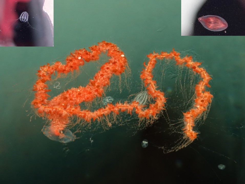
Siphonophore and Ctenophores (top) from marine waters under the sea ice in Tuvaijuittuq, 2018 © Pascal Tremblay and Pierre Coupel, DFO, MAP - Last Ice
Management and conservation
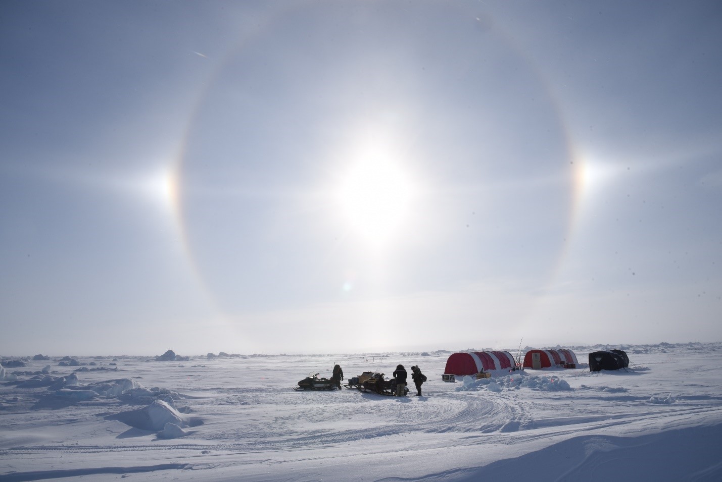
2019 Multidisciplinary Arctic Program (MAP) ice camp in Tuvaijuittuq © Steve Duerksen, DFO, MAP - Last Ice
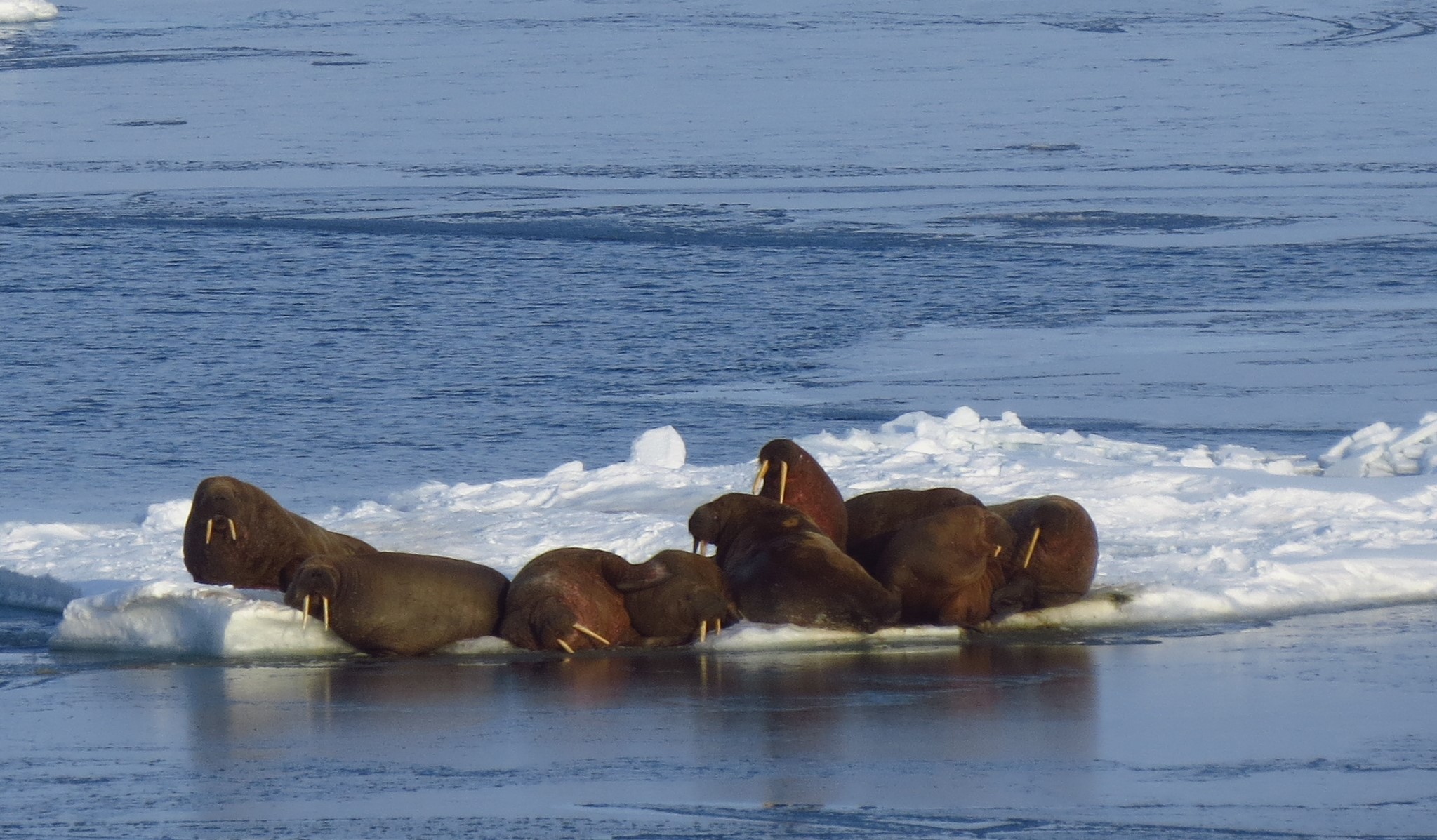
Atlantic walrus on an ice floe in Archer Fiord, Nunavut, 2023 © Megan Lee, DFO, ArcticCORE (Conservation, Observation, Research, and Engagement)
Collaboration and partnership is vitally important to effective management and conservation of the Canadian Arctic marine environment. Work to establish Tuvaijuittuq MPA has been led collaboratively by the Qikiqtani Inuit Association, the Government of Canada and the Government of Nunavut. In 2019, the Inuit Impact and Benefit Agreement negotiated with the Qikiqtani Inuit Association for the establishment of Tallurutiup Imanga National Marine Conservation Area (NMCA) included a commitment to co-establish protection in Tuvaijuittuq. To support advancement of marine protection in Tuvaijuittuq, a memorandum of understanding between the Government of Canada, the Government of Nunavut and the Qikiqtani Inuit Association was also signed in 2019. A whole-of-government approach was involved in the negotiation of both agreements and will continue as work advances for this site.
The primary goal of the Tuvaijuittuq MPA is to protect and conserve biological diversity, structural habitat and ecosystem function while additional information is collected to inform a collaborative approach to long-term protection. Ongoing research activities in the area will be allowed to continue, and in combination with Inuit Qaujimajatuqangit, will provide a strong foundation for assessing an approach to long-term protection.
Inuit Qaujimajatuqangit is a source of information passed down from generation to generation that encompasses Inuit beliefs, principles and values, together with traditional knowledge, skills and attitudes. Inuit Qaujimajatuqangit is a foundational knowledge system which will inform the Qikiqtani Inuit Association’s vision for an Inuit-led Protected and Conserved Area in the future. This work will take into consideration the social, environmental, administrative and economic benefits and impacts of establishing long-term marine protection in the region.
As Tuvaijuittuq is partially located within the Nunavut Settlement Area it is subject to the Nunavut Agreement. The lead federal authority for the Tuvaijuittuq MPA, Fisheries and Oceans Canada, has overall responsibility for ensuring compliance with, and enforcement of, the ministerial order. Enforcement activities are undertaken through the Department’s legislated mandate and responsibilities under the Oceans Act, the Fisheries Act, and other legislation applicable to fisheries conservation, environmental protection, habitat protection and marine safety. Enforcement officers designated by the Minister, pursuant to section 39 of the Oceans Act, will enforce the ministerial order for this area. Anyone contravening the order commits an offence and can be subject to the punishments listed in section 37 of the Oceans Act.
For more information about the Tuvaijuittuq MPA, please contact:
Marine Planning and Conservation
Fisheries and Oceans Canada (Arctic Region)
Email: DFO.ArcticMPC-ArctiquePCM.MPO@dfo-mpo.gc.ca
Research
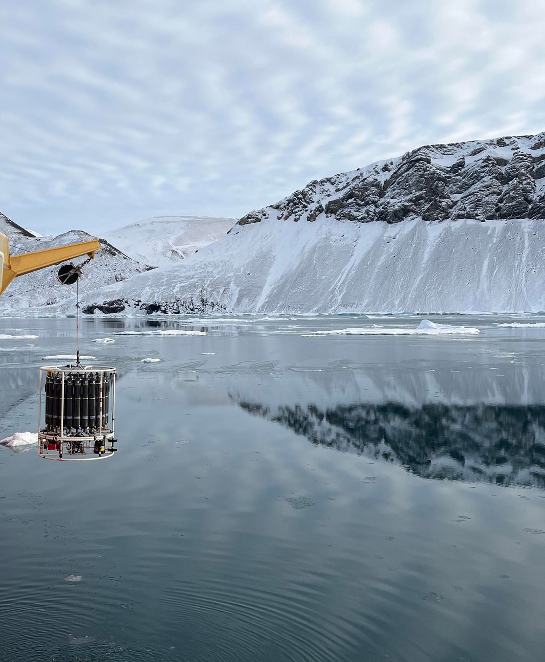
Water sampling in Archer Fiord, Nunavut onboard the CCGS Amundsen, 2023 © Megan Lee, DFO, ArcticCORE (Conservation, Observation, Research, and Engagement)
Fisheries and Oceans Canada, in collaboration with international experts, academia and other government departments, is conducting ongoing multidisciplinary research in Canada’s High Arctic. Initial research began in 2018 through the Multidisciplinary Arctic Program (MAP) - Last Ice, to inform an ecosystem review. The review identified the current state of knowledge for the area, including knowledge gaps and unique ecological features in Tuvaijuittuq.
Current research in Tuvaijuittuq is continuing through the follow-up ArcticCORE (Conservation, Observation, Research, and Engagement), a multi-tiered program that includes:
- ship-based research
- ice-based research
- aerial marine mammal surveys
- long-term observations (e.g., moorings, community-based observations, monitoring)
The intent of ArcticCORE is to characterize the unique ecosystems of Tuvaijuittuq and connectivity to adjacent ecosystems. This research will inform future decisions on long-term protection.
Designation report
The ministerial order and the regulatory impact analysis statement for Tuvaijuittuq MPA were published in Canada Gazette, Part II on July 24, 2024. As per subsection 35.1 (4) of the Oceans Act, Fisheries and Oceans Canada has published the Report on the designation of the Tuvaijuittuq Marine Protected Area (2024).
Publications
- Tuvaijuittuq Marine Protected Area (MPA) annual report 2024
- Tuvaijuittuq Marine Protected Area (MPA) annual report 2023
- Multi-decadal analysis of sea ice type, extent and distribution patterns in Tuvaijuittuq and adjacent regions (2023)
- Multidisciplinary Arctic Program (MAP) - Last Ice: Expedition report, spring 2018 field campaign (2023)
- Summary of marine mammal aerial surveys in Norwegian Bay and Ellesmere Island, Nunavut in 2022 (2023)
- Net heterotrophy in High Arctic first-year and multi-year spring sea ice (2022)
- Arctic climate and ecosystem linkages: impacts and feedback (Chapter 6) (2021)
- Contribution of snow to Arctic first-year and multi-year sea ice mass balance within the Last Ice Area (2021)
- Marine mammal biodiversity and rare narwhal (Monodon monoceros) observations near northern Ellesmere Island, Nunavut, Canada (2021)
- Narwhal (Monodon monoceros) detection by infrared flukeprints from aerial survey imagery (2021)
- Biophysical and ecological overview of the Tuvaijuittuq area (2020)
- Fatty acids and stable isotope signatures of first-year and multiyear sea ice in the Canadian High Arctic (2020)
- Contrasting ice algae and snow-dependent irradiance relationships between first-year and multiyear sea ice (2019)
- Identification of ecological significance, knowledge gaps and conservation objectives for the Tuvaijuittuq Marine Protected Area (Canadian Science Advisory Secretariat Science Response - 2020/056)
- Multidisciplinary Arctic Program (MAP) - last ice: Science plan, spring 2019 field campaign (2019)
- Novel observations of Atlantic walruses (Odobenus rosmarus rosmarus) in Archer Fjord, northern Ellesmere Island, Nunavut, Canada (2019)
- Polar Continental Shelf Program Science Report 2019: Logistical support for leading-edge scientific research in Canada and its Arctic (2019)
- State of Canada’s Arctic seas (2019)
- Tuvaijuittuq news release (2019)
- Multidisciplinary Arctic Program (MAP) - Last Ice: Science logistics meeting report, spring 2018 field campaign (2018)
- Multidisciplinary Arctic Program (MAP) - Last Ice: Science plan, spring 2018 field campaign (2018)
- Multidisciplinary Arctic Program (MAP) - Last Ice: Science planning workshop, January 16-17, 2018 (2018)
- Arctic sea ice (Chapter 5) (2017)
- Temporal and spatial patterns of ship traffic in the Canadian Arctic from 1990 to 2015 (2017)
- Assessment of historical changes (1959-2012) and the causes of recent break-ups of the Petersen ice shelf, Nunavut, Canada (2015)
- Ecological consequences of sea-ice decline (2013)
- Identification of ecologically and biologically significant areas in the Canadian Arctic (Canadian Science Advisory Secretariat Research Documents - 2011/070)
- Predicting 21st-century polar bear habitat distribution from global climate models (2009)
Related links
- Aquatic Climate Change Adaptation Services Program: Projections of climate change impacts in the Arctic Ocean (2018)
- Oceans North. Canada’s Arctic Marine Atlas
- Circumpolar Biodiversity Monitoring Program: Canadian Implementation (2016)
- Ice Shelves (2017)
- Inuit Circumpolar Council
- World Wildlife Fund. Last Ice Area
- Oceans North
- Polar Knowledge Canada
- Date modified: