
From Static to Dynamic: S-100 and the Future of Maritime Navigation
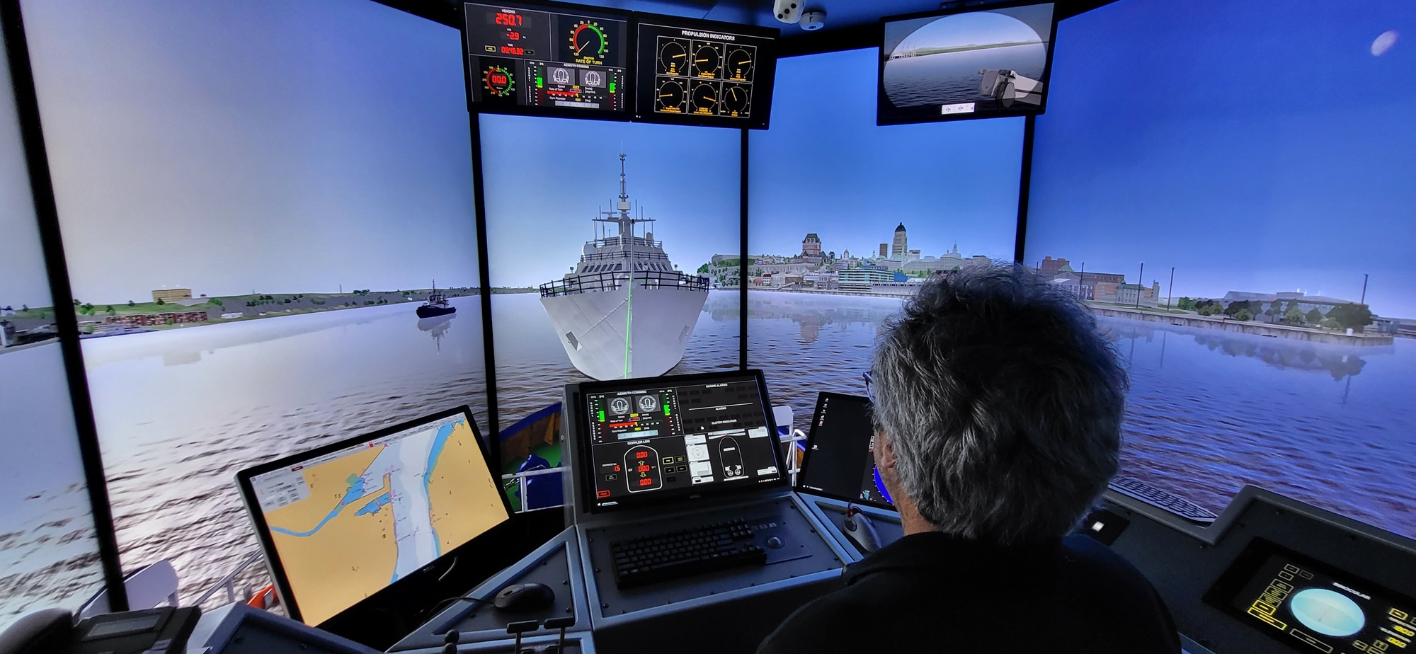
A marine navigator in a simulator uses digital charts to guide vessels safely in a busy waterway. Credit: Corporation des pilotes du Bas Saint-Laurent (CSEM)
We live in a globally interconnected world. As we learned during the pandemic, and are now being reminded by U.S. tariff negotiations on a range of products and materials, the efficiency, effectiveness and reliability of international supply chains can make all the difference when it comes to the affordability of basic needs such as groceries, building supplies, and other essentials.
“Sometimes people ask me, why should I care about things like navigational charts?” reflects Louis Maltais of the Canadian Hydrographic Service (CHS). “And I remind them: we are connected, and our connected world depends on the efficiency of our networks. Maritime waterways are like a series of highways that form a global network, and if that network is running smoothly and efficiently, that also has an impact on costs.”
Here in Canada, the marine shipping industry contributes approximately $3 billion to national GDP, with overall benefits estimated at approximately $30 billion due to its role in facilitating international trade.
To help illustrate, Maltais holds up a can of maple syrup.
“The price of this maple syrup,” he says, “is dependent on how efficiently and reliably we can move it from one place to the next, and that’s where clear navigational routes and effective maritime charting come in. It can have an impact on the price consumers in the EU pay for Canadian maple syrup, as well as the price Canadians pay for a range of goods that are shipped here from across the globe.”

CHS Director Louis Maltais holding a can of Canadian maple syrup.
Indeed, as the world has continued to evolve and become more entwined globally, mariners increasingly rely on dynamic navigational tools in the digital realm. But as that digital shift has progressed, a strong need to standardize approaches and data has also emerged. That’s why the International Hydrographic Organization (IHO) created S-100, which consists of a series of standardized digital datasets aimed at creating a universal standard for maritime data across communities concerned with nautical phenomena globally.
“So for example,” illustrates Maltais, “if I’m piloting a commercial shipping vessel to deliver goods into the global marketplace, I need to have reliable navigational charts. I need to know water levels at every point along the route, including under keel clearances, and have ongoing access to high resolution bathymetric data.”
Bathymetric data consists of topographic maps that help illustrate the features of the land that lies underneath the water. A proper understanding of bathymetric features, as well as related tides, currents and waves, are essential to safe and reliable maritime traffic. While this sort of data has been available for a long time, the digitization of it is proving revolutionary.

“As we all know,” emphasizes Maltais, “boats move, and so does the water. The key phrase when it comes to consistent digital charting under S-100 is this: From static to dynamic. Instead of referring to paper charts, some of which may become outdated, mariners can now navigate digitally in real-time, which is leaps and bounds ahead in terms of overall efficiency and reliability when compared to static charting.”
In order to be successful, the S-100 suite of maritime datasets needs to be comprehensively tested and validated, and Canada is taking a leading role. From June to November 2025, Canada is stepping up to host an international S-100 sea trial on the St. Lawrence River. A range of mariners, from large commercial shippers to hydrographic organizations, nautical pilots and other interested parties, will be able to freely access S-100 datasets and test them in real-world integrated scenarios.
These crucial tests will be “a significant step forward in the realization of products and services that meet the S-100 suite of standards,” says IHO Director John Nyberg. “The IHO Secretariat thanks Canada… and encourages all interested parties to take full advantage of this opportunity to test the S-100 systems and provide valuable feedback.”

S-100 sea trials test area in the St. Lawrence River.
This summer’s S-100 sea trials on the St. Lawrence River will be led by the Canadian Hydrographic Service, in collaboration with the Canadian Coast Guard. Registration is now open and interested mariners can learn more here.
“What we hope to achieve with these sea trials is to enhance maritime safety and transportation efficiency, all while reducing costs for mariners and contributing to CO2, reductions as part of a blue economy,” says Maltais.
“Canada is a leader in the field of maritime security and efficiency, supported by effective digital hydrography. These sea trials will provide an excellent opportunity for Canadians to showcase that excellence on a global stage.”
- Date modified: