
Map companion: Ontario and Prairie Region - Science field operations 2026–2027
oki, edlánat'e, boozhoo, tanisi, tan’si, hello!
Have you heard?
Ontario and Prairie Region has joined Fieldnotes. This web mapping application is an annual compendium of science field research and monitoring conducted by Fisheries and Oceans Canada (DFO) and collaborators.
Field work takes place in the Pacific, Arctic and Atlantic Oceans, as well as the freshwater bodies of participating DFO Regions:
- Pacific
- Arctic
- Ontario and Prairie
- Maritimes
- Gulf
Web map features
Users can access the following interactive map features in the 2026–2027 edition of Fieldnotes:
- Learn about field operations by:
- Share links to selected operations
- Export text summaries to Excel
- Overlay reference information such as Indigenous communities or watersheds
Enjoy your Fieldnotes explorations.
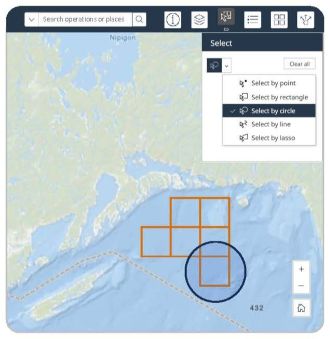
Example view of the interactive Fieldnotes map demonstrating the select widget, with the circle shape enabled.
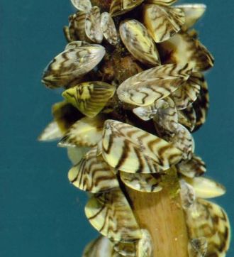
Zebra mussels can rapidly colonize underwater surfaces with dense clustering.
Credit: Fisheries and Oceans Canada
Page details
- Date modified: