
A Technical Manual for Small Stream Fish Habitat Improvement in Newfoundland and Labrador

On this page
- Preface
- 1.0 Introduction
- 2.0 Watershed processes
- 3.0 Formation of rivers and fish habitat
- 4.0 Salmonid stream environment
- 5.0 Habitat degradation
- 6.0 Project planning
- 7.0 Regulatory requirements
- 8.0 Salmonid biology and habitat requirements
- 9.0 Stream improvement options
- 10.0 Monitoring, maintenance and documentation
- 11.0 Glossary
- 12.0 Bibliography
- Appendix A
- Contact information
© His Majesty the King in Right of Canada, as represented by the Minister of the Department of Fisheries and Oceans, 2023.
Paper: Cat No. Fs114-29/2023E ISBN 978-0-660-41864-3
PDF: Cat. No. Fs114-29/2023E-PDF ISBN 978-0-660-42069-1
Published by:
Fisheries and Oceans Canada (DFO)
Aquatic Ecosystems Branch
Fish and Fish Habitat Protection Program
Newfoundland and Labrador Region
P.O. Box 5667
St. Johns, NF A1C 5X1
Correct citation for this document is:
DFO. 2023. A Technical Manual for Small Stream Fish Habitat Improvement in Newfoundland and Labrador. St. John’s, NL. viii + 106 p.
Preface
This guideline is an update to the Technical Manual for Small Stream Improvement in Newfoundland and Labrador produced by the Canada-Newfoundland Inshore Fisheries Development Agreement in 1989 (Buchanan et al. 1989). It also builds on a more recent draft version created in 2003. Chapter 2 of this document has been adapted from Ecological Restoration of Degraded Aquatic Habitats: A Watershed Approach created by Fisheries and Oceans Canada, Gulf Region (DFO 2006). All of the authors involved in this previous work are gratefully acknowledged.
1.0 Introduction
Stream habitat improvement may be defined as “those activities which increase the number of fish in a stream by technical measures” (Clarke et al. 2001). In its broadest sense habitat improvement may be seen as including elements that aim to:
- restore fish habitat to some historical condition (restoration)
- create new fish habitat features that currently don’t exist (creation)
- or modify existing fish habitat to a preferred condition (enhancement)
Each of these elements are meant to improve the capacity of existing fish habitat to support the requirements of important fish species and communities. This comprehensive definition of habitat improvement includes possible actions that can be taken to improve streams that may have been degraded or affected by manmade activities and/or streams that may have a natural limiting factor, such as limited areas of suitable spawning or overwintering habitat.
This manual is intended to describe a variety of methods to improve instream fish habitat as well as guidelines on their use and applicability in Newfoundland and Labrador. This manual isn’t intended to describe measures with the goal of repairing or modifying large ecosystem problems, such as:
- land-use or threats
- altered flow regimes
- introduced species
- changes in water quathlity
Climate change is an identifiable threat to aquatic ecosystems and fish and fish habitat. In Newfoundland and Labrador (NL), climate change is expected to contribute to changes in the hydrological regime and water cycle including (Conestoga-Rovers and Associates, 2015):
- a greater variation in stream velocity and water levels
- increasing frequency and magnitude of floods and storm surges
- higher ambient air temperatures with associated changes in water temperature
- decreasing snow cover
- earlier and more frequent snowmelt
- sea level rise
- coastal flooding and erosion
Habitat improvement methods provide an opportunity to improve conditions for aquatic ecosystems and reverse, mitigate or adapt to past and ongoing impacts including those that may be exacerbated by the effects of climate change. The Government of Canada has recognized the importance of habitat improvement, enhancement and restoration to:
- support climate change mitigation and adaptation strategies
- conserve biodiversity
- protect all species in an area, including species at risk
Climate change must be considered when designing habitat improvement works but also in assessing the overall reasons for habitat degradation. Throughout this manual, be mindful of climate change and its effects on watersheds, the water cycle and also its impact on habitat improvement measures that are described. Climate change effects are projected to intensify anthropogenic stresses, and will make fish habitat improvement efforts more complex (Edwin 2009; Mulholland et. al. 1997). A precautionary approach is essential as modifications to contemporary approaches may be required to help enhance the resilience of freshwater ecosystems to climate change (Seavy et al. 2009).
Historically, habitat improvement initiatives in Newfoundland and Labrador have relied on design and implementation criteria developed in other regions (for example, American mid-west and the Pacific Northwest) and for other species (primarily western trout and Pacific salmonids). However, since 1989, there have been a number of government sponsored, public delivered, habitat improvement and restoration projects undertaken throughout Newfoundland and Labrador. Where applicable, this manual incorporates lessons learned from these projects.
1.1 Organization of this manual
This manual is organized so that users are given sufficient information to understand the history and process of fish habitat improvement. It includes an overview of:
- watershed processes
- formation of rivers and fish habitat
- salmonid biology and habitat requirements
- salmonid stream environment
- fish habitat degradation and general considerations
- project planning
- applicable regulatory requirements
- stream improvement options
- monitoring, maintenance and documentation of stream improvement projects
2.0 Watershed processes
A watershed is a geographic feature designating a natural depression or area draining into a single expanse of water (Figure 1). Elements of this hydraulic entity are:
- rainwater
- runoff
- snowmelt
- groundwater

Figure 1. Overview of watershed features
Description
Overview of watershed features showing:
- rainfall and direction of overland flow into rivers
- infiltration into underground rivers
- groundwater flow into a catchment
- two or more catchments form sub-watersheds
- a group of sub-watersheds form a watershed
- a group of watersheds form a basin
Other factors, such as climate, land features, vegetation and land use all affect the quality and quantity of water within the watershed.
Most of the earth’s accessible freshwater is stored in large lakes; the rest circulates dynamically:
- it evaporates from the earth’s surface
- is transpired from plants
- it falls as rain or snow
- it percolates into the ground
- it travels through rivers and lakes
- eventually returns to the ocean
This continuous recycling process, which is so vital to life on earth, is called the hydrological cycle. Figure 2 illustrates the various components of the cycle, including:
- evapotranspiration
- evaporation
- percipitaton
- precipitation interception
- transpiration
- surface detention
- depression storage
- overland flow
- surface runoff
- infiltration
- groundwater flow
- Interflow
- stream channel
- water table
Though simple in concept, the many alternative routes within the cycle make science of hydrology very complex.

Figure 2. The hydrologic cycle (Ontario Ministry of Natural Resources and Watershed Science Center, 2002)
Description
The various components of the hydrologic cycle displaying how freshwater circulates dynamically and identifying the various routes including:
- evapotranspiration
- evaporation
- percipitaton
- precipitation interception
- transpiration
- surface detention
- depression storage
- overland flow
- surface runoff
- infiltration
- groundwater flow
- Interflow
- stream channel
- water table
3.0 Formation of rivers and fish habitat
3.1 The watercourse
There are many physical processes within a watershed that are responsible for giving a watercourse its shape. Watercourses consist of:
- a series of pools (deep water area of the watercourse)
- riffles (shallow water area of rapid flow where the surface is broken by gravel and cobble)
- runs (deep, moderate to fast flow areas that are much less turbulent than rapids)
A watercourse originates in the upper reaches of a watershed where the land is at a higher elevation. Small streams are fed by springs, runoff during rain events or spring snow melt (through intermittent or ephemeral streams). The force of gravity pulls the water downhill toward the lowest elevation. The flowing water erodes the topsoil, sediments, cobble and gravel and it starts to form a channel. The interaction and dynamics of the stream flow with its channel bed and banks causes it to become turbulent, where, depending on the channel bank and bed composition, channel erosion and deposition occurs forming patterns of pools (deep water) and gravel riffles (deposited material, shallow water). Pools are formed at approximately 5 to 7 channel width intervals on alternate sides, forming a meandering/“S” shape pattern (Figure 3). Pools provide shelter habitat through depth and still waters, while riffles re-oxygenate water with turbulence and high stream flows.

Figure 3. Pool-riffle sequence and erosional and depositional features in meandering streams (modified from FISRWG, 10/1998)
Description
Sequence of a sill-pit habitat showing pools and sills. The spacing of the sills run from the top of one sill to the top of the next. The height of the sill is measured from the top of the sill to the bottom of the pool. "Weir-forming clast" refers to the substrate at the bottom of the watercourse.
Vegetation also plays a role in channel development. Grasses and shrubs grow along the edges of the channel in areas that are dry during most of the summer months. The roots of the plants help bind the soils and the vegetation compresses during high flows to prevent erosion. Fall and spring high flows are slowed as they pass through the vegetation and drop silt, sand and gravels they are carrying. This helps build and maintain the banks.
Trees, branches and roots (large woody debris or LWD) that grow or fall into the river in random locations, also play an important part in building the structure of the stream and its habitats. In gravel and cobble bed rivers, the LWD is moved by flows. This helps clean and sort the bed materials as the logs are moved and embed where the bottom currents are slow at the head of the pools and in the pools. Logs embedded at the head of the pools establish the toe of the riffle/run areas, allowing them to build stable slopes without the gravel being washed into the pools. The small branches lying in the pools provide habitat diversity and cover for all aquatic species. Roots hold soils on the banks and permit undercuts, important for cover in medium to large rivers. Roots also form low dams in small streams, helping to maintain water depth and habitat structure.
The Canadian beaver, a natural occurring species to NL ecosystems, can also provide a positive benefit to fish by creating favorable fish habitat. They co-existed and co-evolved with salmonids and despite being considered nuisance animals, they have highly demonstrated and published ecological benefits (Pollock et al. 2004; Rosell et al. 2005; Kemp et al. 2012; Bouwes et al. 2016; Wathen et al. 2019). Beaver are referred to as “keystone species” (Duncan 1984; Naimen et al. 1986; Mills et al. 1993) or “ecosystem engineers” for the services they provide (Thompson et al. 2020). In the case of salmonids, when beaver build dams they generate complex nursery and resting habitats. Beaver dams (Figure 4) slow the movement of water, creating “beaver ponds” that trap nutrients (leaf litter and other detritus) which are beneficial to early life history stages of fish, particularly salmon parr. Beaver ponds are:
- deep
- cool
- slow-moving
- food-rich habitats
- persist year-round
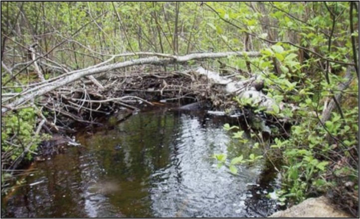
Figure 4. A beaver dam built with branches and fallen logs
This habitat promotes fish growth during critical early life history periods and provides refuge for adult salmonids. Beaver also dig foraging canals (sometimes referred to as dendritic channels) which:
- increase the surface area of the beaver pond
- promote streamside (riparian) vegetation growth
- offer habitat to aquatic species (including salmon parr)
Atlantic salmon and other native salmonids have evolved to thrive in complex and diverse environments and thus beaver activity results in a net positive benefit to population health and recovery.
3.2 Fish habitat
Habitat diversity is important for providing key habitat components to all life stages within a fish population (Gosse et al. 1998). Diversity and productivity are highest when streams are in “dynamic stability”, meaning when a stream achieves a balance in the erosion and deposition of sediment, and retains its physical characteristics like:
- slope
- width/depth ratio
- substrate composition
Key factors to keeping this “dynamic stability” are rainfall intensity and frequency and riparian vegetation.
A stream with healthy riparian vegetation normally receives a regular and slow input of LWD from the riparian zone. LWD assists in keeping the channel stable by becoming incorporated into the bottom and banks of streams. It also assists in creating a diversity of fish habitat by forming instream cover and small eddies (pockets of slow-moving water within the channel). As LWD decomposes, it also provides food to microbes which are in turn eaten by scraper type invertebrates, like caddisfly larvae. Some invertebrates live in the holes and crevices on LWD. Such features provide ideal rearing and feeding areas for some species of fish and make LWD an essential part of the stream habitat.
Other important habitat components include spawning areas located at the edge of pools where there are springs and seeps or the head of riffles where water seeps through the gravel and out onto the riffle. These habitats rely on a delicate balance of the erosional-depositional processes.
When hydrologically balanced and in presence of ample riparian vegetation, a stream is host to a multitude of organisms:
- microscopic bacteria and fungi
- phytoplankton and zooplankton
- larger aquatic invertebrates
- predatory fish
3.2.1 Pool-riffle habitats
Pool-riffle habitats, as featured in Figure 5, are watercourses that have an overall land gradient (slope) of less than 2% (meaning a 2 meter drop over a distance of 100 meters). Stream anatomy consists of a series of pools, riffles and runs. They meander to the right and left, scouring pools on the outside bends (each 5 to 7 channel widths apart). The most habitat diversity and the highest productivity are attained when streams are in “dynamic balance”, with the pools migrating at a rate measured in millimeters to a couple of centimeters per year and bed load movement is minimal and comprised mainly of very low levels of silt and sand (see Table 1 and 2 for substrate definition and transport velocities of stream bed materials).

Figure 5. Pool-riffle sequence showing cross-section (A above) and arial view (B below) of a stream. Riffles have a rapid flow and occur where there is shallow water and the surface is broken by gravel and cobble. Pools are the deep areas of the stream characterized by smooth quiet flow.
| Substrate type | Description | Size range (diameter in mm) |
|---|---|---|
Bedrock |
Continuous solid rock exposed by the scouring forces of the river/stream. |
Continuous |
Boulder |
Very large rocks. |
> 256.0 |
Cobble |
Moderate to large rocks. |
64.0 to 256.0 |
Pebble |
Large stones to small rocks. |
4.0 to 64.0 |
Gravel |
Small stones. |
2.0 to 4.0 |
Sand |
Sand sized deposits frequently found on margins of streams or between rocks and stones. |
0.06 to 2.0 |
Mud (Silt/Clay) |
Small stones. Very fine deposits from mud to silt on the stream margins, between rocks and on top of other substrates. |
< 0.06 |
| Material | Diameter (mm) | Transport velocity (m/s) |
|---|---|---|
Silt |
0.005 to 0.05 |
0.15 to 0.20 |
Sand |
0.25 to 2.5 |
0.30 to 0.65 |
Small pebble |
5.0 to 15 |
0.80 to 1.2 |
Large pebble to small cobble |
25 to 75 |
1.4 to 2.4 |
Large cobble |
100 to 200 |
2.7 to 3.9 |
The most productive riffles are on 1.2% to 0.8% land slopes and are made up of gravels and cobble with less than 10% sands and silts (Amiro 1993). These riffles are essential for invertebrate production (food for fish and small birds) and habitats for juvenile salmonids. Without them, fish productivity is seriously limited.
The pools are of best quality when:
- they are deeper than 45 cm in low flow
- have plenty of clean gravel and cobble on the bottom
- undercut banks
- overhanging vegetation
- large organic debris
These pools provide cover and refuge for all fish species and life stages in summer and winter low flows. They also provide resting places, spawning habitat and act as holding pools. The ideal slope on the tail of the pools for spawning is 1.8 to 2.4%. Deeper pools are required for adult salmon holding pools.
At higher gradients (over 2%), there is a lot of riffle and very little run or pools. This habitat is best suited to the younger age classes of salmon. They can be very productive if base flows (the portion of the streamflow that is sustained between precipitation events, fed to streams by delayed pathways) are good and the small percentage of pools are well developed and suitable for spawning. As the gradient drops, there is a shift towards more pools and less riffles. Salmon habitat is best at
75% riffle run and 25% pool (0.75% gradient). The best trout habitat is:
- 50% pool and 50% riffle run (0.5% gradient)
- in the higher gradient step pool formations.
Lower gradient reaches have more pool and are well suited to migrating adults, brown trout and suckers.
3.2.2 Step-pool habitats
The step-pool habitats become evident in watercourses with gradients above 2% and become dominant when the gradient surpasses 4%. Lower gradient rivers (less than 2%) still have the same frequency of pools (every 5 to 7 channel widths) but the drop between them is taken up in short steps over rocks or rapids with long runs and short pools. As the gradient increases, the watercourse runs disappear and there is a series of drops over large organic debris or rocks into pools, resulting in a step-pool system (Figure 6). The pool frequency becomes as short as 1 per channel width in small streams and 3 channel widths in larger rivers.

Figure 6. Step-pool sequence
Description
Step-pool habitat sequence identifying pools and steps. Step spacing runs from the top of one step to the top of the next step. Step height can be measured from the top of the step to the bottom of the pool. Step-forming clast refers to the stream bottom substrate.
3.3 River continuum concept
The River Continuum Concept (RCC) developed by Vannote et al. 1980 describes the structure and function of communities along a river system from the headwaters to the mouth (Figure 7). As the physical gradient changes and river size increases, chemical systems and biological communities shift and change in response. This relationship is called longitudinal connectivity. The composition of organisms (like shredders, collectors, grazers, predators) in different sections of the water change. Predators, for example, are dependent on the availability of prey animals in the area. Also, as a river progressively flows to the sea, the water becomes warmer.
The RCC groups river sections into 3 categories according to size (relative channel width):
- headwaters (orders 1 to 3)
- medium-sized streams (orders 4 to 6)
- large rivers (orders > 6)

Figure 7. The River Continuum Concept (modified Vannote et al. 1980) showing relationships between land and water with a river running down the middle.
3.3.1 Headwaters
Trees normally provide shade to small headwater streams, so instream primary production (the growth of green plants) is low due to the lack of direct sunlight. This means that instream production of oxygen is low, perhaps lower than the oxygen required by living organisms. Hence the oxygen production/respiration ratio is less than 1 (P/R < 1). For energy needs, these streams rely on terrestrial inputs of organic materials (leaves, coniferous needles, twigs, etc.). In order to transform this organic material into a useable form of energy, small streams have a community of bacteria and shredder-type insects (Figure 7) to break down these materials and a smaller population of collector or gatherer-type insects that feed on drifting algae and the smaller, broken-down materials (called Coarse Particulate Organic Matter or CPOM).
3.3.2 Medium-sized streams
As the forest canopy opens for wider streams, there is a shift to instream primary production by green plants that are fed by nutrients and the increased amounts of sunlight. Changes become apparent in these streams as aquatic vegetation and algae proliferate. This boosts the production of oxygen to the point where it surpasses respiration by living organism (P/R > 1). Most of the organic matter is CPOM, so collector or gatherer-type invertebrates are most abundant, followed by grazers who feed on microbial film on the surface of decaying organic matter.
3.3.3 Large rivers
In larger river systems, primary production is reduced (P/R < 1) because of increased water depth (less light penetration) and increased turbidity. The main source of food is no longer from riparian or aquatic vegetation. At this point, much of the CPOM is broken down, but there is still an abundance of fine particulate organic matter (FPOM) from upstream processing of dead leaves and woody debris that becomes available food for collector or gatherer-type invertebrates.
4.0 Salmonid stream environment
Salmonids are only one part of the stream ecosystem, a system that is very complex. A schematic summary of this complex system is presented in Figure 8. In general terms, the small stream ecosystem is usually fueled by the input of organic matter of terrestrial origin, like decaying leaves and wood, that is broken down by fungi and bacteria. The decaying material and its associated microorganisms provide food for aquatic invertebrates, particularly insect larvae. The larvae feed on the material in a variety of ways and can be classified based on their feeding like shredders, collectors and grazers.

Figure 8. A simple model of the stream ecosystem (adapted from Wetzel (1975))
Description
A simple representation of the complex nature of a stream ecosystem showing how terrestrial and aquatic energy get cycled through a freshwater ecosystem. It includes the addition of light which helps with instream photosynthesis and terrestrial organic matter. Terrestrial and upstream organic matter including large particulate organic matter and dissolved organic matter move downstream from its origin and forms the basis for food used by bacterial activity which leads to carbon dioxide and heat loss, and creates fine particulate organic matter which aquatic invertebrates (collectors, shredders, grazers and predators) feed on. The energy and nutrients created by shredders, grazers and predators as well as bacteria is cycled through the water column and becomes available for the downstream ecosystem. The transfer of matter and the resultant creation of energy is continual and comprises the basis for all freshwater ecosystems.
The insect larvae are in turn fed upon by salmonids and other fish. Microscopic algae can free drift in the water (known as phytoplankton, of which diatoms are the dominant group). They can also be attached to rock or plant substrate. They may provide food for invertebrates in some streams, particularly those at the outflow of ponds.
The environment within a salmonid stream includes a large number of physical, chemical and biological factors.
Physical factors include such variables as:
- water depth
- slope of the stream bed
- bottom substrate type and roughness
- width of floodplain
- drainage area
- bank composition and slope
- groundwater input
- water discharge
- sediment load
- stream shape
- water temperature
Important chemical variables include:
- pH
- dissolved oxygen
- metal concentrations (like iron, copper, mercury, lead)
- nutrient concentrations (like phosphate, nitrate)
- input of deleterious substances (like pesticides, oil)
Biological factors include such components as:
- bacteria, fungi and mold populations
- instream vegetation, including microscopic algae (both drifting and sedentary forms)
- type and quantity of stream bank vegetation
- invertebrate communities (like worms, insect larvae, adult insects, crustaceans)
- forage fish populations (like sticklebacks, smelts)
- salmonid species
- predator species and abundance (like eels, pike, mink, otter, osprey, gulls)
Most if not all of the physical, chemical and biological components of the stream environment are closely interrelated so that if one variable is changed, other related variables will also change. For example, channelizing or straightening a stream changes the stream's shape, a physical variable (see above), that can influence many other factors in sequence:
- the normal pool-riffle sequence is replaced by a straight run
- water velocities increase
- stream bed erosion increases which deepens the channel and hence changes the slope of any feeder stream near its junction with the main stem
- flooding increases in frequency downstream; severity may also increase
- scoured sediments are deposited downstream which may smother instream vegetation, bottom invertebrates and fish spawning habitat
- loss of stream bank vegetation resulting from the increased water velocities leading to increased bank erosion results in changes in nutrient input, insect production, temperature and fish shelter
- the stream seeks to attain a more natural sinuous pattern (like a “S” shape with pools every 5 to 7 channel widths) which may cause increased bank erosion
While the above example is over-simplified in that more factors than those described may be involved, it highlights the need to understand that changes to the stream environment can result in complex impacts that can extend over many years. Due to the interconnected nature of the stream ecosystem, a change in one variable can affect a variety of other variables, many of which can directly affect fish populations like species composition, growth, size and abundance. For example, biological components, such as vegetation, can also influence the chemical and physical aspects of a stream by:
- affecting water tables and flows
- nutrient inputs
- oxygen levels
- stream shape
This is particularly true for small streams where the impact of any one variable is likely to be much greater than it would in a larger river.
The stream ecosystem can be termed dynamic in that it is constantly changing, with each change affecting further changes. The physical and chemical components of the stream system are much like a living system in that they are very interrelated and in a constant state of flux.
Intervention in such a complex system should be done with some caution and with expert advice. Every instream feature will create a reaction from the stream whether it is a negative one from poor construction practices or a positive one from well planned and executed instream features.
A typical stream environment in Newfoundland and Labrador that is amenable to healthy salmonid populations can be characterized, in general terms, as one where the following conditions are met:
- the pH (a measure of acidity and alkalinity) is greater than 5.0
- metal and pollutant concentrations are low
- oxygen is at or near saturation levels
- nutrient input is below the level where aquatic plant growth would be accelerated
- base flow is at least 25% (preferably >50%) of the average annual daily flow
- relatively clear water and substrates free of fine sediments
- a diversity of habitat types with a pool: riffle ratio of approximately 1:1 (Thorn 1988), and typical pool-to-pool spacing of 5 to 7 channel widths (Montgomery et al. 1995)
- a diversity of water depth, substrates and cover type
- a healthy biological system that has normal proportions of bottom dwelling invertebrates, such as mollusks, crustaceans, insect larvae and adults
5.0 Habitat degradation
In order to improve fish habitat, it is first necessary to define some of the problems/symptoms associated with degraded habitat. The need for action is most evident in those areas that have been seriously degraded by human activities (Figure 9).
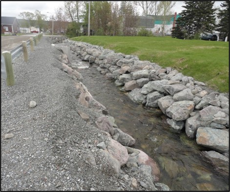
Figure 9. A highly impacted channel and banks next to a road
Areas that can be clearly defined as requiring remedies and where the remedies are likely to work can include:
- channelized areas
- unstable and eroding stream banks
- obstructions to fish passage
- sedimentation that has buried spawning gravels
- areas lacking sufficient instream and stream bank cover
- interrupted or artificially altered stream flow that can interfere with fish passage, migration and cause the drying of fish spawning areas
5.1 Channelization
Stream channelization is particularly harmful to fish habitat since it can:
- increase water velocity and erosion of the stream bed
- increase the overall stream bed substrate sizes
- increase the frequency and severity of downstream flooding
- devoid of a normal pattern of pools and riffles
These are essential to the maintenance of healthy salmonid populations. Channelized areas also may be devoid of vegetation which is important for food and shelter of both fish and their food organisms (Figure 10).
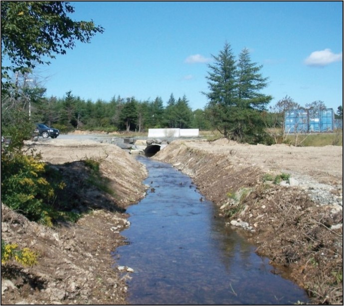
Figure 10. Channelized stream showing loss of vegetation
5.2 Erosion/sedimentation
Particles of sand, silt, clays and muck in the stream substrate can be part of a natural stream condition. However excess sediment, above natural levels for extended periods of time, can fill pools, decrease substrate variation and can reduce useable habitat areas for many fish species (Figure 11). Clogging of the interstitial spaces between larger substrate particles makes them less suitable and, in some cases, unusable for various life cycle stages, such as spawning and juvenile rearing. Excess sediment can also damage the gills of fish and suffocate eggs laid in the substrate.
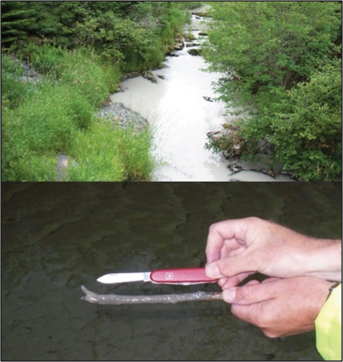
Figure 11. Excess sediment in a river (above); Spawning gravels buried in sediment (below)
Very fine suspended sediment may be visible as turbid (discoloured) water and is sometimes caused by the erosion of the stream bed and/or the stream banks (Figure 12). It is often associated with channelization or poor land/buffer management practices somewhere within the watershed. Since gravels are used by all species of trout, char and salmon for spawning, the sedimentation of spawning habitat can be a very serious problem, particularly if it is in limited supply within the stream.
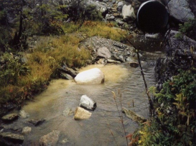
Figure 12. Visible sediment entering a stream near a road crossing
Areas prone to erosion can also be characterized by lack of vegetation with resulting loss of food and shelter. The management strategy for this problem is to prevent/decrease erosion and prevent sediment from reaching the stream.
5.3 Obstructions
Obstructions to fish passage include:
- improperly installed culverts
- dams
- log jams
- waterfalls
- landslides
These can be harmful to anadromous and stream-resident salmonids as they can limit fish movements past the obstruction, particularly upstream movement (Figure 13). Obstructions often limit the amount of available habitat. Some obstructions can be particularly harmful if they isolate important habitat types, such as spawning, which can no longer be accessed by portions of a population.
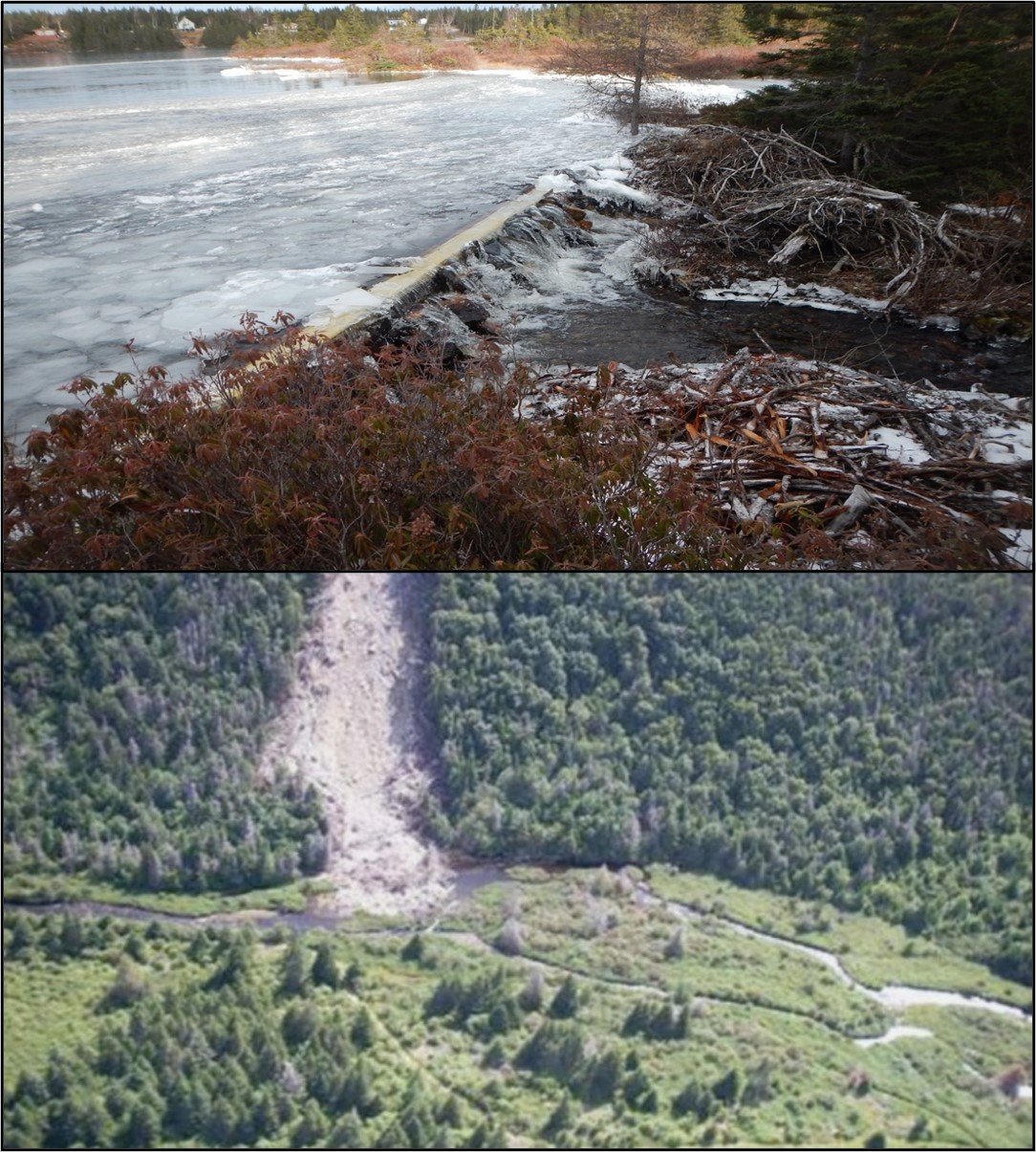
Figure 13. Top photo: a man-made dam causing obstruction at pond outflow. Bottom: Landslide causing obstruction of stream
Often, natural obstructions (such as waterfalls, which limit the upstream movement of downstream species or populations) may be an important component in maintaining biodiversity in an ecosystem. Populations and even species composition can be different above a natural falls compared to downstream.
5.4 Instream and stream bank cover
Stream bank cover can be reduced or lost due to excess erosion (Figure 14). Excessive removal of stream bank vegetation and instream structures, such as log jams, can limit the overall availability of cover for both juvenile and adult fish. This in turn can limit the holding capacity of a stream. Other effects of lost cover can be altered water temperatures, exacerbated erosion and changed flow regimes.
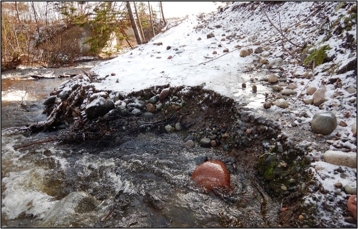
Figure 14. Stream bank showing a large amount of erosion and altered water flow
5.5 Summary
The above problems/symptoms can be alleviated to some extent by:
- removing complete man-made obstructions
- stabilizing and revegetating stream banks
- careful placement of boulders and deflectors to clean and stabilize gravels and diversify habitat
- installating various cover devices
In order to select the appropriate techniques, the entire stream with all its natural and man-made components should be considered.
6.0 Project planning
An important part of project planning includes conducting a thorough reconnaissance of the stream system and its supporting drainage basin. Learn about the drainage basin and try to become familiar with how the stream responds to:
- rainfall and snowmelt
- high and low flow conditions
- areas prone to flooding
- land cover
- vegetation
- soil
- wetlands
- land use
To help identify problems and issues that should be addressed, gather Information from a variety of sources:
- topographical mapping
- aerial photos
- site visits
- local knowledge
Conducting a thorough and detailed reconnaissance will inform you on planning solutions.
6.1 General approach
Successful stream habitat improvement considers fluvial processes, stream geometry, site specific hydraulics, biological processes and must minimally affect the natural stream channel morphology (Frissell and Nawa 1992; Newbury and Gaboury 1993; Beak Consultants 1993; Clarke and Scruton 2003). When considering project planning, it is important to:
- confine efforts to improve streams that have been degraded due to human activities or to streams where there are unnatural obstructions to fish movements
- define the factors that limit production and seek expert advice if necessary
- consider the entire system and not just short sections when determining the problems
- strive for a diversity of habitat types
Plan to use cost effective and environmentally appropriate materials and construction practices. Also, consider any requirements for future maintenance and/or replacement. Consider lifecycle management. For example, will your proposed project to install low head barriers to improve fish passage now, become an obstruction to fish passage in 20 years due to lack of future maintenance?
Careful project planning and design in the preliminary stages will usually be helpful to
- obtain funding and government permits
- execute a successful stream improvement project
Figures 15, section 6.1.1, and Table 3, provide a suggested outline for the project planning process.

Figure 15. Hierarchical decision-making tree for watershed assessment and action planning (modified from Roni et al. 2002)
Description
The first step in the watershed habitat assessment and action plan is to consider if the habitat is degraded. If it is not degraded then you should protect, maintain, monitor and enjoy while continuously reviewing to ensure it does not become degraded.
If the habitat is degraded then you need to determine if the habitat is fragmented in terms of culverts, dams, causeways or other barriers to fish migration. If so, you need to prioritize and reconnect. If it is not fragmented, then you need to determine if there is a land use problem (point source), if so and there is erosion, runoff patterns and quality then you must stabilize, buffer and use best management practices. If there is poor water quality- non point source from erosion runoff patterns and quality then it is important to clean-up and mitigate. If there is a riparian quality and process problem (width, vegetation type, LWD input, stability, shade or organic input) then you must restore riparian processes. If there is a physical aquatic habitat quality and processes problem from no cover, warm water, embedded substrate or eroding banks then it is essential to use habitat restoration structures. Once all of these issues have been identified and rectified then it’s time to protect, maintain, monitor and enjoy.
| Defined problem | Proposed solutions | ||||||
|---|---|---|---|---|---|---|---|
| Revegetation | Debris removal | Boulder placement | Low head barriers | Brush bundles | Bank stabilization | Wing deflectors | |
Channelization |
Yes |
No |
Yes |
Yes |
Yes |
Yes |
Yes |
Buried gravels |
No |
No |
Yes |
Yes |
No |
Yes |
Yes |
Bank erosion |
Yes |
No |
No |
No |
No |
Yes |
No |
No instream cover |
Yes |
No |
Yes |
No |
Yes |
No |
No |
No bank cover (or riparian zone) |
Yes |
No |
No |
No |
Yes |
No |
No |
Obstruction (full or unnatural) |
No |
Yes |
No |
No |
No |
No |
No |
Culvert caused obstruction |
No |
Yes |
No |
Yes |
No |
No |
No |
No pool habitat |
No |
No |
No |
Yes |
No |
No |
Yes |
Trash |
No |
Yes |
No |
No |
No |
No |
No |
6.1.1 Checklist of activities
- Consultation and problem statement
- Identify potential problems
- Clearly define your objectives
- Consult with DFO and other federal/provincial/municipal authorities
- Consult with local landowners
- Consult with other interest/user groups
- Obtain access approval
- What are the personal safety and environmental issues that need to be considered and addressed
- Reconnaissance and survey
- Delineate and study the characteristics, area, flow, land cover etc. for the water shed for the subject stream – how does this data influence your project objectives?
- Preliminary baseline surveys
- Detailed field surveys
- Planning and design
- Design and plan project structure details
- Submit applications for funding
- Submit applications for permitting
- Determine needs for personal, equipment and material
- Plan tasks, timings, schedules
- Develop contingency plans
- Incorporate a safety plan for all components and aspects of the project
- Construction
- Arrange deliveries
- Assign teams/tasks
- Implement plans
- Work safely
- Photograph all phases of the project
- Organize for next day
- Maintenance and Monitoring
- Monitor at intervals or after large flow events
- Complete required maintenance
- Document all activities
6.2 Safety
Safety must be of utmost concern during all aspects of a project. Consider all factors concerned with safety:
- Maintain current and up to date safe work training and remember that volunteers will have varied levels of:
- physical fitness
- experience
- with construction equipment
- working around water and flowing rivers
- knowledge of proper safety procedures
- For projects like these, special precautions should be taken:
- working in the water or near fast moving waters
- moving in slippery, rocky and/or uneven stream beds
- handling heavy rocks and equipment
- Prepare a safety plan in accordance with all applicable federal, provincial and municipal safety laws, codes and requirements
- Conduct safety briefings for all workers and visitors to your work site
- Ensure all workers and site visitors are properly equipped, wearing and trained in the use of required safety equipment
7.0 Regulatory requirements
In Newfoundland and Labrador, all work in and near waterbodies is regulated under both federal and provincial legislation. Fisheries and Oceans Canada conserves and protects fish and fish habitat by applying the fish and fish habitat protection provisions of the Fisheries Act, in combination with other applicable federal laws and regulations related to aquatic ecosystems, including the:
- Species at Risk Act
- Oceans Act
- Aquaculture Activities Regulations
- Aquatic Invasive Species Regulations
The fish and fish habitat protection provisions of the Fisheries Act are the authorities for the regulation of works, undertakings or activities that risk harming fish and fish habitat. Specifically, they include the 2 core prohibitions against persons carrying out works, undertakings or activities that result in the “death of fish by means other than fishing” (subsection 34.4(1)), and the “harmful alteration, disruption or destruction of fish habitat” (subsection 35(1)) (DFO 2019).
When planning and implementing works, undertakings or activities, it is important to do so in a manner that avoids harmful impacts, specifically the death of fish and the harmful alteration, disruption or destruction of fish habitat. If proponents believe that their work, undertaking or activity may result in harmful impacts to fish and fish habitat, the department will work with proponents to:
- assess the risk of their proposed work, undertaking or activity resulting in the death of fish or the harmful alteration, disruption or destruction of fish habitat
- provide advice and guidance on how to comply with the Fisheries Act (DFO 2019)
Authorizations, licenses or permits may be required in order to proceed with works, undertakings or activities. This can include instances where the proposed activity has the potential to:
- impact fish and fish habitat
- affect a species listed as endangered or threatened or their residence or critical habitat as per the Species at Risk Act
- be carried out within a Marine Protected Area or conservation area
- introduce live fish into fish habitat or transfer live fish to or between fish rearing facilities
- control aquatic invasive species
Proponents are encouraged to contact their regional DFO office to ensure all applicable regulatory requirements are met.
Provincial legislation within Newfoundland and Labrador also regulates work in or near waterbodies. The provincial Environmental Protection Act and the Water Resources Act apply to any alteration of a waterbody and a permit must be obtained from the Provincial Government.
Under certain circumstances, other municipal, provincial or federal legislation may apply, such as:
- municipal government, town and city councils may require that you obtain zoning and building permits for your proposed work
- Environment and Climate Change Canada exercises control of specific contaminants (like oil, PCB’s, etc.) and accidental spills of toxic substances
- Canadian Wildlife Service of Environment and Climate Change Canada will review the proposed project if it could affect waterways or wetlands that are important to migratory birds
- the provincial Department of Fisheries, Forestry and Agriculture may need to review if the project has the potential to impact beaver, moose, caribou or other wildlife species
In summary, authorizations, licenses or permits from both federal and provincial levels of government may be required for instream work. It is a good practice to contact DFO, Environment and Climate Change Canada and appropriate provincial departments (like Crown Lands and Water Resources). If your project is within the boundaries of a municipality or a municipal water supply area, the town or city council office should also be consulted to discuss your proposed project to ensure all legal environmental requirements will be met. In all cases, it is the responsibility of the proponent to ensure the requirements of federal, provincial, and municipal jurisdictions are followed and compliance with applicable legislation is met.
The following section presents both general construction activity and mitigation techniques aimed at reducing or eliminating potentially harmful impacts on fish and fish habitat during stream improvement activities.
8.0 Salmonid biology and habitat requirements
This section focuses on salmonid biology and habitat requirements, but it is recognized that there are other, non-salmonid species found within the province having cultural and economic value.
The majority of the freshwater species fished in Newfoundland and Labrador are salmonids. The term salmonid refers to any fish species of the Family Salmonidae. There are 32 species of salmonids in Canada. Of these, 8 occur in Newfoundland and Labrador:
- Atlantic salmon or ouananiche (Salmo salar)
- Brook trout (Salvelinus fontinalis)
- Arctic char (Salvelinus alpinus)
- Lake trout (Salvelinus namaycush)
- Lake whitefish - including dwarf form (Coregonus clupeaformis)
- Round whitefish (Prosopium cylindraceum)
- Brown trout (Salmo trutta)
- Rainbow trout (Oncorhynchus mykiss)
Some of the salmonid species are difficult to distinguish, particularly at the younger stages. Fish from saltwater or from different ponds or streams may differ considerably in coloration and general appearance. In addition, some of these species, such as brown trout, may interbreed with salmon or brook trout to produce hybrids. The brown-brook trout cross is termed “tiger trout” and may be fairly common on the Avalon Peninsula. Atlantic salmon and brook trout are the most common freshwater fish on the island portion of the province with Arctic char also playing an important role in Labrador.
In addition to salmonids, other recreational/subsistence fish species may be present, particularly in Labrador, such as:
- American eel (Anguilla rostrata)
- Northern pike (Esox lucius)
- Rainbow smelt (Osmerus mordax)
- Longnose sucker (Catostomus catostomus)
- White sucker (Catostomus commersoni)
- Burbot (Lota lota)
All of the above salmonid species, as well as American eels and rainbow smelt, are similar in that they all have the biological capability of moving between fresh and saltwater although not all populations do so. Populations that spawn in freshwater but run to sea for feeding purposes are termed sea-run or anadromous. As discussed in the previous sections, stream-resident salmonids are similar in their general habitat requirements for:
- dependable supply of clear, cool, well oxygenated water
- clean spawning gravels-shelter in the form of instream and stream bank cover
- food from both aquatic and terrestrial sources
- a mixture of pool and riffle habitat
There are specific differences between species in time of spawning, some differences in the type of area where a species can spawn successfully (like a headwater stream vs. a rocky shoal in a lake), and differences in adult feeding areas.
This section of the manual is a brief overview of the range of habitat preferences for the various life cycle stages of Atlantic salmon/ouananiche, brook trout, Arctic char, brown trout and rainbow trout from reference documents particular to Newfoundland and Labrador. A generalized life history of salmonids is presented in Figure 16. The first 3 species have been highlighted since these represent the most fished and in fact the species for which most improvement projects are conducted. The last 2 are introduced salmonid species that support important recreational fishing activities. They can also compete with resident species and hence their habitat requirements are briefly outlined.

Figure 16. Typical life cycle and habitat requirements of a salmonid fish (from Buchanan et al. 1989) showing scale and sizes of salmon at 10 stages of life: (and then include a bulleted list of the text seen in the figure in the best order).
Description
Typical life cycle and habitat requirements of a salmonid fish (from Buchanan et al. 1989) showing scale and sizes of salmon at 10 stages of life.
- Redd formation and spawning in fall (spring for rainbow trout)
- Large pink or orange eggs are buried in gravel (only 20% of eggs will survive to fry stage)
- Larvae with attached yolk sacs remain in gravel
- Stretch with clean gravel and good water flow for redd formation and spawning
- Fry emerge in spring and required shallow areas with lots of cover. Only 10% of salmon fry survive to smolt stage
- Brook trout prefer uppers reaches for spawning
- Parr inhabit pool; riffle habitat
- Sea run trout and char do not venture far from their home streams
- Atlantic salmon range many miles at sea for 1-3 years before returning to spawn
- Atlantic salmon smolt run to sea (10%) survive to adulthood
Habitat requirements of salmonids in Newfoundland and Labrador
Atlantic Salmon / Ouananiche
Background information
Spawning usually occurs between October 15 and November 20 in Newfoundland and between September 1 and October 31 in Labrador (Scruton et al., 1997). Redds, or nests, consist of several depressions 10-50 cm deep where the female will lay her eggs (Bley, 1987; Calkins, 1989). Once eggs are laid and fertilized, the female will cover the eggs with about 10-25 cm of substrate (Bley, 1987).
Redds are normally a distinctive, elongated mound of relatively clean gravel. The optimum location for a spawning redd is a shallow, gravelly area at the tail of a pool where the water velocity is increasing. Other locations may include the head of a pool, the downstream end of riffles or areas near upwelling of ground water. Before and after spawning, nearby pools may be used by adults for resting.
Eggs incubate during winter and will usually hatch in April. The newly emerged alevin will remain in the gravel until their yolk sac is absorbed (typically May or June). Fry will emerge from the gravel and stay in shallow riffle areas near the redd until about 65 mm in length.
Typical juvenile (parr) habitat is composed of riffle areas with gravel or cobble substrate (Buchanan et al. 1989). Good rearing habitat in Newfoundland is generally characterized by large numbers of instream boulders where young can shelter.
Life stage, habitat variable and suitable range of values (from literature)
Eggs
- Remain buried in the redd until hatching
- Generally speaking hatching takes place in April (~110 days after spawning at water temperatures of 3.9°C)
- Eggs may die if water temperature exceeds 12°C (Scott and Crossman 1998)
Redd
- Substrate:
- Coarse gravel (2.5 – 8 cm in diameter); can be up to 50 cm deep in gravel and covered by 20 cm of substrate
- Water depth:
- Optimum water level ranges 15-61 cm
- Water velocity:
- Optimum velocity of current over redd 15-76 cm/s (upwelling and downwelling necessary for successful incubation)
Emergence
- Lower substrate embeddedness is considered better for emergence
Fry
- Substrate:
- Young-of-year have been associated with substrates of 0.0062- 25 cm in diameter
- Best suitable substrate for summer is considered gravel (0.2-3 cm in diameter)
- Best suitable substrate for winter is considered cobble (6-13 cm in diameter)
- Water depth:
- Young-of-year have been associated with depths ranging from 10-70 cm
- Suitable mean depth for highest fry density: 10-30 cm (best is suggested as 15-22 cm: minimal densities at depths >60 cm)
- Water velocity:
- Best suitable mean velocity for highest fry density: 15-70 cm/s (best suggested as 20-60 cm/s)
- Stream width:
- Suitable mean stream width at minimum summer flow for production of fry: 0.5-4 m
- Cover:
- Suitable % cover at minimum summer flow for production of fry: 0-50% (best suggested as 0-30%)
- Suitable % cover for production of fry (winter): 60-100% (best is suggested as 75-100%)
Parr
- Substrate:
- Associated substrate range of 0.0004 cm-bedrock
- Water depth:
- Associated water depth range of 10-85 cm
- Water velocity:
- Associated mean water column water velocities of 0 - 95cm/s
- Water temperature:
- Suitable temperature for optimal instantaneous growth of parr: 11-24°C
- Cover:
- suitable % instream cover (boulders and/or logs) for high habitat quality of parr: 0-68% (best suggested as 23-62%)
Arctic Char
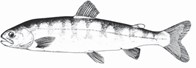
Background information
Arctic char are principally found in Labrador, however, some populations are known to occur within Newfoundland in some of the deeper lakes, on the Northern Peninsula (Bradbury et al. 1999) as well as Gander Lake (O’Connell and Dempson 2002), with a few anadromous populations. Char are usually very slow growing with the largest ones normally recorded from the northern anadromous populations.
Anadromous char may migrate to the sea for feeding during summer but they do not range as far from their home rivers as do Atlantic salmon (tens of miles vs. hundreds of miles) and they do not jump obstacles as well as salmon.
Life stage, habitat variable and suitable range of values (from literature)
Redd
- Substrate:
- Optimal spawning substrate is suggested as consisting of a range between sand and cobble. Size range would therefore range between 0.1 – 13 cm
- Water depth:
- Variable, however usually occur between 1.5 - 2 m.
- Water velocity:
- Variable but similar to that of brook trout (0.2 - 0.5 m/s).
Fry
- Substrate:
- Young-of-year are typically associated with larger substrates of 6 - 100 cm in diameter
- Water depth:
- Young-of-year have been associated with relatively shallow depths (<20 cm)
- Water velocity:
- Young-of-year have been generally associated with mean velocities of <1.0 m/s
Juvenile
- Substrate:
- Associated substrate range of 0.004 mm-100 cm
- Water depth:
- Have been associated with relatively shallow depths (<20 cm)
- Water velocity:
- Have been generally associated with mean velocities of <1.0 m/s
Brook Trout
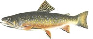
Background information
Brook trout are also known locally as mud trout and speckled trout. They are the most common salmonid in Newfoundland streams and ponds and are an important recreation and food fish. A portion of some populations may migrate to the ocean, generally staying within the brackish, estuarine habitat.
Brook trout spawn between October 1 and 31 on Insular Newfoundland and between September 1 and 30 in Labrador (Scruton et al., 1997).
Preferred spawning areas are in cool, clear headwater streams with clean well-ventilated gravel, in water depths of approximately 61 cm. Spawning can also occur in lakes, particularly in gravelly areas subject to spring upwelling and moderate water currents.
Female brook trout digs a redd and deposits her eggs. One male is in attendance but both sexes will drive out intruders. Some Newfoundland trout mature at a very small length (eg. 8-15 cm); some are precocious while others are dwarf populations.
Eggs will hatch in approximately 100 days (exact timing depends upon water temperature). The dissolved oxygen content of the water flowing through the redd should not fall below 50% saturation for embryo development to occur (Harshbarger, 1975). The young (alevin) will remain within the spaces in the gravel until their yolk-sac is absorbed (~38 mm in length).
The fry prefer the quiet, shallow edge areas of a stream and they tend to utilize pools more than young salmon. Older juveniles tend to frequent the riffle areas.
Temperature tolerance ranges between 0-25 °C although acclimation is required for extreme changes. Optimal growth of brook trout occurs between 11-14 °C (Raleigh, 1982).
Optimal brook trout habitat in streams is characterized by a pool:riffle ratio of 1:1, well vegetated banks, abundant instream cover, and stable water flows and temperatures. Instream cover and deep pools may also be very important for ensuring overwintering success.
Life stage, habitat variable and suitable range of values (from literature)
Redd
- Substrate:
- Optimal spawning substrate is suggested as consisting of a range between 3 - 18 cm
- Optimum substrate size for embryos is suggested as 0.3 - 5.0 cm
- Water depth:
- Variable
- Water velocity:
- Variable but usually less than that of Atlantic salmon (upwelling and downwelling necessary for successful reproduction)
Fry
- Substrate:
- Young-of-year have been associated with substrates of 10- 40 cm in diameter
- Water depth:
- Young-of-year have been associated with depths ranging from 27-40 cm
- Water velocity:
- Young-of-year have been associated with focal velocities of 0.5-4.3 cm/s (in winter)
Juvenile
- Substrate:
- Associated substrate range of 0.004 mm - 1 m
- Water depth:
- Associated water depth range of 40 - 95 cm
- Water velocity:
- Aassociated focal water velocities of 4.6 - 17.8 cm/s
Brown Trout
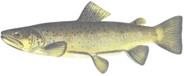
Background information
Brown Trout are common on the Avalon Peninsula where sea- run populations have become established. In some areas, they may tend to displace native brook trout since they are more tolerant of certain kinds of pollution such as increased turbidity and warmer water temperatures. They tend to occupy lower stream reaches, grow faster and to a larger size, live longer and are harder to angle than brook trout. Browns have a preference for undercut banks and grassy areas. Sometimes the largest fish will be found hiding in grasses in very shallow water.
Brown trout generally spawn in the late fall - early winter period; later than brook trout. Their eggs are amber in colour as opposed to the other salmonids whose eggs are orange or pink. Eggs usually hatch in April. They are capable of producing hybrids with both brook trout (called 'tiger trout'), salmon and rainbow trout.
Habitat requirements
Habitat requirements of brown trout are similar to those of brook trout.
Brown trout are more tolerant of high temperatures and can tolerate a range between 0°C and 27°C, although optimal growth is between 12°C and 19°C (Raleigh et al., 1986).
Brown trout are less tolerant of low pH than brook trout and normally occur within a pH range of 5.0 - 9.5 (Raleigh et al., 1986).
They may utilize the same gravel substrate in headwater spawning areas as brook trout as well as habitat in the lower reaches.
Rainbow Trout
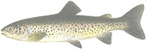
Background information
Rainbow trout were originally native to western North America but have been introduced throughout. Sea-run populations are known as steelhead and are a most sought after game fish.
Rainbows were introduced to Newfoundland from the mainland in 1887. They have been transplanted in various locations across the province over the years and are now found in many systems on the Island portion of the province. They generally prefer more open and faster water than do brook trout of equal size.
Growth and maximum size is highly variable and dependent upon environmental conditions. They are not particularly long-lived (i.e. about 6-8 years).
Habitat requirements
Adults in Newfoundland prefer lake habitat (clear, cold, deep lakes) over stream habitat except during spawning season. Inlet or outlet streams with gravel bottom riffle areas are normally required for spawning purposes. Young rainbows normally move into the lake environment during the first growing season or after overwintering in their natal stream.
Rainbow trout typically spawn in the spring with their preferred spawning sites being fine gravel beds in riffles above a pool.
Lake-dwelling populations appear to require feeder streams for successful spawning.
The timing of egg development is highly dependent upon local conditions but eggs normally hatch in about 4 - 7 weeks. Alevins require an additional 3 - 7 days to absorb the yolk before becoming free swimming.
9.0 Stream improvement options
Proponents are advised to consult with DFO prior to commencement of any project to allow the provision of project specific advice to avoid and mitigate any inadvertent impacts to fish and fish habitat. Acceptance of a habitat improvement project by the department doesn’t release the applicant from any obligation to obtain permission from or to comply with the requirements of any other regulatory agencies (for example, federal, provincial or municipal). This is applicable to the following sections which detail the various improvement options.
9.1 Removal of instream debris
The removal of instream debris is probably one of the oldest stream improvement techniques. The technique likely originates from man's desire to maintain free passage for fish, to clean up after forest harvesting activities, to alleviate flooding, and to 'just keep things tidy on favorite trout streams'. On larger river systems there has also been considerable pressure over the years to maintain free passage for watercraft.
The removal of instream debris by de-snagging and stream clearing has been widespread in some regions of North America in the past (Figure 17). However, this activity can decrease instream structural and habitat complexity and lead to channelization of flows and ultimately to changes in stream depth, velocity and substrate size.
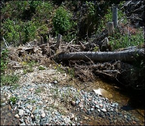
Figure 17. Instream debris of fallen trees and other organic materials blocking a stream
In the past few decades, fisheries biologists have come to realize that the input of fallen trees from the riparian area surrounding a stream is an important process in maintaining a healthy productive salmonid stream. Researchers have found that LWD is an important structural component to a stream, maintaining regular stream sinuosity, channel depth, and creating pools and riffles (Keeley and Slaney 1996). It is also thought to provide instream cover from predators as well as improve substrate for the rearing of aquatic invertebrates. Studies have also found that an increasing presence of LWD tends to be correlated with fish abundance (Fausch and Northcote 1992).
It is important to remember that fallen trees, logs, and wood debris occur naturally in streams and are essential components in the stream ecosystem (Figure 18). Streams aren’t necessarily tidy and often contain cluttered assemblages of instream objects (such as logs, boulders, wood debris and plants, which contribute to a diversity of water velocities and substrate topography).
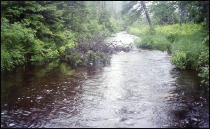
Figure 18. Typical healthy instream debris (primarily fallen trees and snagged limbs not completely blocking stream)
Therefore, naturally occurring debris removal should be minimized in impovement projects. In fact, the management of instream LWD does not necessitate their removal. For example, trees or snags that aren’t complete obstructions should be left as they are or, if required, re-oriented within the stream bed.
The technique is, however, still valuable in certain circumstances.
9.1.1 Objectives
The major objectives of debris removal are to:
- remove unsightly and/or polluting man-made material
- maintain free passage for anadromous and stream resident salmonids to upstream spawning, rearing and feeding areas
- restore previously logged areas to a more natural state
- encourage natural scouring of accumulated silt and organic debris
9.1.2 Applicability
The technique is applicable where there are large amounts of manmade refuse or where there is a complete obstruction to fish passage caused by jams of woody debris, organic material and/or fine sediment. Inoperative dams constructed by beavers or man could also be considered in this category, yet recent research shows beaver dams are rarely a full barrier to salmonid passage. The overriding constraint with the technique, as with all of the techniques covered in this manual, is that the benefits of action must out-weigh the potential detrimental effects. For example, if removal of an obstruction results in the release of large amounts of fine sediment that settles on spawning gravel downstream, then the removal may cause more harm than good to fish habitat.
Debris removal may be justified however, in those instances where a small stream has become sluggish and choked with organic debris and silt because of past construction or logging activities and has become virtually devoid of salmonids.
9.1.3 Advantages
The advantage of the technique is that it removes unsightly and possibly polluting man-made material. Fish can be harmed by abandoned vehicles or machinery on the banks or in the water. These can add toxins like metals, hydraulic fluids, lubricants and fuels. Trash and garbage may also seriously degrade the productivity of stream habitats.
The removal of complete obstructions is beneficial to migrating salmonids since it allows them normal or increased access to spawning and feeding grounds. It is also likely that resident fish would also benefit from increased access to areas for feeding, shelter during low flows, spawning and overwintering habitat.
9.1.4 Disadvantages
The removal of log jams, stumps and debris can result in a sudden release of fine sediments and organic material which could be carried downstream. In some areas, complete natural barriers separate species that would otherwise compete with each other to the detriment of one of the species. These barriers could be maintaining additional biodiversity within the system. The technique may also require the use of expensive equipment, such as chain saws, winches and heavy equipment. Safety is also of prime concern with debris removal. Some routine maintenance may also be required if the source of debris is still present.
9.1.5 Guidelines/implementation
- Survey the stream in order to select sections for debris removal
- Remove all man-made refuse in order to achieve a natural stream environment, including LWD from forestry operations
- Remove only woody debris that, in conjunction with sediment, forms a complete obstruction to fish movement
- If there is doubt, consult an expert
- The obstructing material (like a tree) can be left in a stream but repositioned along the bank so that the trunk is parallel to the flow
- Please note that it is illegal to remove active beaver dams in Newfoundland and Labrador, contact appropriate provincial wildlife authorities to make sure all work is legal and completed with all applicable permits
- Woody debris that provides shelter/cover for fish or contributes to the diversity of habitat features within a stream (like pool scouring), should be left in place
- Prime cover areas for salmonids are on the outside of meanders
- Partial removals are often more effective than complete removal
- Trees which have fallen across a stream should be trimmed or removed if they result in damming or creation of a stream diversion, which can increase downstream erosion and sedimentation (Figure 19)
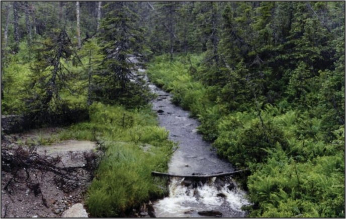
Figure 19. Natural log jam in stream. Notice how it has collected rocks and debris
- Restrict activities to a relatively short stream reach (100 m) at any one time
- Commence activities from the downstream end working in an upstream direction
- If you work in a downstream direction, there is some potential for worsening obstructions downstream
- There is also the potential for temporarily disturbing sediment and hence reducing water clarity, which makes removal more difficult and dangerous
- In general, debris removal should begin in the center of the stream and progress towards the banks
- Avoid using power saws in the water since it can be extremely dangerous due to slippery rocks and chain oil can contaminate the stream
- If large amounts of sediment are likely to be released, conduct work during the lowest summer flow period and attempt to limit the duration of instream activity
- Other mitigations may be required as specified on government permits (like silt traps or filter fabric)
- Advice from DFO may also be needed
- Project timing is important and is usually specified by regulatory agencies
- Instream work should not be conducted during the spawning or egg incubation period
- To avoid impacts on fish in Newfoundland and Labrador, do not carry out in-water work:
- in estuaries and main stems of scheduled salmon rivers from May 1 to September 30 (migrating period)
- in tributaries and headwaters of scheduled salmon rivers on the island of Newfoundland from October 1 to May 31 (spawning, incubating and hatching period)
- in tributaries and headwaters of scheduled salmon rivers in Labrador from September 15 to June 15 (spawning, incubating and hatching period)
- in estuaries and the main stems of brown trout rivers from October 1 to November 30 (migrating period)
- Do not use heavy equipment near a stream unless absolutely necessary
- If heavy equipment is used, stabilize banks and follow the appropriate government guidelines
- Revegetation and additional stabilization of stream banks may be necessary
- Consult with experts and regulatory agencies for suitable mitigation techniques
- In some cases, it may be possible to simply reposition some debris/obstruction to maintain habitat diversity and encourage scouring flows
- In the case of small, smothered streams, remove only enough material to expose some bottom substrate
- This should only occur under the supervision of a qualified environmental professional
- In order to be effective, the technique should be combined with a velocity increasing technique to keep some areas of the bottom substrate scoured clean (see ‘Deflectors’)
- It also may be desirable to remove silt from the stream bed to prevent further siltation downstream
- Trees, bushes, shrubs, weeds or tall grasses should not be removed along a bank unless the vegetation is choking a small stream (like urban streams)
- In such instances, thinning or selective removal may be appropriate
- Mats of floating algae or vegetation should not be removed from any section of stream
- Stream sections should be inspected several days after debris removal to ensure that the stream bottom is clearing, and that further material isn’t building up
- All debris removed from the stream should be disposed of in a manner to ensure that it doesn’t re-enter the watercourse
- Safety is of utmost concern with this technique if using chain saws, winches, levers and/or heavy equipment
- It is often best approached by using manual labour
9.1.6 Monitoring and maintenance
The stream should be monitored periodically to remove debris and any other obstructions that may develop. Check stream banks to ensure stability is maintained and any revegetation has been successful. Continue smaller scale debris removal efforts and conduct biological monitoring as required.
9.1.7 Cost considerations
Costs can range from very low for simple trash removal programs to very high for projects involving extensive use of heavy rental equipment. Heavy equipment could include logging equipment, hoists and 4-wheel drive vehicles with winches. In some cases, it may be possible to get equipment and operators donated for a few days.
Other costs could include chain saws, cables and chest waders. Safety equipment, such as first aid kits, hard hats and gloves, should be mandatory for all personnel involved at the site.
9.2 Planting of stream bank vegetation
The importance of streamside vegetation to stream ecosystems can’t be overemphasized. Naturally occurring native vegetation surrounding a stream is essential for the well-being of the aquatic ecosystem. It acts as a buffer from surrounding land-uses and is the interface for stream-terrestrial interactions (Figure 20). For example, many instream features originate from the surrounding vegetation (like LWD). Bank vegetation is also important to a stream's food production capacity by providing:
- organic matter in the form of decaying leaves and wood which forms the basis of the aquatic food chain
- substrates for the production of benthic invertebrates upon which trout feed
- terrestrial insects
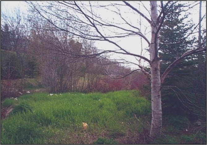
Figure 20. Planted stream bank vegetation, Kelly’s Brook, St. John’s
Shelter is provided in the form of low hanging trees or shrubs and their root systems. Grasses can provide beneficial habitat by providing overhang from both the stream edge as well as undercut banks.
Stream bank vegetation plays a role in temperature regulation by shading in the summer and lessening convective cooling in the fall and winter. The trapping of snow cover on some streams may be important in protecting overwintering areas for salmonids. In some systems, the amount of overwintering habitat may be a critical factor in determining the number of salmonids that can be supported.
Vegetation also prevents excessive erosion which is a major cause of disrupted spawning areas (Figure 21). It has been determined that the stream restoration techniques most likely to produce positive results are those that eliminate or reduce sources of erosion and encourage stream bank vegetation. Hence this manual stresses the importance of stream bank planting as vegetation is important to a stream's health.
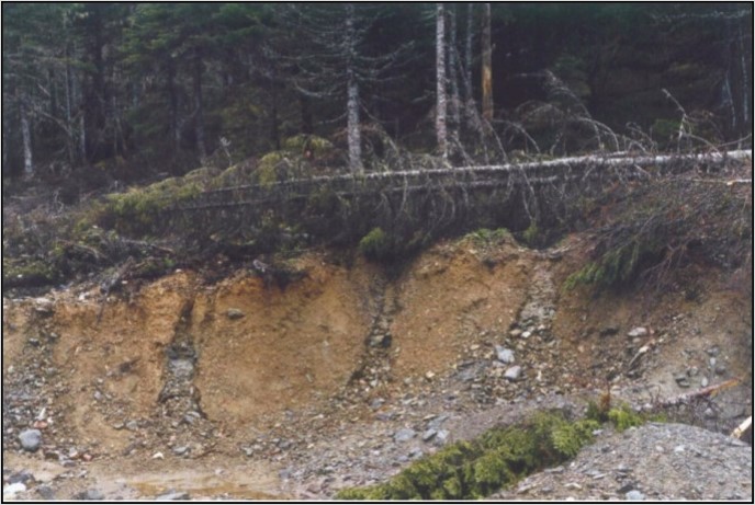
Figure 21. Excessive streamside erosion
The root systems of most plants, particularly grasses and shrubs, tend to stabilize banks which lessens erosion. In general, healthy stream bank vegetation tends to trap and hold sediments and thus provides a coarse filter system for streams (Figure 22).
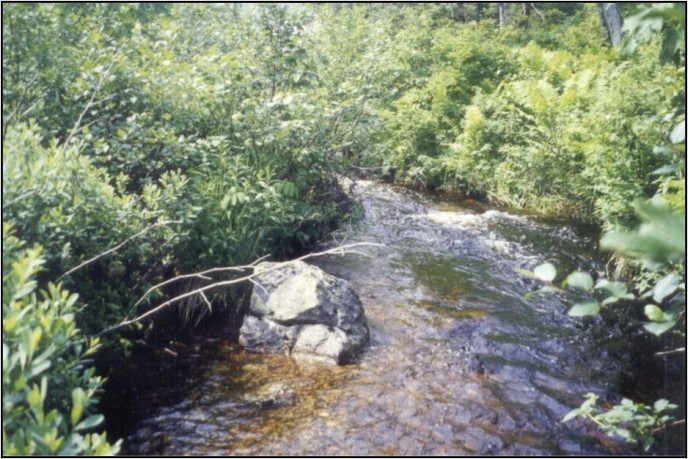
Figure 22. Natural streamside vegetation (Southern Newfoundland stream)
For habitat improvement purposes, it generally appears that deciduous trees are better than conifers, low hanging shrubs and trees are better than high ones, and herbaceous annuals are better than woody plants. In addition, broadleaf plants may be better than narrow leaf ones.
In general, the best approach for this province is to protect all types of stream bank vegetation as much as possible. For highly erodible areas, plant fast growing species to assist in initial stabilization and to encourage the long-term revegetation of a diversity of naturally occurring species.
9.2.1 Objectives
The objectives of planting stream bank vegetation are to:
- stabilize erodible banks and trap sediments before entering the stream
- provide natural cover in the form of:
- undercut banks (in grass sod areas)
- root systems
- overhanging vegetation
- input of LWD
- dampen temperature fluctuations by reducing heating of water in the summer and cooling in winter
- increase food supplies, both of instream and terrestrial origin
- provide aesthetically pleasing vegetative cover that may be used by birds and other wildlife
- regulate stream flows by controlling penetration of frost and moisture retention
9.2.2 Applicability
This technique is intended for use where erosion has occurred or could occur resulting in detrimental impacts on a stream. It may also be applicable in combination with other stream improvement techniques where stream bank stabilization and provision of cover is a concern.
9.2.3 Advantages
Stream bank vegetation can improve:
- food supplies
- cover
- temperature regulation
- erosion control
- water quality
- aesthetics
It can provide additional habitat for birds and wildlife. It is very cost effective and can become established in 2 to 3 years. This type of work is low technology, easy to perform and typically doesn’t require the use of heavy equipment. In most circumstances, long term maintenance isn’t required. Vegetation is natural in appearance and self-renewable.
9.2.4 Disadvantages
There are limited disadvantages if conducted properly. Over planting can potentially cause excessive shading, lowering of the water table and clogging of the stream. However these situations would most likely correct themselves over time. Improper selection of plants may also cause some concern if they out-compete natural/native species.
9.2.5 Guidelines/implementation
- Survey the stream and identify areas to be planted
- Carefully plan where to plant the different species to be utilized, taking into consideration the species’ environmental requirements, such as:
- exposure
- sun
- soil type
- water tolerance
- salinity tolerance
- Carefully plan where to plant the different species to be utilized, taking into consideration the species’ environmental requirements, such as:
- Stop any obvious causes of erosion by stabilizing banks
- Banks can be stabilized using a variety of techniques including:
- grading
- gabions
- rip rap
- terracing (see 'Bank Stabilization')
- Banks can be stabilized using a variety of techniques including:
- Banks must be sloped to accommodate high flows (Scruton 1996)
- Consideration should be given to site preparation prior to planting
- This may range from simple weed/debris removal to provision of engineered structures to support bank stabilization
- Streamside vegetation should consist of a combination of grasses, shrubs and trees, using local species as much as possible (see Appendix A).
- Do not over plant. DFO (1988a) suggests the following limits for New Brunswick streams:
- stream width less than 4.5 m (15 ft) – plant grasses and annuals
- width between 4.5 and 9.0 m (15 to 30 ft) – plant a combination of low shrubs approximately 1.0 m apart
- width greater than 12.0 m (40 ft) – plant shrubs and trees
- These guidelines are generally applicable to Newfoundland conditions, but it should be kept in mind that environmental factors other than stream width may also determine the desirable species to plant
- Utilize local species in order to minimize cost and maximize survival rates
- Plant local grasses by using wild sods where possible, otherwise plant with commercial seeds if not feasible due to time or cost constraints
- Newfoundland and Labrador’s Department of Transportation and Infrastructure (2022), who performs the largest amount of restorative planting of grasses in the province, suggests a mixture of:
- 45% Kentucky Blue
- 10% Wild White Clover
- 10% Italian Rye Grasses
- 35% Creeping Red Fescue
- Newfoundland and Labrador’s Department of Transportation and Infrastructure (2022), who performs the largest amount of restorative planting of grasses in the province, suggests a mixture of:
- Plant local grasses by using wild sods where possible, otherwise plant with commercial seeds if not feasible due to time or cost constraints
- The Ontario Ministry of Natural Resources (2002) recommends mixing legumes, such as birdsfoot trefoil or crownvetch, with grass seed in a roughly 1:1 ratio in order to provide nitrogen fixation
- Provide proper topsoil, pH (adjust with lime), fertilizer and water conditions
- Suitable conifer species include:
- white spruce for moist, well drained soils
- black spruce for wet, poorly drained soils (not particularly good species for stabilizing soils since the root system is shallow)
- balsam fir for a variety of habitat types
- white pine for moist, sandy or loamy soil
- larch for a variety of habitat types
- Suitable deciduous species include:
- red or mountain maple for moist stream banks and hillsides
- willow for all moist areas (a good species for restoration since it is fast growing, has good root system and drapes into or close to the water)
- poplar or aspen for moist, well drained areas (fast growing species)
- birch for moist, well drained areas
- mountain ash (dogberry) for a variety of habitat types
- Suitable shrub species, common to Newfoundland and Labrador stream banks, include:
- alder
- red osier dogwood
- sweetgale
- northern wild raisin
- willow shrubs
- Willows and red osier dogwood, and many of the other shrub species, can be started from fresh cuttings
- Obtain cuttings from last year’s growth (0.6 cm diameter) and plant at the water’s edge (Figure 23)
- If planted in drier areas back from the stream’s edge, make some provision for watering
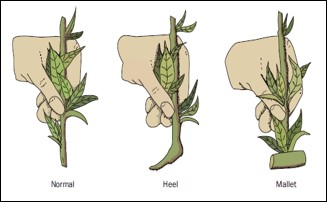
Figure 23. Cutting types for plant propagation include normal, heel and mallet
- If commercial plants are used, follow the supplier’s instructions carefully
- It may be possible to obtain seeds, sods, seedlings or even trees by donation from government or private nurseries
- Plant trees from seedlings and keep roots moist in transit
- Shrubs can also be planted from seedlings, if available, in order to increase survival rates
- Excavate a square foot of topsoil and carefully replace soil around the root system
- Stamp the soil in place so that it is firm but not too tight
- Ensure the plant’s roots are loose and at the proper depth for the tree or shrub
- In areas where ground cover is required, plant a mixture of grasses and legumes.
- Where bank cover and shade are important, plant shrubs and trees (Figure 24)
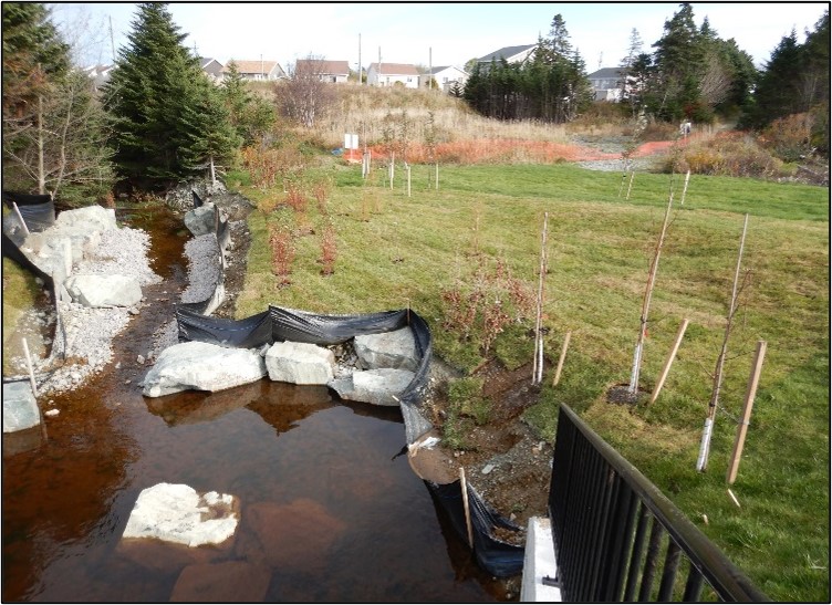
Figure 24. Revegetation planning adding shrubs and trees
- Consider the need for open areas to provide some light penetration and access areas, if desired
- The best time for planting is usually in the spring after frost
- Fall plantings may be more suitable for some species or in certain soil/hydrological conditions
- Care must be taken when applying fertilizers near streams, particularly those with low flows
- Surface runoff from lands treated with fertilizers may contribute to eutrophic (contains increased nutrients) conditions in the stream which in turn may degrade fish habitat quality
- Fertilizers should be used only where little or no fertilizer loading into adjacent watercourses will occur
9.2.6 Monitoring and maintenance
Plantings should be monitored initially for survival rates and possible adjustment of fertilizer, water or additional planting. In the longer term, some monitoring can be conducted to judge success. Some shrub species become more vigorous in rooting and may require pruning. Plant replacement may be necessary until the plant community becomes well established. Some seedlings may be lost to erosion or grazing by wildlife.
9.2.7 Cost considerations
Cost is variable depending upon how much manpower and donated material is available. It is generally a very cost-effective method for boosting salmonid production in small streams since shrub cuttings can be obtained from local plants for free and most projects can be conducted with hand tools.
Hydroseeding requires special equipment that is relatively costly to rent. If conditions are such that special soil cultivation techniques are required, then the project could be expensive. It may be possible to obtain seedlings for free from government sources. Purchase of seedlings from a commercial nursery would add to the overall cost.
9.3 Placement of instream boulders
Boulders are a common natural element of riffles, runs, rapids and to a lesser degree pools. The location within a channel, in combination with its slope, dictates the habitat function (Figure 25). They are a simple, cost-effective means of enhancing the complexity of habitat within a suitable reach of stream. Boulders are durable and when placed properly, maintain their original arrangement and function. Large angular rocks or smooth field boulders create surface turbulence and expose coarser substrates as a result of scouring. This technique can enhance the production and diversity of aquatic insects by exposing larger substrates. In addition, large boulders create more fish spawning and nursery habitat in riffles and cover habitat in pools. Commonly, this application can result in significant increases in the production of juvenile salmon and trout. Typically, boulders are placed adjacent to the thalweg of the channel. Large boulders can be placed individually, however they are generally placed in groups referred to as boulder clusters (Figure 26). The minimum boulder size is dependent on the maximum velocity of the bank full channel. Previously channelized watercourses can be visually enhanced through the placement of boulders (Figure 27).
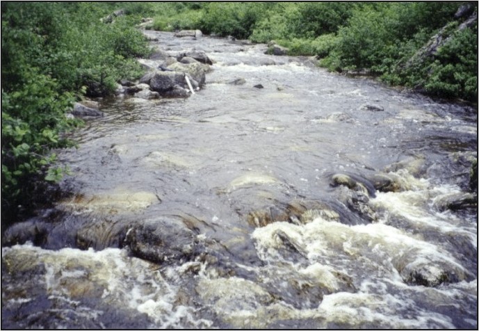
Figure 25. Boulder placement in a small stream
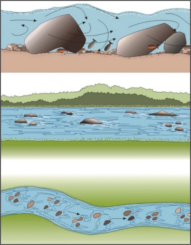
Figure 26. Various views of boulder placement in a stream
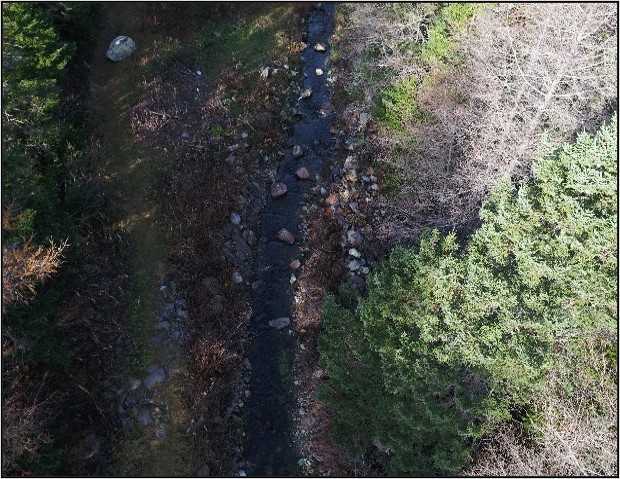
Figure 27. Aerial view of strategic boulder placement at Rocky Pond outlet in Bay Roberts
9.3.1 Objectives
The objectives of this technique are to:
- increase habitat diversity
- increase spawning, holding and feeding cover for adults and protective cover for juveniles in riffles, runs and pools
- increase amount of substrate for settlement by benthic invertebrates
- stabilize and provide scouring flows for spawning gravels and aquatic insect substrates
- increase surface turbulence which may protect salmonids from predation by decreasing their visibility
9.3.2 Applicability
The technique is most useful in those areas that are easily approached by truck and front-end loader since boulders are typically too large, heavy and awkward to transfer large distances by hand.
Work areas must also be suitable for safe instream work by crews working with hand levers. Placement may be in riffle, run or pool areas. It is particularly appropriate for previously channelized areas or other streams lacking suitable cover. Boulder placement is effective in wide, shallow, fast flowing streams as well as to increase velocities in slow moving sections.
9.3.3 Advantages
The primary advantage of this technique is that it is relatively simple, effective, long lasting, inexpensive and natural-looking.
9.3.4 Disadvantages
The disadvantage of this technique is that the boulders can collect debris and ice and cause ponding in certain areas. Boulders added to pools to increase available cover in relatively unstable habitat isn’t recommended as they can act as focal points for the accumulation of material and fines eroded from riffle areas (Scruton 1996). This can result in the development of gravel bars and infilling of pools. Some placements may require repositioning if placed in unstable areas where they will eventually become buried. Increased erosion is possible if placed too close to an unprotected bank in fast water areas.
9.3.5 Guidelines/implementation
- Conduct a stream survey to determine need for boulder placement and suitability of candidate stream sections and, if required, seek expert advice at this stage
- Use large (30 to 60+ cm in diameter, depending on size of stream), angular, rock boulders placed 1.0 to 2.0 m apart
- Place in clusters as per the following illustrations if the stream is large enough (Figure 28)
- This approach is more effective than single boulders since clusters are less likely to move from ice or current and provide better cover for fish
- Supervise personnel closely since there is high potential for injury when handling heavy boulders

Figure 28. Types of boulder clusters (top) and aerial view of boulder placement pattern
Description
Above - Types of boulder clusters:
- 3 boulders make a triangle
- 4 boulders make a diamond
- 3 rows of 2 boulders make a rectangle
- 2 rows of 3 boulders make a semi-circle
- 2 alternating columns of 3 boulders
Below – Aerial view of boulder placement pattern showing a triangle cluster in a river.
- Generally, boulders should be placed in the deepest third of the stream (in or near the main channel) and not obstruct more than 20% of the stream’s cross-sectional area
- If placed on the stream’s edge in order to increase cover for juveniles, ensure that the bank won’t undergo erosion
- This technique should be implemented with caution
- If bank erosion is likely, either do not install boulders or use bank stabilization methods
- Do not install boulders at the crest of riffles
- The best locations in riffle areas are the middle or tail sections
- Boulders can be installed at the upper, middle or lower sections of runs
- In pools, the best areas for installation are at its head and tail and not within the pool
- Install during the summer low flow periods
- If heavy equipment use is required, work should be conducted from the shore and the banks stabilized
- Once placed in the stream, boulders can be carefully levered into position
9.3.6 Monitoring and maintenance
Boulders should be monitored periodically to determine effectiveness (to aid in future projects) and to guard against undesirable erosion or debris buildup.
9.3.7 Cost considerations
This is a relatively inexpensive option if there is a good local supply of suitable boulders and transportation costs of non-local boulders isn’t prohibitive. Ease of access to the stream bank will also need to be a consideration. Costs will increase substantially if bank stabilization is required.
9.4 Low head barriers
Low head barriers are small dams designed to create scour pools (plunge pools) immediately downstream and aren’t intended to create significant pooling of water upstream (Figure 29). The dams may be constructed of rocks, gabions, logs or concrete and must be low enough to allow fish passage and debris to pass over them (Figures 30 and 31). Gravels removed from the lower scour pool are cleaned and deposited a short distance downstream and may form suitable spawning habitat.
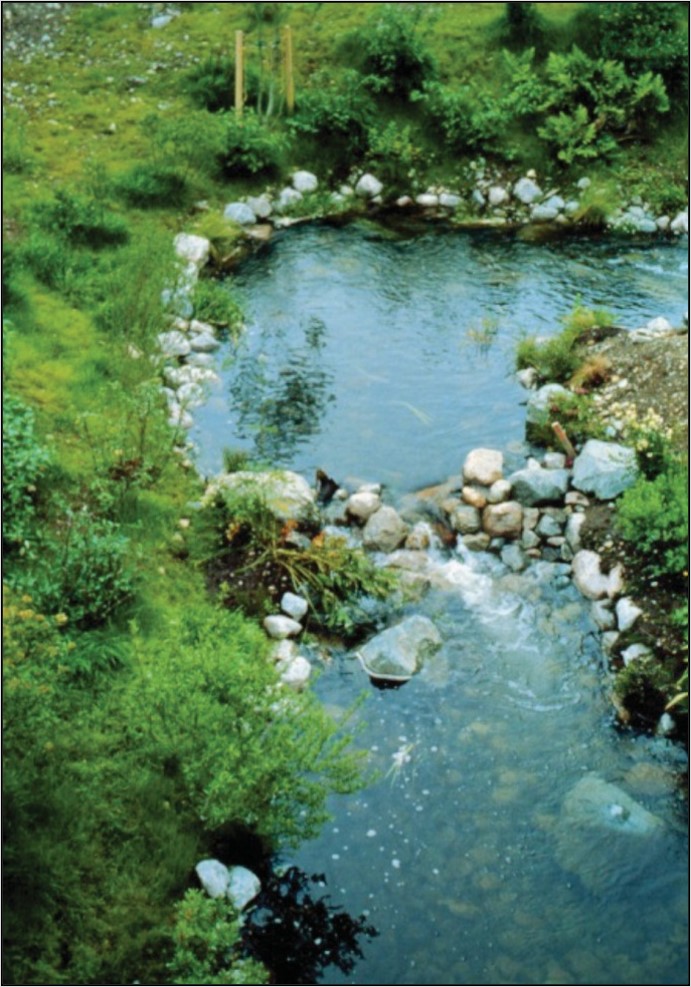
Figure 29. Properly installed low head barrier placement pattern
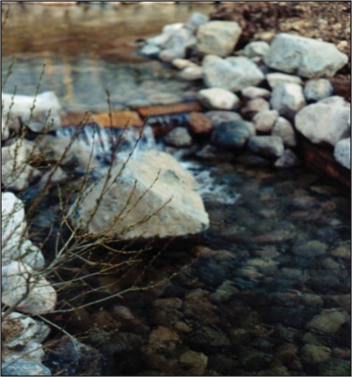
Figure 30. Properly installed wooden low head barrier
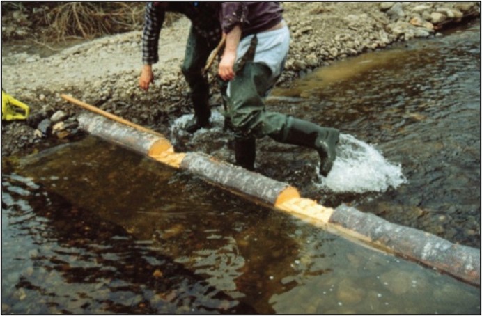
Figure 31. Installing the transversal beam across the stream bed
9.4.1 Objectives
The primary objectives of low head barriers are to:
- Create scour pool habitat with roughened surface water to serve as cover for fish, particularly during low flow periods
- Increase oxygen content of the water which is beneficial in stream sections that may warm up quickly and/or extremely in the summer
- Possibly create spawning habitat immediately downstream at the base of the plunge pool
9.4.2 Applicability
This technique should be used with caution since it has a number of disadvantages (see below, Section 9.4.4). Low head barriers are most suited to streams that have been channelized or contain stretches of straight, steep gradient and as a result have little or no pool habitat.
9.4.3 Advantages
The primary advantage of this technique is that it forms deep plunge pools relatively quickly under small-substrate conditions. Such pools are particularly valuable as protection of freshwater fish during periods of low flow. Natural materials available close to the installation often can be used for most of the construction.
9.4.4 Disadvantages
The barriers may cause bank erosion if they aren’t properly protected. They may collect ice and debris which could cause excess pooling above the structures. The technique is relatively labour intensive and involves more disturbance of the stream bed during construction than the other stream restoration techniques covered in this manual. The structures may also require periodic maintenance, and if not properly installed and/or maintained, they could become obstructions to fish movements. Substrates should be stable to prevent the structure from washing out. In addition, low head barriers should not be constructed in areas of:
- unstable banks
- heavy ice
- large amounts of floating debris
9.4.5 Guidelines/implementation
- Survey the stream to determine suitable installation sites(s)
- Survey and design may require engineering expertise or personnel with previous experience
- Install in small streams where there is little or no pool habitat and at least a moderate gradient
- Low head barriers may be suitable for steep gradient areas only if the substrate and banks are very stable and the structure is very well anchored into the substrate and bank
- Low head barriers comprised of rock (rock dams) may not work well in high gradient streams since strong flows and ice may destroy the structure
- Install in areas where the substrate and banks are relatively stable (such as rocks, shrubs and tree roots) and the banks can withstand high flow conditions
- Low head barriers should not be constructed adjacent to a spring or tributary since this may cause or increase erosion
- To ensure stabilization, the banks may require protection with log cribs or rip rap
- If wood is used as a construction material, use rot resistant soft wood species (like larch)
- Ensure the wood is completely submerged to help increase its lifespan
- Treated preserved wood must not be used as it contains harmful chemicals
- Do not install in spawning areas
- If a series of dams is used, they should be no closer together than 5 to 7 times the average stream width
- Use construction techniques that will minimize erosion (barriers installed at 30 degrees to flow)
- Ensure the structure won’t obstruct fish passage at all flow regimes
- Use manual labour as much as possible to key material together carefully and prevent impacts on the stream
9.4.6 Construction steps
The following specific construction techniques are outlined for rock and wooden structures. Wooden structures are more suitable than rock dams for steeper gradient sections since they are less likely to wash out.
- Rock dam
- Excavate a ditch at least 30 cm in depth across the width of the stream
- Position so that the center of the dam is farther upstream and lower than the ends in order to direct flow to the center
- Excavate a ditch at least 30 cm in depth across the width of the stream
- A cross section of the dam should be triangular with a 30-degree slope or less on the upstream side in order to facilitate fish passage
- Construct the base with several rows of rocks
- Use largest rocks on downstream side and in the center
- Fill upstream crevices in upstream side with smaller rocks, gravel and sand
- Rock placement should be done by hand and keyed together to increase stability
- If constructing a series, start downstream and work up in order to best judge the amount of water that will be impounded
- Install rip rap along the bank flush with the ends
- Digger logs
- Logs are most effective in streams under 6 m (20 ft) wide
- Log diameter should be approximately 10 cm (4 in) to 15 cm (6 in) with a minimum of taper from one end to the other
- The digger log must be firmly anchored to the substrate
- It should be rotated to a 30-degree angle form straight across the stream and, when looking downstream, turned towards the side the pool is on
- The ends of the log must fit tightly to the banks and be well rocked in place to prevent erosion of the banks
- A rock ramp should be built, sloping the stream bed up to the log
- Typically, this means a 1 to 3 m (3 to 10 ft) long ramp on the upstream side
- Cobble and large rocks armouring the surface should be removed from the pool area to assist the scour by the flows
- Wooden dam
- This design is good for small streams about 1.5 to 3.0 m in width
- It can be constructed with or without planks
- This design is good for small streams about 1.5 to 3.0 m in width
- Carefully level the stream bed from bank to bank in a 75cm wide strip
- Dig holes into both banks and place the log (transversal beam) across the stream bed
- The holes should be approximately 30 to 40 cm in width and extend at least 1.4 m into the bank
- Support the transversal beam with longitudinal and diagonal braces (Figure 32)
- If fish passage is desired, cut a 20 to 40 cm groove in the transversal beam to a depth of 2.5 to 4.0 cm
- Stabilize the upstream and downstream portions of the bank with rip rap or a log crib
- For rip rap, extend protection upstream and downstream for at least 1.6 m
- For log crib, extend protection 4.0 m upstream and 2.0 m downstream

Figure 32. Aerial view (above) and cross section (below) of a single log rock dam
Description
Above: Aerial view of a single log rock dam showing the log driven into bank with a nail and supported by longitudinal and diagonal braces and reinforced bank. Gravel present before log and spillway identified in the middle of the log.
Below: Cross section view of a single log rock dam. Plunge pool identified after dam.
9.4.7 Monitoring and maintenance
Rock dams and digger logs should be checked each spring for signs of rot, erosion and undermining. Take steps to correct these problems and prevent a recurrence.
Check scour pool for signs of potential undermining and replace rocks, logs and other pieces of the structure as necessary. This technique requires somewhat more monitoring and maintenance than the other techniques.
9.4.8 Cost considerations
This method is very labour intensive and thus cost of labour is the major factor. Materials aren’t particularly costly if available locally. Most if not all of the work can be performed with simple hand tools. As mentioned above, this method requires regular monitoring and maintenance which should be factored into any costs.
9.5 Instream cover
After 32 years of extensive trout stream restoration in Wisconsin, only stream bank cover, particularly in conjunction with current deflectors (see section 9.7 ‘Wing deflectors’), have consistently improved trout numbers, with emphasis on larger trout (Hunt 1988). Extensive testing of habitat improvement devices for brown trout in SE Minnesota waters revealed that cover was, by far, the single most important factor (Thorn 1988).
Instream cover is provided in natural streams by boulders, logs, vegetation (such as brush or trees that hang in the water) and undercut banks. Thus, instream cover has been discussed in previous sections of this document (see ‘Planting of stream bank vegetation’ and ‘Placement of instream boulders’).
Various artificial devices have been designed to enhance instream cover, such as:
- half log structures, mounted above the stream bed using rebar
- floating logs or pallets
- submerged log bank cover
These techniques, however, look artificial and may fail completely under Newfoundland and Labrador conditions. They have not been proven to be overly effective in increasing total numbers of fish. Half logs can be applicable in small streams with low water velocities as instream cover where other techniques would be too large, like lunkers.
In Newfoundland and Labrador, brush cover is probably the most practical means of increasing stream cover other than by placement of boulders and the encouragement of bank vegetation and undercut banks.
The undercut bank technique developed in Wisconsin (lunkers), which is very effective here, is also described (Figure 33).
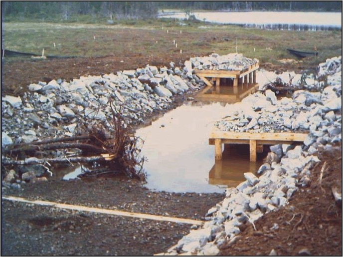
Figure 33. Constructed instream cover (undercut lunker structures (right) and rootwad placement (left)) in a man-made stream prior to re-watering
9.5.1 Objectives
The objective of this technique is to increase cover for juvenile and adult salmonids in prime feeding and holding areas. This technique may also provide some bank protection on the outside of meanders.
9.5.2 Applicability
The brush technique is useful in areas where cover, particularly for juveniles, is deemed to be a limiting factor to production. Suitable locations include along banks in riffle areas and behind large boulders. It can be applied to a wide range of stream sizes.
Lunkers are primarily used to introduce overhead cover for fish where existing habitat is limited.
They can be used in rivers or streams independently or in conjunction with erosion control measures, such as native material revetments. This structure is placed below the elevation of the low flow channel typically along the outside bends of a stream where the channel depth is consistently higher than the top of the lunkers. Usually, it is placed in a location which allows for a gentle flow under it to inhibit sediment accumulation. The undercut bank method should not be used in unstable areas. It may be difficult to install in areas of bedrock since reinforcing rods must be driven into the stream bed.
Both techniques may not be suited to streams that experience severe flooding or have an unstable stream bottom.
9.5.3 Advantages
The advantages of these techniques are that they look natural, have been proven effective, are relatively inexpensive and simple to install. These techniques may also provide some erosion control.
The location of trees/brush bundles can be easily readjusted for optimal success.
It has been shown in this province that pools designed with ‘’lunkers” had on average 2.6 times more large brook trout biomass than those without (Clarke and Scruton 2003). The lunker structure can be prefabricated off-site and materials are usually available locally.
Undercut bank structures usually narrow and deepen a stream.
9.5.4 Disadvantages
The disadvantage of the tree/brush technique is that it can encourage some clogging of stream flows if not installed properly or if it is overdone. Tree/brush placement should be considered to be a temporary technique unless funding exists to replace them every few years. Annual maintenance may also be required. Rootwads (medium-sized trees with the root structures still attached) may be used in place of brush piles to extend the durability of tree/brush placements (Figure 34).
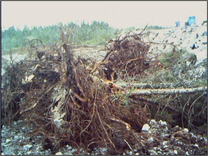
Figure 34. Typical rootwad bundles prior to placement
While lunkers work best in lower velocity environments, they may be vulnerable to dislodging by ice in spring freshets. Also, the undercut bank technique may fill in with fine sediment or gravels if placed in an unstable area.
9.5.5 Guidelines/implementation
- Tree/brush technique
- Survey area carefully. Install on the outside of meanders or across and slightly downstream from deflectors
- Anchor tree or bundle of brush to bank with heavy gauge galvanized wire tied to a stump or a stake driven into the ground
- Anchor above the high-water mark
- Align whole trees or branches parallel to the axis of the stream or angled downstream
- Can be installed as a permanent or temporary structure
- Use long-lasting woods (softwoods) and use branches, brush bundles or whole trees as appropriate
- Do not place in areas of very fast current
- Undercut bank technique
- Survey area carefully. Most effective placement will be on the outside of a meander and/or where the current is deflected into the bank
- Design and obtain materials. Preserved or pressure treated wood is to be avoided
- Do not place in areas with unstable substrate as the structure will simply fill in with gravel
- Do not place in areas subject to extreme flow or ice
- Stabilize the upstream and downstream ends with rock rip rap and revegetate the area if necessary
- Prefabricated structures similar to those illustrated in Figure 35 can be used
- Construct during the summer low flow period
- All wood should remain submerged to reduce decay and rot resistant wood (like spruce, cedar) should be considered
- Dig trenches into the stream bank for horizontal support
- Position larger stones along the toe of the original bank to prevent water from eroding under the structure (Figure 36)
- Place filter fabric over the entire platform area of the structures
- Deposit a layer of rock and gravel over the filter fabric, cover with soil and sod, and seed or plant cuttings as required
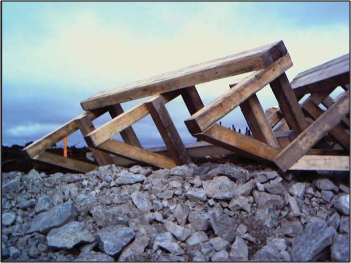
Figure 35. Prefabricated frame made of wood for undercut bank treatment

Figure 36. Aerial view (above) and side view (lower) of the undercut bank technique
Description
Above: Aerial view of the undercut bank technique. Exposed natural bank with rock backfill surrounded by revegetation.
Below: Side view of the undercut bank technique showing reinforced rods and fish cover underneath bank.
9.5.6 Monitoring and maintenance
Structures should be inspected every spring and replaced/repaired as necessary. Determine if the structure is serving its intended purpose and reposition or remove as necessary. Ensure that structures aren’t collecting debris or causing erosion. Inspect for and protect against infilling by sediment and debris.
9.5.7 Cost considerations
Tree/brush placement is an extremely cost-effective technique since it is simple, works very well and uses natural materials that can be placed with a minimum of hand tools. Annual maintenance is required and replacement of structures may be necessary at periodic intervals.
The artificial undercut bank technique is:
- more expensive
- requires materials (purchased or donated)
- considerable labour
- requires additional bank stabilization and revegetation
9.6 Bank stabilization
Bank stabilization can be an important stream improvement technique in streams where erosion has resulted in the deposition of excess sediment in the aquatic environment. While sediment is a natural part of aquatic habitat, excess sedimentation can have a variety of negative effects on fish and fish habitat, such as:
- damaging fish gills
- smothering eggs
- infilling spawning and rearing habitats
Stream bank stabilization can prevent erosion that degrades fish habitat on site as well as downstream by eliminating the source of the sediment.
Hunt (1988) found bank stabilization to be one of the most effective stream restoration techniques. As a general rule, stabilization techniques should only be applied to those areas that have been disturbed, such as livestock grazing or improper stream crossings.
Several factors should be considered prior to initiating a bank stabilization project:
- determine the cause of erosion
- evaluate the level of protection required
- implement the appropriate technique taking into account:
- bank slopes
- aesthetics
- site-specific information
Remember to work in low flow periods but design for peak flows.
Care must be exercised in the use of bank stabilization techniques because they can be very expensive and, if not properly constructed, may simply shift the erosion problem to another site further downstream.
Methods suitable for small streams include revegetation (see 'Planting of stream bank vegetation'), changing of bank slope, rock rip rap, gabions or some combination thereof (Figure 37). Terracing is another method that can be used on long, steep slopes composed of unstable sandy soil. Terracing isn’t covered in this set of guidelines since it would require strong engineering expertise to install properly.
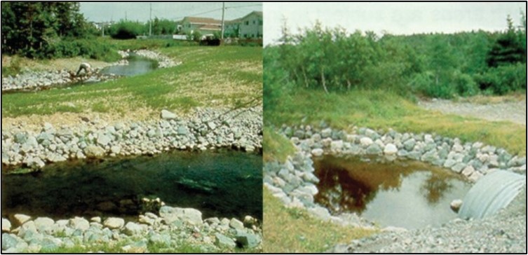
Figure 37. Photos of stream bank vegetation (hydroseed) and rip rap (left). Rebuilt stream banks using rip rap, sod and natural vegetation (right)
Concrete walls or other smooth surfaces aren’t recommended as they don’t dissipate any flow energy and thus may increase erosion and flooding downstream. They also don’t create fish habitat. The techniques outlined in this section are general guidelines only. It is recommended that engineering expertise or experienced assistance be sought for detailed design work, particularly for major projects.
9.6.1 Objectives
In general, the primary objective of bank stabilization is to prevent erosion that degrades fish habitat at the site and downstream. A secondary objective may be to increase fish habitat with the use of rip rap composed of large angular rock. Fish production may be increased by:
- protection and improvement of spawning gravels through lessening of sediment input and revegetation
- providing additional stream bank substrates for benthic invertebrates
9.6.2 Applicability
These techniques are applicable to those areas previously impacted by disturbance and at those locations where the bank can be stabilized without simply shifting the problem up or downstream. Rip rap or rock filled gabions should only be used in those areas where revegetation alone isn’t sufficient (as is, those rapidly eroding areas that won’t readily support vegetation without stabilization).
Unstable banks are those characterized by:
- loose
- un-compacted soils
- usually with steep slopes
- groundwater seepage may also be present
The decision to use rock rip rap or gabions is primarily determined by the slope of the channel sides and with due consideration to aesthetics.
- Revegetation
- Vegetation provides stream bank stability and as such prevents erosion which can impact upon fish and fish habitat (Figure 38)
- Revegetation can include seeding, sodding and planting
- A mixture of grasses, shrubs and trees is recommended unless specific site conditions indicate otherwise (see Section 9.2)
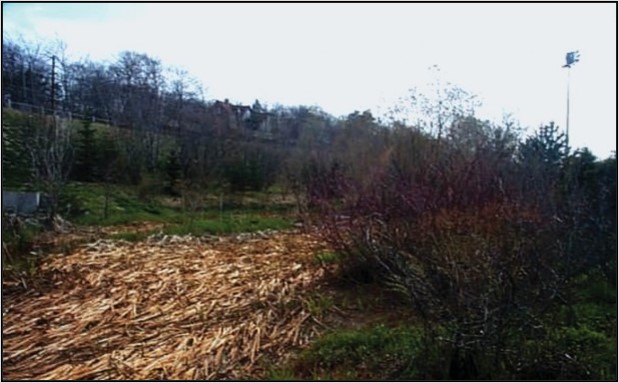
Figure 38. Planted vegetation along a stream bank
- Rip rap
- Rip rap is a common technique used to stabilize eroding stream banks primarily in situations when vegetation alone doesn’t provide adequate bank support (Figure 39)
- The choice of rip rap technique depends on site specific conditions and availability of source material
- Rock is the most common material used
- Angular rocks of suitable sizes (that will resist displacement during peak flows) should be used
- Source material should not be removed from the stream bed
- In general, rock rip rap is applicable when:
- the banks are less than 3.0 m in height
- grade is no steeper than 2:1
- water velocity is no more than 3.5 m/s
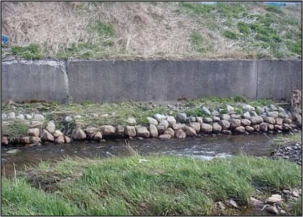
Figure 39. Rip rap lined along a section of walled stream bank
- Gabions
- This technique is preferred where slopes are too steep for rip rap stabilization techniques
- Gabions are basically pre-constructed steel wire baskets filled with rocks
- Gabions protect stream banks from the erosive action of stream flow and provide retaining wall support for an unstable soil bank (Figure 40)
- For stream banks with lower slopes, gabion “blankets” can also be utilized
- As with rip rap, rock material for gabions should not be removed from the stream
- In general, gabions are applicable when:
- the banks are less than 3.0 m in height
- bank grade is steeper than 2:1
- there are no suitable rocks available for rip rap
- aesthetics aren’t of primary concern
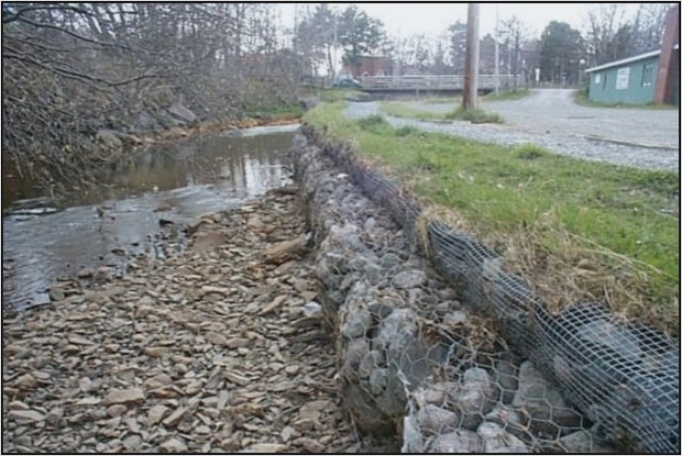
Figure 40. Typical stream bank gabion (note backfill and planted grass to assist in stabilization)
9.6.3 Advantages
The advantages of using rock and vegetation for bank stabilization are that they are natural materials and are usually readily available. Rip rap or gabions, if installed properly, are flexible and will protect banks from wind, ice and water scour.
They can survive groundwater seepage and are relatively permanent structures that require little maintenance. The rocks increase fish habitat, particularly for young fish. Both rip rap and gabions provide excellent long term stream bank stability.
9.6.4 Disadvantages
Stream bank revegetation may not adequately protect an extremely disturbed stream bank and additional stabilization, sloping and reconstruction may be required. This would obviously also increase the cost. Replanting may also be necessary on a regular basis (such as annually) until the site is stable.
The primary disadvantage of rip rap is that it is very expensive unless a free supply of boulders and heavy equipment is readily available. In addition, placement of boulders may be difficult without instream use of heavy equipment.
Gabion construction is labour intensive, and the baskets are expensive. Both rip rap and gabions look unnatural until they have been revegetated. Engineering expertise and access to stream banks by heavy equipment is also likely required. If not properly installed, erosive forces of the stream may be shifted up or downstream (Figure 41). Both techniques are also vulnerable to undermining.
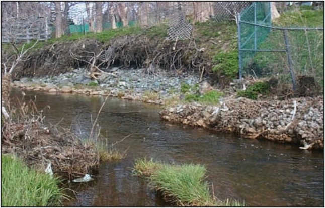
Figure 41. Collapsed gabion structure has decreased stream width and has caused excess erosion directly downstream
9.6.5 Guidelines/implementation
- Before deciding upon bank stabilization:
- determine the cause of the erosion
- the level of protection required
- the best technique to be implemented considering factors, such as:
- bank slopes
- flows
- appearance
- Revegetation
- See Section 9.2. Planting of stream bank vegetation
- Rip rap
- Consult an engineer concerning detailed design criteria, such as:
- proper rock size
- grade
- length
- installation methods
- bank tie ins and base protection
- Consult an engineer concerning detailed design criteria, such as:
- General recommended rock sizes
| Velocity (m/s) | Size (cm) |
|---|---|
Less than 3.0 |
20 to 46 |
3.0 to 4.0 |
20 to 77 |
4.0 to 4.6 |
50 to 122 |
- Assemble material, arrange for supply of boulders and transportation
- The location of rocks, transportation of large amounts of rock and access to the stream bank are critical factors for these techniques
- Use angular, hard rocks of suitable size to resist displacement during peak flow events
- Rock rip rap should be comprised of a mixed gradation so that smaller stones fill the voids between the larger ones to provide compaction and stability as shown in Figure 42.
- A layer of filter stones may be required depending upon the type of underlying soil and the size of the protective rip rap (Fisheries and Oceans Canada 2022)

Figure 42. Cross section of properly placed rip rap structure on stream bank
Description
Cross section of properly placed rip rap structure on stream bank showing graded bank covered with filter stone and topped with rip rap. Bottom of bank, also known as the toe, is strengthened with large rocks to reduce the risk of undermining the rip rap and the stream bank.
- Design for high flows and construct during low flows
- Divert stream flows around construction with sandbags or other devices only if absolutely necessary
- Fit, by keying into the bank, the largest rocks at the upstream and downstream ends and into the toe of the stream bank
- Taper the rocks at the up and downstream ends
- Instream work may be required to properly embed the rocks at the toe
- Do not remove rocks from the stream bed
- Installation of rip rap should not result in a decrease in the cross-sectional width of the stream
- Arrange rip rap in a layer at least 1.5 times the thickness of the maximum rock size and not less than 30 cm in thickness
- To help stabilize the area, revegetate the bank slopes
- Shrub cuttings can be used in and around the rip rap
- Gabions
- Consult an engineer concerning detailed design criteria, such as:
- proper gabion size
- grade
- length
- installation methods
- bank tie-ins
- base protection
- Assemble material, arrange for supply of rock/gabions and transportation
- The location of rocks, transportation of large amounts of rock which may damage truck beds, and access to the stream bank are critical factors for these techniques
- Use proper bedding of gravel and fabric as a lining (similar to rip rap installation)
- Use plastic or galvanized baskets and fill with rocks larger than the holes
- Do not use rocks from the stream bed
- Tie empty baskets to each other and into the bank and then fill with rocks, no deeper than 0.3 m and repeat in stepwise fashion
- Backfill behind baskets and revegetate similar to rip rap
9.6.6 Monitoring and maintenance
Structures should be checked periodically for any signs of undermining. Replace rocks, repair any damaged gabion baskets and revegetate as required. Check for erosion downstream of stabilized sites. If installed properly, they should require very little if any maintenance.
9.6.7 Cost considerations
The use of rip rap and gabions is generally considered to be very expensive in time and equipment, particularly for large projects. Major costs, aside from personnel, include:
- backhoe rentals
- transportation of rocks
- purchase of special baskets
Other factors to consider include ease of access, proximity and type of work available, and reseeding and revegetation costs.
9.7 Wing deflectors
In a review by Hunt (1988), most projects with bank cover/deflector structures demonstrated a positive response in trout population parameters. Wing deflectors are structures that protrude from the stream bank into the main flow and are utilized to:
- narrow the stream which increases stream velocities
- deflect the flow to the opposite bank in order to reestablish a natural meander pattern (Figure 43)
Figure 43. Example of single wing deflector
Description
Single wing deflector shown protruding from the stream bank into the flow, narrowing the stream to increase velocity.
Various designs have been tested, but the most natural in appearance and durable in the field have been those made of rocks and/or log cribs (Figure 44). They can be very effective in improving salmonid habitat if they are used to deflect currents into areas of stream bank cover (Hunt 1988). Deflectors can be placed singly or in pairs to:
- narrow a stream and deepen the channel
- return a stream to a meandering form by being placed in an alternating pattern
Gabions are frequently used as deflectors although they aren’t as aesthetically pleasing as plain rock/log deflectors.

Figure 44. Illustrated cross section of the earth, water and sky showing examples of rock and log crib deflectors.
Description
A four panel image showing various designs of rock and log crib deflectors indicating resulting flow of water. Top panel is an aerial view of a twin rock deflector narrowing the river from both sides, a single rock deflector, a log crib plus rock deflector and a log riprap deflector. The images below are illustrated cross sections of a rock technique, a log crib plus rock technique and a log riprap technique (using cut off T-bar at ground level with wire underground).
9.7.1 Objectives
The primary objectives of wing deflectors are to:
- accelerate the return of a channelized stream to its natural meander pattern in order to increase the amount of high-quality salmonid habitat
- increase velocities in order to clean substrate of excess sediment
- deposit clean gravels immediately downstream
9.7.2 Applicability
This technique is most applicable to channelized areas of low or moderate gradient. Flat, wide, slow areas are particularly improved by deflectors. If the stream gradient is too steep, it is very difficult to prevent structures from washing out. They aren’t suitable for areas with large amounts of heavy ice or debris or unstable stream sections. Deflectors should not be placed on the outside of a curve as they may create or accelerate an erosion problem. Single deflectors used in sequence will redirect the thalweg (main channel) and emphasize a meander pattern. Their effectiveness in terms of fish habitat is increased by placing stream bank cover on the bank opposite and slightly downstream of the deflector. Twin placements of deflectors concentrate flow in the centre of the channel and primarily have a deepening/pool scour effect. Rip rap may also be required on the bank opposite the defector to prevent erosion.
9.7.3 Advantages
The advantages of deflectors are that they are very cost-effective if used properly and if sufficient numbers of suitable rocks are on site. Combined with stream bank cover they are proven to increase numbers of trout (Hunt 1988). They provide habitat diversity, cover and depth, and contribute to cleaning of downstream substrates.
Deflectors, if properly placed, can also aid in stabilizing stream banks and in controlling erosion.
9.7.4 Disadvantages
The disadvantages of this technique are that construction is relatively labour intensive and that it is only suitable in certain situations. Heavy equipment may also be required. Expert advice is highly advisable since these structures can cause some erosion and loss of bank stability if not designed and constructed properly.
9.7.5 Guidelines/implementation
- Survey and design carefully, preferably in conjunction with professional advice
- Consider physical variables, such as:
- bank composition and height
- stream gradient
- width
- depth (at high and low flows)
- Consider physical variables, such as:
- Deflectors should be designed to ensure that unfavorable conditions, such as extremely high water and ice buildup, don’t result in damage or total removal of the structure
- As with most other techniques, design for peak flows and construct during summer low flows.
- Locate and assemble suitable supplies of rocks and transportation
- As with boulder placement and rip rap, this is a critical phase
- Access to the stream bank by truck may also be critical
- In general, it is recommended that deflectors be placed in an alternating pattern, 5 to 7 stream widths apart in a manner that accentuates and guides (but doesn’t dam) the normal flow pattern
- If the desired effect is to narrow the stream in order to create a long deep channel or pool, consider installation of twin deflectors
- Long, straight, sluggish sections of a stream are the best locations for deflectors
- In general, deflectors should not reduce the stream width by more than one third
- Deflectors should be triangular in shape and:
- on the upstream edge form an angle of less than 45 degrees, preferably nearer to 30 degrees
- on the downstream edge form an angle of 90 degrees or greater to the upstream edge
- Protect the bank with rip rap or other measure where the deflector meets the bank at up and downstream ends and, if necessary, also protect the opposite bank
- Do not place on crests of riffles or on stream bends
- Place only on a firm bottom; some stream bed excavation may be required
- Take all necessary steps to control bank erosion through stabilization and revegetation techniques
- Use the largest rocks on the upstream side of the defector and near the bottom
- The largest rock should be at the apex
- Place rocks in an overlapping pattern (double row on the upstream side)
- fill any gaps with smaller rocks
- Slope deflector up to the bank, fill in center with smaller stones and consider vegetating with grasses
- The final height of the deflector should allow ice and debris to pass over during high flow events
- Rock to be used in the deflector should not be removed from the stream bed, unless removing armour rocks to accelerate pool/thalweg creation
9.7.6 Monitoring and maintenance
Structures should be inspected periodically for undercutting, bank erosion and any other damage and the appropriate repairs conducted. Eroding stream banks should be stabilized and any scouring and/or deposition of material identified.
9.7.7 Cost considerations
This is a cost-effective technique if a good supply of suitable rocks are nearby. It can be a labour-intensive project if large numbers of deflectors are required. Repair costs are minimal or nil if designed and constructed properly. If heavy equipment is required, the cost will increase substantially.
9.8 Tailwater pools (culverts)
Poorly or improperly installed culverts can have drastic effects on fish populations by eliminating previous access to upstream fish habitat. The Salmon Association of Eastern Newfoundland (SAEN) conducted extensive surveys of culverts on the Avalon Peninsula during 1988 and found that of the 850 culverts examined, approximately one third were considered to be totally impassable by fish and another one third were considered questionable (Buchanan et al. 1989).
The physical removal/replacement of large barriers, such as improperly installed road culverts, waterfalls or the construction of fishways, is beyond the scope of this manual. Small-scale obstruction removal is covered under Section 9.1 (Removal of instream debris). This section outlines the creation of structures, such as tailwater pools, that would facilitate fish passage through improperly installed culverts (Figure 45).
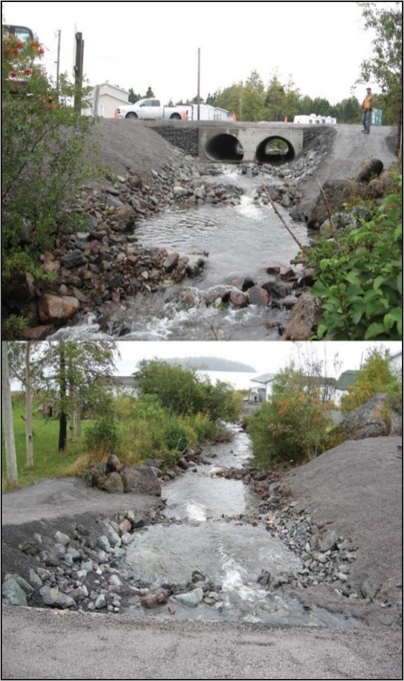
Figure 45. Culvert with tailwater pools
Description
Above: Looking upstream towards a culvert, with tailwater pools to facilitate fish migration into the culvert
Below: Looking downstream from culvert at tailwater pools
9.8.1 Objectives
The objective of facilitating fish passage through culverts is to re-establish the total amount of fish habitat available to the entire stream population by restoring fish passage to a more natural, pre-culvert condition.
9.8.2 Applicability
The creation of tail-water or outlet pools applies mostly to low or moderate grade culverts where the tail of the culvert creates an obstruction for migrating fish. It should only be considered in cases where fish habitat exists above the culvert and there isn’t excessive movement of substrate, debris or heavy ice. Large drops or steep gradient below culverts may preclude this type of approach for improving fish passage, therefore, engineering expertise should be consulted prior to undertaking such a project.
9.8.3 Advantages
The advantages of creating pools at the tails of culverts are that it restores accessibility to upstream reaches, provides a resting area during migration and can be constructed using natural materials.
9.8.4 Disadvantages
The primary disadvantage of creating plunge pools at the tail end of culverts is that if improperly installed, they can wash out or backup and cause localized flooding. Improperly designed plunge pools can also become obstructions, particularly during low flow periods (Figures 46 and 47).
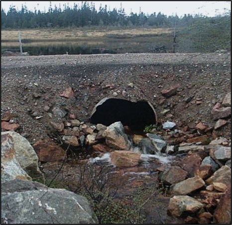
Figure 46. An ill attempt to create a plunge pool on an improperly installed culvert
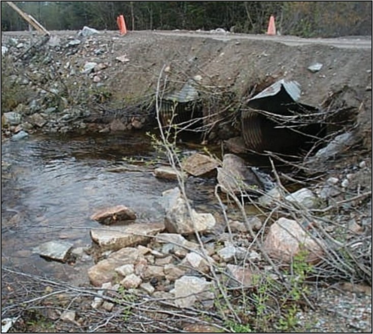
Figure 47. Proper pool construction but poor bank protection
9.8.5 Guidelines/implementation
- Plan and design carefully in cooperation with appropriate expertise
- Engineering and biological advice should be obtained during the planning stage of the project
- Install only for culverts that have a downstream waterfall that is a complete barrier or has the potential to create a barrier to fish habitat upstream
- Install only in those areas where the substrate is reasonably stable and large amounts of floating debris and ice aren’t present
- Protect stream bed and banks with rip rap where necessary
- Construct tail water control pools with rocks as illustrated in Figure 48
- Allow for fish passage at low water.
- If a complete rock dam is used, ensure that it is notched in the center to allow passage at low flow
- If the drop from the control structure exceeds about 15.0 cm, then a series of structures (forming steps) should be used
- Pools should be pear shaped and sized such that:
- pool length is 2 to 4 times the fish passage culvert diameter
- pool width is 2 to 3 times the fish passage culvert diameter
- pool depth equals 0.5 times the fish passage culvert diameter with a 1 m minimum
- Pools should be designed so there is a smooth transition of flow from the culvert to the natural stream width

Figure 48. A schematic of a tailwater pool properly constructed with rocks and the recommended pool dimensions (above) along with a profile of culvert and pool construction (lower)
Description
Above: A schematic aerial view of a properly constructed tailwater pool with rocks to stabilize pool edges. Culvert and pool outlet are identified as well as the notch. The recommended pool dimensions are labeled, with D = the diameter of the fish passage culvert, the pool width 2-3 timed the fish passage culvert diameter and the length of the pool 2-4 times the fish passage culvert diameter indicating a pear shape. A minimum of 300 mm between the culvert outlet and the rock wall.
Below: a profile of culvert and pool construction.
9.8.6 Monitoring and maintenance
Structures should be checked periodically for undercutting, erosion and debris buildup. Repair as necessary. Check upstream reaches for evidence of fish presence as an indicator of successful passage. This can be done by visual surveys, electrofishing or other DFO approved methods.
9.8.7 Cost considerations
This is a reasonably cost-effective technique if rocks are available near the site and if a backhoe isn’t required. Only natural materials are used. Should require little or no maintenance if installed properly.
9.9 Gravel catchment and placement
In many rivers in Newfoundland and Labrador, owing in large part to regional geomorphology and stream gradient, spawning locations and suitable spawning substrates are considered potentially limiting to fish production (Scruton et al. 1996). In instances where spawning habitat has been identified as a limiting factor, salmonid production can be improved by increasing the quality and quantity of available spawning habitat. This can be achieved by installing instream structures to trap gravels of appropriate size and/or by adding clean, sorted gravel directly to the stream bed (Figure 49).
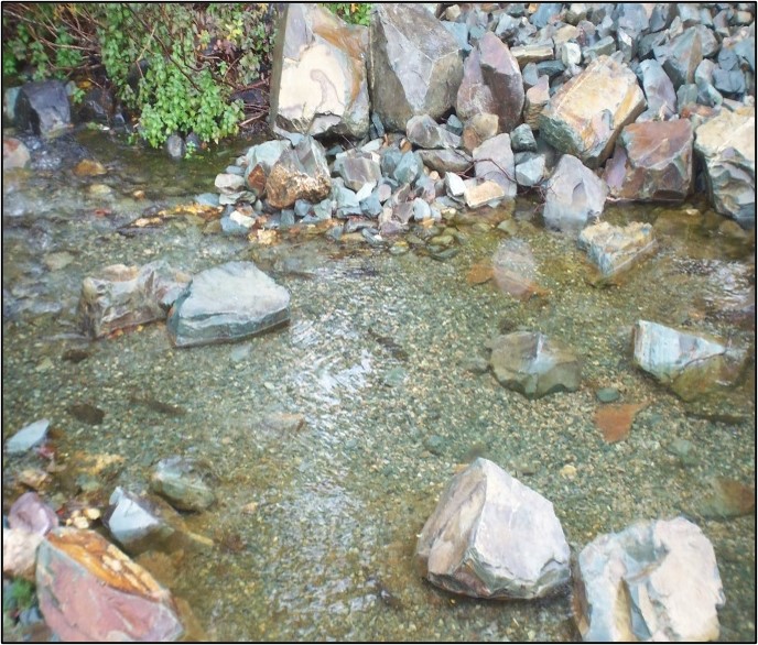
Figure 49. Stream showing good gravel placement
9.9.1 Objectives
The objectives of this technique are to increase the spawning potential of fish habitat by the placement of suitable gravel material or by the use of instream structures which capture or clean existing spawning material.
9.9.2 Applicability
Gravel catchment devices are only suitable for streams that have an adequate bedload (sediment moving on or near the stream bed) but insufficient instream features to stabilize them. Catchment devices should be installed within stream sections that are stable and relatively straight.
Gravel placement is appropriate for stream sections that meet hydraulic criteria suitable to retain gravels but lack a natural source (such as a stream section downstream of a lake or reservoir). Success rates are highest where stream flows are relatively stable. Streams with unstable flows, or those that experience extreme flooding, will require the use of catchment devices to stabilize the gravels.
It should be determined whether spawning habitat is a limiting factor prior to project planning. Sufficient rearing habitat must also be available in order to support any increases in fry production.
9.9.3 Advantages
The advantage of gravel catchment is that many of the above instream structures, such as wing deflectors, boulders and low head barriers, can be installed for diversifying habitat as well as gravel catchment (Figure 50).
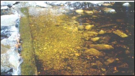
Figure 50. Gravels accumulating at the upstream end of a low head barrier
Gravel placement can be conducted by hand, if required, and can yield successful results with respect to fish production with relatively little additional effort.
9.9.4 Disadvantages
Gravel catchment by instream structures becomes a disadvantage when excess gravels are deposited and disrupts other characteristics of the structure. For example, an undercut bank structure may capture gravels such that the cover provided by the undercut characteristic is lost.
Keep in mind that the absence of gravels in one section of stream may not be due to the fact that upstream supply is limited, but may be due to a characteristic of the area, such as excessively high spring flows or ice scour. Gravel may be lost if it is improperly placed and washed away by the stream or covered in silt. Also, unless there is a source of continual gravel refreshment, gravel may eventually disappear due to bed load movement.
9.9.5 Guidelines/implementation
- All instream work should be carried out during low flow periods
- Professional advice should be obtained to predict the location of scour and deposition as well as determine what type of structure would be most efficient
- Structures should be installed within riffles or the tail end of pools, preferably where the channel is 30% to 50% wider than the mean channel width
- Any structures used must allow fish passage at all times and flows
- High quality spawning gravels are loose and tend to be unstable
- Gravel placement should be accompanied by installation of catchment devices to ensure that newly added gravel isn’t washed away
- Spawning substrate consists of clean gravels of various sizes typically ranging between 0.2 and 5 cm, depending on the fish species and size
- Gravels can be placed around existing instream structures, such as boulder clusters (Figure 51)
- The lack of suitable spawning substrate may not be due to the inability of the stream to stabilize material, but rather a lack of an appropriate material source
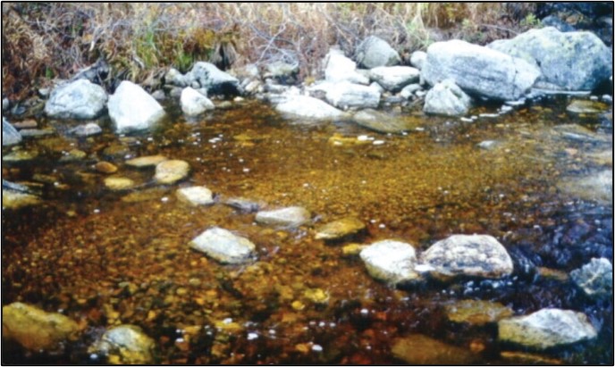
Figure 51. Gravels placed upstream of a loose boulder cluster
9.9.6 Monitoring and maintenance
Instream structures should be checked for erosion and any observed problems should be remedied. If the catchment structures are stable but aren’t trapping adequate spawning gravels, placement of gravels might be considered. Placed gravels that have been transported downstream could be stabilized by installing catchment structures (Figure 52).

Figure 52. Illustrated cross section of a straight river with land on both sides and various placements and sizes of gravel caught around different rock structures.
Description
Illustration of gravels placed and caught around different rock structures. Catchment structures are used to help stabilize placed gravel. Illustration also depicts instream structures including wing deflector, near-bank boulders, mid-channel boulder group and rock groin and the resulting water flow and associated gravel deposition ideal for spawning.
9.9.7 Cost considerations
Catchment structures would have similar cost considerations as outlined previously. The acquisition of spawning gravels for placement may be expensive if a local source isn’t available. The substrate material required for spawning would have to be placed with sufficient depth to ensure that redds can be created by females of the target species (this can be up to 50 cm deep). On that point, it should also be noted that the shape of the gravels and spawning substrate should be smooth and rounded. If it’s sharp and angular, it will be too rough on fish during redd construction. Also, the composition of placed substrate should be consistent with the existing substrate (same rock type). All of these factors can add to the cost of this technique.
Transportation of material can be expensive. Placement can also be expensive if heavy equipment is required, however, most placement may be possible by hand. In which case, the total number of available personnel/volunteers required should be considered.
9.10 Other techniques and combinations
Other techniques that are often covered in stream improvement and enhancement manuals include:
- large obstruction removal
- riffle/pool construction
- installation of fishways
- installation of spawning channels
- various combination techniques
9.10.1 Large obstruction removal
Removal of major obstructions to fish movement, such as waterfalls (Figure 53) or velocity barriers, can open up new areas for sea-run salmon and trout. Because this technique usually involves blasting or fish ladder construction, it isn’t recommended for routine use by public groups.
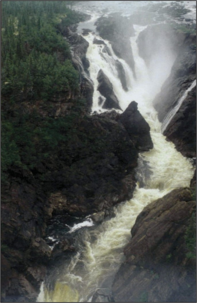
Figure 53. Waterfall which completly obstructs fish passage, Metchin River, Labrador
However, under certain circumstances removal of major barriers may be highly desirable and DFO should be consulted if this appears to be the case. Careful study of the system would be required in order to ensure that there would be no adverse impacts, such as:
- introduction of unwanted disease, parasites or predators to other portions of the watershed
- significant disruption of biodiversity above a complete obstruction
9.10.2 Riffle/pool construction
The construction of new channels that incorporate riffle and pool sequences in existing natural streams or man-made streams are large-scale projects beyond the scope of this manual and the funding of most public interest/conservation groups (Figure 54). Newbury and Gaboury (1993) present an overview of the survey and construction techniques. They also have produced a video showing the construction process. These projects would not be conducted without professional assistance from qualified environmental professional, hydrologists and engineers.
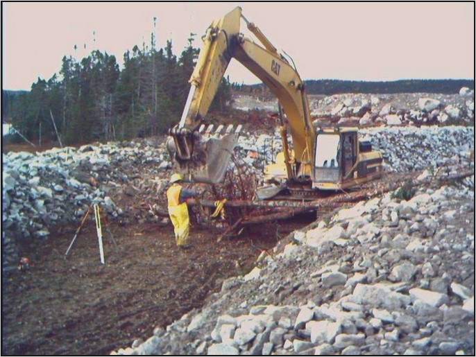
Figure 54. Construction of man-made riffle pool sequences
9.10.3 Fishways and side channels
Spawning channels and fishways are major projects and thus are outside the scope of the present manual (Figure 55). Further information on fishways and side channels can be obtained from Clay (1961); DFO et al. (1980) and Katopodis (1992).
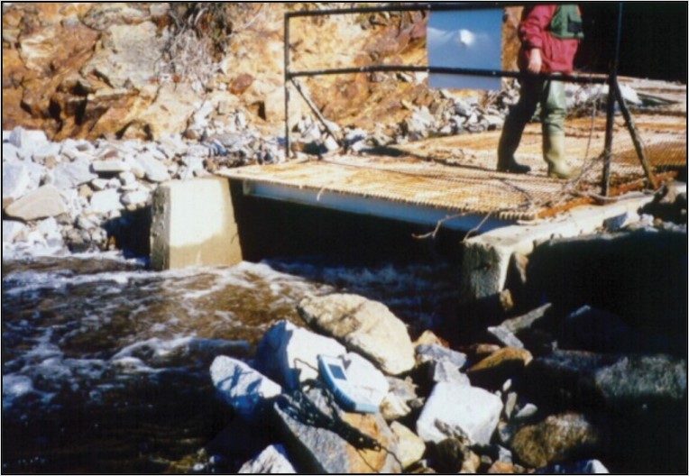
Figure 55. Outflow of typical vertical slot fishway
9.10.4 Combined techniques
Most techniques described in this manual can be used in various combinations with each other or for more than one desired result (Figure 56). The most effective known combination is the use of deflectors with stream bank cover on the opposite bank (Hunt 1988). Under local Newfoundland and Labrador conditions, the use of deflectors in conjunction with tree or brush shelters (or planting of low hanging vegetation) on the opposite bank may also be recommended. Deflectors also can be very effective when used with undercut banks. Rip rap is often used in combination with many of the techniques, such as low head barriers and wing deflectors, as they enhance stability of the structures and the shoreline.
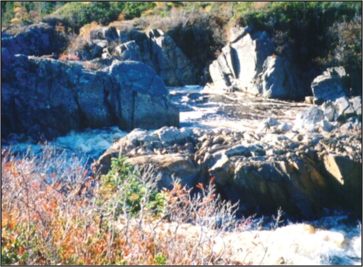
Figure 56. Blasted side channel around existing barrier to migration
10.0 Monitoring, maintenance and documentation
10.1 Monitoring
An important component of any restoration program is to develop an evaluation strategy to assess the effectiveness of restoration efforts and improve future programs; a component often lacking or inadequate in many programs (Keeley et al. 1996).
Proper monitoring allows:
- evaluation of the effectiveness of the methods and materials used in order to provide valuable feedback for future projects
- improves the quality of future designs and provides additional data on applicability
- assists in the determination of maintenance needs
A major consideration in evaluation of habitat restoration projects is the time frame required for habitat features to stabilize and it may take additional time for fish populations to respond to those conditions (Hunt 1976; Reeves et al. 1991; Scruton 1996).
It has been recommended in other jurisdictions that any evaluation or monitoring of a restoration or habitat construction project is continued for a time period up to twice the life cycle of the species in question to adequately document its response (Everest et al. 1991).
As well as monitoring for structural integrity, the best monitoring is one that assesses the resident fish population size and/or habitat availability before and after stream improvement. Population estimates should include all age groups and a large enough segment of the stream to be confident that any change in population size isn’t simply due to a change in distribution within the stream. Electrofishing is probably the most effective technique to use in small streams in Newfoundland and Labrador, however proper surveys require equipment and knowledge that isn’t readily available to most public groups (Figure 57). It may be necessary to engage an experienced/qualified environmental professional. A permit is required from DFO for electrofishing or any other survey technique that requires handling of fish. Therefore, it is recommended that any group interested in conducting electrofishing surveys contact the Newfoundland and Labrador DFO Licensing Team to obtain proper permits. See Contact information at the end of this manual.
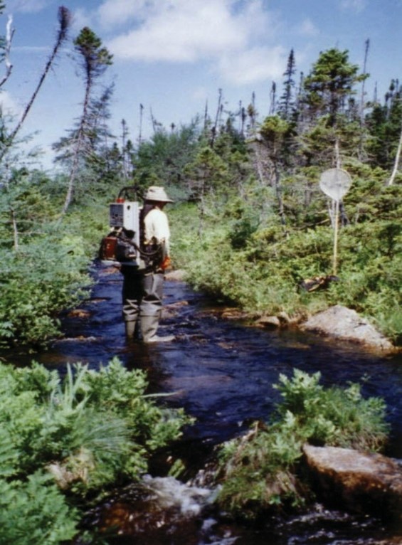
Figure 57. Electrofishing surveys of a small stream
Other, much less effective monitoring techniques involve:
- visual surveys
- walking or snorkeling
- monitoring the recreational fishery (surveys of angler rate of success)
These techniques are considerably less valuable than properly conducted electrofishing surveys since smaller fish, including young-of-the-year (probably the most dependable indicator of a healthy stream), are greatly underestimated or missed completely.
Surveys of physical habitat to judge habitat improvements can also be conducted but they should be related to information on distribution and abundance of fish in order to be most meaningful.
10.2 Maintenance
Maintenance requirements for each recommended technique are discussed briefly within their respective sections within this document. In general, techniques have been emphasized that, if properly applied, should be more or less maintenance free. Hulbert (1986) provides one of the few available analyses of maintenance costs over a long-time frame for a variety of stream improvement structures from New York state (138 in total). He found that after a 30-year period, the following percentages of each instream structure type required maintenance:
- pool diggers (low head barriers, ramp type) – 28%
- triangular deflectors (logs) – 20%
- deflectors (log crib) – 14%
- rip rap – 14%
- log bank stabilizers – 14%
- pyramid deflectors (logs) – 6%
However, most were relatively inexpensive to repair except for the bank stabilization material (both rip rap and logs).
10.3 Documentation
One of the most important aspects of stream improvement projects is the documentation of the entire process. Documentation of a project, from inception to completion, can provide valuable information to new or proposed projects and can highlight some of the effort and timeframes involved. For example, photo documentation of a revegetated shoreline would emphasize which plants grew best initially and which became the dominant cover once the site was stable.
Some of the methods to document projects and to provide a basis for which to evaluate effectiveness are:
- Project documentation
- location
- type
- materials used
- reporting
- results
- instream diagrams
- Photo documentation
- photo points are established and used to maintain a visual record of observed changes
- both pre and post treatment and 2 years after initial construction
- Record information, such as:
- basin
- stream name
- GPS location
- number
- date
- focal length
- Photos generally taken conservatively and from a higher location for repeatability
- Photo points should be:
- well described (and marked if possible)
- shot annually at the same flow and week of the year
- marked or sufficiently described for repeatability
- Digital recordings of instream projects may also be used to record project changes
11.0 Glossary
- Adult:
- Mature fish, able to spawn.
- Alevin:
- Young salmonid fish immediately after hatching, still with attached yolk sac that is used for nourishment.
- Algae:
- Microscopic plants that live in the water or attached to rocks.
- Anadromous:
- Refers to fish that spawn in freshwater but migrate to sea for feeding purposes.
- Bank stabilization:
- Erosion control pertaining to stream banks.
- Bedrock:
- Solid rock with no overlaying soil.
- Benthic:
- Relating or occurring at the bottom of a body of water; typically referring to where animals or plants live.
- Boulder:
- Rock over 25 cm in diameter.
- Buffer strip:
- Where a strip of natural vegetation is left in place between a road or other development and the stream.
- Channel:
- The area in which water runs or used to run.
- Channelization:
- Where man has created an artificial stream by straightening an existing channel or diverting the stream into a straight trench; commonly done in Newfoundland to lower the water table, reduce the risk of flooding and/or provide more land for development.
- Cobble:
- Rock between 6 and 25 cm in diameter.
- Cover:
- Where fish can find shelter from strong currents and predators and where suitable conditions of temperature and light occur.
- Caddisflies:
- Small to medium sized moth like insects with stream-dwelling larval stages (Order: Tricoptera), common food for trout and young salmon.
- Chironomids:
- Small insects called midges with aquatic larvae; common food for salmonids.
- Conifers:
- Trees the typically retain their needle-like leaves throughout the year, such as pine, larch and spruce. Larch is an exception in that this species will lose its leaves in the fall.
- Deflector:
- A stream restoration device that is used to deflect the current toward the opposite bank.
- Diatoms:
- Most common type of microscopic water-borne algae.
- Deciduous:
- Generally, refers to trees with relatively flat leaves that are lost in the fall.
- Ecosystem:
- That complex relationship between all life forms (bacteria, plants, animals, their biological processes (photosynthesis, respiration, waste excretion) and their physical environment (light, temperature, chemical factors). The term is often scaled down to the “stream ecosystem” or the “lake ecosystem”.
- Eddies:
- Those areas of a stream where the water currents run in a circular pattern, such as at the edges of structures like boulders. Eddies provide excellent habitat for salmonids.
- Enhancement:
- Includes those activities that increase the numbers of fish in a stream by technical measures. Methods and techniques used in salmonid enhancement work may include fishway construction, fish stocking, semi-natural rearing, adult transfers, spawning channel operation, egg incubation and barrier removal.
- Erosion:
- The process of weathering of rock and soil by wind and water. It can be of natural origin, such as in areas of very steep banks, spring water seepage and frost penetration or caused by man through removal of vegetation, topsoil or alterations to stream channel or stream banks. Excessive erosion of stream banks is detrimental to fish habitat primarily by destroying stream bank vegetation and by increasing sediment load in the stream that can settle out on and destroy salmonid spawning beds.
- Fingerlings:
- Term used to describe salmonids immediately after the alevin stage; also known as fry.
- Floodplain:
- That area adjacent to a stream that is often flooded during spring and fall high water periods.
- Foodweb:
- A diagram that represents all of the different feeding relationships that concern an individual species, group of species or an ecosystem; sometimes called food chain.
- Fungi:
- Primitive organisms that usually feed on plant or animal material, both living and dead; over 90,000 species in this group including mildew, yeast, and mushrooms. Extremely important in terms of transferring nutritional energy from lower life forms to higher ones.
- Gabion:
- Specially designed wire basket (galvanized or plastic coated) that can be filled with rocks to stabilize slopes.
- Gradient:
- Slope.
- Gravel:
- Rock between 0.2 and 0.4 cm in diameter.
- Grilse:
- One sea-winter salmon returning to their home rivers.
- Groundwater:
- Water from underground sources; found in porous rock and aquifers.
- Habitat:
- The total environment required by an organism to sustain its life. Fish habitat includes such things as water quality, food, shelter and space.
- Hybrid:
- A cross between 2 different species; often results in sterile offspring.
- Hydroseeding:
- A process by which fertilizer, grass seed and mulch are mechanically mixed and sprayed under pressure onto a substrate to be seeded.
- Hydrology:
- The study of water resources and the physical and geological processes that affect those resources.
- Invertebrates:
- Animals, such as insects, that lack internal skeletons.
- Juvenile:
- Immature fish.
- Landlocked:
- Salmonids that don’t run to sea. A landlocked salmon is known as an ouananiche in Newfoundland.
- Larvae:
- The young stages of insects; many insects lay their eggs in streams and have aquatic larvae that live on or near the bottom; insect larvae are primary sources of food for all salmonids, particularly for stream-dwelling trout and young salmon. Alevins are sometimes referred to as fish larvae.
- Low head barrier:
- A low dam.
- Meander:
- A curve in the stream's pattern.
- Meter (m):
- Equal to 3.28 feet. A centimeter (cm) is 1/100th of a meter or 0.39 inches.
- Molluscs:
- A group of invertebrates including clams, mussels, snails, and slugs.
- Nutrients:
- Those chemicals, such as silicate, phosphate and nitrate, that are essential for all types of plant growth. However, too much nutrient input is detrimental to the freshwater ecosystem since it over stimulates plant growth.
- Nymph:
- A young life stage for some types of insects (like mayflies); it follows the larval stage and is free-Iiving.
- Oligotrophic lake:
- Characterized by low primary productivity and low phosphorus concentrations. Many northern lakes are oligotrophic.
- Organic matter:
- Material derived from living organisms (such as from decaying plant leaves); it is an extremely important source of food energy in the small stream ecosystem.
- Ouananiche:
- Landlocked salmon.
- Parr:
- Juvenile salmonids; can usually be recognized by their size (6.0 – 12.0 mm) and the presence of parr marks (vertical bands) on the side of the fish.
- Pebble:
- Rock between 0.4 and 6 cm.
- Pesticides:
- Toxic chemicals used to kill unwanted plants (herbicides or weed killers) or animals; fenitrothion is a pesticide used against the spruce budworm. Many pesticides are toxic to young fish in varying degrees.
- pH:
- A logarithmic scale of 1 to 14 used to provide an indication of acidity (or conversely alkalinity); the lower the number, the more acid the liquid; pH of 7 is neutral.
- Plankton:
- Water borne organisms; phytoplankton is composed of plants, including diatoms; zooplankton is composed of animals, such as small copepod crustaceans. May be an important food source for salmonids in lakes and in the sea.
- Pool:
- A deep water area of the stream; a smooth, quiet area of the stream except at its head where the water flows into it.
- Production:
- Fish production is the increase in biomass of fish over time for a certain area usually expressed as g/m2/year.
- Rapids:
- Those areas of a large stream or river where the water is very fast-flowing, turbulent, mostly white, and the bottom is bedrock or boulders.
- Rearing habitat:
- Those areas of the stream in which juvenile fish carry out their life process. Salmonid rearing areas differ somewhat by species (brook trout prefer quieter water than salmon) but are generally characterized by shallow, riffle areas with boulder/cobble substrate and instream and stream bank vegetation.
- Redd:
- Gravel “nest” where salmonid fishes deposit their eggs.
- Restoration:
- The attempt to bring a stream back to its natural level of fish production after it has been impacted by man.
- Riffle:
- Shallow water where the surface is broken by gravel and cobble; flow is rapid.
- Rip rap:
- Blanket of rocks placed to protect a stream bank from erosion.
- Run:
- Deep, moderate to fast current flow that is much less turbulent than rapids.
- Salmonid:
- A member of the biological class of fish called Salmonidae; the class includes trout, salmon, char, whitefish and grayling.
- Saturation level:
- That concentration at which a liquid (like water) can except no additional gas (like oxygen); varies with temperature.
- Scouring:
- Erosion of stream bed or walls by water current.
- Sediment load:
- Refers to the amount of sediment that is carried in the water.
- Smolt:
- That life history stage of the Atlantic salmon that first runs to sea after losing parr marks; usually occurs in Newfoundland at between 2 and 5 years of age; silvery in color.
- Steelhead:
- Sea-run rainbow trout.
- Stream bed:
- Stream bottom.
- Substrate:
- Refers to the surface of the stream bed, such as gravel, cobble or boulder.
- Terracing:
- A technique used to stabilize steep slopes. It involves constructing a series of broad “steps” in the terrain.
- Terrestrial:
- Originating from the land.
- Thalweg:
- Deepest part of the main stream channel typically meandering back and forth across the wetted width of the stream as one progresses up or down stream.
- Transpiration:
- That process by which plants take up water from the ground and release it into the air as water vapour. A large, broad-leafed tree may transpire 500 gallons a day.
- Undercut banks:
- Where the current carves out some of the stream bank to create an overhang; salmonids, particularly brown trout, prefer such areas for cover over most other types of shelter. They usually occur on the outside of bends in grassy areas.
- Velocity:
- Term used to denote speed, such as water speed, expressed in m/s, km/h or mph.
- Water table:
- Natural, underground water storage area that contains water year-round; may or may not be located close to the surface.
12.0 Bibliography
- Amiro, P. 1993. Habitat measurement and population estimation of juvenile Atlantic salmon (Salmo salar). p.81 – 97. In R.J. Gibson and R.E. Cutting [ed.] Production of juvenile Atlantic salmon, Salmo salar, in natural waters. Canadian Special Publication of Fisheries and Aquatic Sciences 118, 262 p.
- Anderson, T.C. 1985. Proceedings of the Noel Paul's Atlantic salmon enhancement workshop 1982, 1983 and 1984. Rep. by Resource Develop. Section, Freshwater and Anadromous Fish Program, Fish. Res. Br., Fisheries and Oceans, St. John's. 130 p.
- Beak Consultants Limited. 1993. Evaluation of the effectiveness of man-made spawning and rearing habitat in reservoirs and streams. Rep. 9119 G 862, Canadian Electrical Association, Montreal, 116pp, 2 appendices.
- Bley, P.W. 1987. Age, growth, and mortality of juvenile Atlantic salmon in streams: a review. U.S. Fish Wildl. Serv. Biol. Rep. 87(4). 25p.
- Bouwes, B., Weber, N., Jordan, C.E., Saunders, W.C., Tattam, I.A., Volk, C., Wheaton, J.M., and Pollock, M.M. 2016. Ecosystem experiment reveals benefits of natural and simulated beaver dams to a threatened population of steelhead (Oncorhynchus mykiss). Scientific Reports 6:1-12.
- Bradbury, C., Roberge, M.M., and Minns, C.K. 1999. Life History Characteristics of Freshwater Fishes Occurring in Newfoundland and Labrador, with Major Emphasis on Lake Habitat Characteristics. Can. MS Rep. Fish. Aquat. Sci. 2485:vii+150p.
- Buchanan, R.A., Scruton, D.A., Anderson, T. 1989. A technical manual for small stream improvement and enhancement in Newfoundland and Labrador. Canada-Newfoundland Inshore Fisheries Development Agreement, St. John’s, NL. 107pp.+appendices.
- Calkins, D.J. 1989. Winter habitats of Atlantic salmon, brook trout, brown trout and rainbow trout: a literature review. Special Report 8934, US Army Corps of Engineers, Cold Regions Research and Engineering Laboratory, Hanover, NH. 11p.
- Clarke, K.D., Scruton, D.A., Pennell, C.J., and Cote, D. 2001. A scientific evaluation of two habitat improvement projects for Atlantic salmon (Salmo salar) conducted within the Gander River watershed, Newfoundland, Canada. Can. Man. Rep. Fish. Aquat. Sci. No. 2575: v+16p.
- Clarke, K.D. and Scruton, D.A. 2003. Seal Cove River revisited: Evaluating the Performance of artificial fluvial salmonid habitat a decade after construction.
- Clay, C.H. 1961. Design of fishways and other fish facilities. Fisheries and Oceans Canada, Ottawa. 301 p.
- Conestoga-Rovers and Associates. 2015. The Office of Climate Change and Energy Efficiency, Government of Newfoundland and Labrador. Intensity-Duration-Frequency Curve Update for Newfoundland and Labrador. Retrieved from https://www.gov.nl.ca/ecc/files/publications-idf-curve-2015.pdf.
- Department of Transportation and Infrastructure. 2022. Division 6 – Specifications for Protection, Gov. Newfoundland and Labrador. 4 p. Available from https://www.gov.nl.ca/ti/files/Division-6-Combined.pdf
- DFO. 2019. Fish and Fish Habitat Protection Policy Statement.
- Duncan, S.L. 1984. Leaving it to beaver. Environment 26(3):41-45
- Everest, F.H., Sedell, J.R., Reeves, G.H., and Bryant, M.D. 1991. Planning and evaluating habitat projects for anadromous salmonids. Am Fish. Soc. Symp. 10:68-77.
- Erwin, K. L. (2009). Wetlands and global climate change: the role of wetland restoration in a changing world. Wetlands Ecology and management, 17(1), 71-84.
- Fausch, K.D. and Northcote, T.G. 1992. Large Woody Debris and salmonid habitat in a small coastal British Columbia stream. Canadian Journal of Fisheries and Aquatic Sciences 49:682-693.
- Fisheries Act, Revised Statutes of Canada [1985, c. F-14]. Retrieved from https://laws-lois.justice.gc.ca/eng/acts/f-14/.
- Fisheries and Oceans Canada, B.C., KWL and DBL. 1980. Stream enhancement guide. Fisheries and Oceans Canada, Ministry of Environment, Province of British Columbia, Kerr Wood Leidal Associates Ltd. and D.B. Lister and Associates Ltd. 82+ p.
- Fisheries and Oceans. 1988a. A guide for fish habitat improvement. Fisheries and Oceans, Gulf Fisheries Centre, Moncton, N.B. 104 p.
- Fisheries and Oceans Canada. 2006. Ecological restoration of degraded aquatic habitats: a watershed approach. DFO Oceans and Science Branch, Gulf Region. ISBN: 0-662-42818-8. 180p FISRWG (10/1998).
- Fisheries and Oceans Canada. 2022. Protection of Freshwater Fish Habitat in Newfoundland and Labrador. St. John’s, NL. Vi + 80p.
- FISRWG. 10/1998. Stream Corridor Restoration: Principles, Processes, and Practices. By The Federal Interagency Stream Restoration Working Group (FISRWG) (15 Federal agencies of the US gov’t). GPO Item No. 0120-A; SuDocs No. A 57.6/2:EN3/PT.653. ISBN-0-934213-59-3.
- Frissel, C.A. and Nawa, R.K. 1992. Incidence and causes of physical failure of artificial habitat structures in streams of western Oregon and Washington. N. Am. J. Fish. Manage. 122:182-197.
- Gosse, M.M., Power, A.S., Hyslop, D.E. and Pierce, S.L. 1998. Guidelines for Protection of Freshwater Fish Habitat in Newfoundland and Labrador. 113 p.
- Harshbarger, T.J. 1975. Factors affecting regional trout stream productivity. In: Proceedings, South-eastern Trout Resource: Ecology and Management Symposium. U.S. Department of Agriculture, South-eastern Forest Experiment Station, Asheville, North Carolina, p11-27.
- Hulbert, P.J. 1986. Longevity and maintenance requirements of stream improvement structures in New York waters. In: J.G. Miller, J.A. Arwayand, R.F. Carline (Eds.). Fifth Trout Stream Habitat Improvement Workshop, Lock Haven University, Lock Haven, Penn. Sponsored by Amer. Fish. Soc., Penn. Fish Comm., Sport Fishery Research Found., Trout Unlimited, and U.S. Forest Service.
- Hunt, R.L. 1976. A long-term evaluation of trout habitat development and its relation to improving management-oriented research. Trans Am. Fish. Soc. 105:361-364.
- Hunt, R.L. 1988. A compendium of 45 trout stream habitat development evaluations in Wisconsin during 1953-1985. Wisc. Dept. Nat. Res. Tech. Bull. 162:81pp.
- Indian Bay Ecosystem Corporation. 2015. Native Plants of Newfoundland and Labrador. Taken from website: https://indianbayecosystem.files.wordpress.com/2015/10/photos-characteristics-of-common-nl-plants.pdf.
- Katopodis, C. 1992. Introduction to Fishway Design. Freshwater Institute, Central and Arctic Region, Fisheries and Oceans Canada, 501 University Crescent, Winnipeg, Manitoba.
- Keeley, E.R. and Slaney, P.A. 1996. Quantitative measures of rearing and spawning habitat characteristics for stream-dwelling salmonids: guidelines for habitat restoration. Province of British Columbia, Ministry of Environment, Lands and Parks and Ministry of Forests. Watershed Restoration Project Report No. 4.
- Keeley, E.R., Slaney, P.A., Zaldokas, D. 1996. Estimates of production benefits for salmonid fishes from stream restoration initiatives.
- Kemp, P.S., Worthington, T.A., Langford, T.E.L., Tree, A.R.J. and Gaywood, M.J. 2012. Qualitative and quantitative effects of reintroduced beavers on stream fish. Fish and Fisheries 13(2):158-181.
- Memorial University of Newfoundland. 2021. Gardening Information: Gardening with Natives. Taken from Botanical Garden website: https://www.mun.ca/botgarden/learn/gardeninginformation.php#natives.
- Mills, L.S., Soulé, M.E. and Doak, D.F. 1993. The keystone-species concept in ecology and conservation. BioScience 43(4):219-224.
- Montgomery, D.M., Buffington, J.M., Smith R.D., Schmidt, K.M. and Pess, G. 1995 Pool Spacing in Forest Channels. Water Resources Research. Vol. 31. No. 4. Pages 1097-1105. April 1995.
- Mulholland, P. J., Best, G. R., Coutant, C. C., Hornberger, G. M., Meyer, J. L., Robinson, P. J., ... and Wetzel, R. G. (1997). Effects of climate change on freshwater ecosystems of the south-eastern United States and the Gulf Coast of Mexico. Hydrological Processes, 11(8), 949-970.
- Naiman, R.J., Melillo, J.M. and Hobbie, J.E. 1986. Ecosystem alteration of boreal forest streams by beaver (Castor canadensis). The Ecological Society of America 67(5):1254-1269.
- Newbury, R.W. and Gaboury, M.C. 1993. Stream Analysis and Fish Habitat Design: A Field Manual. Newbury Hydraulics Ltd. British Columbia, Canada.
- O’Connell, M.F. and Dempson, J.B. 2002. The biology of arctic charr, Salvelinus alpinus, of Gander Lake, a large, deep, oligotrophic lake in Newfoundland, Canada. Environmental Biology of Fishes 64:115-126.
- Ontario Ministry of Natural Resources and Watershed Science Center. 2002. Adaptive Management of Stream Corridors in Ontario: Natural Hazards Technical Guides. Trent University, Watershed Science Centre.
- Pollock, M.M., Pess, G.R., Beechie, T.J. and Montgomery, D.R. 2004. The importance of beaver ponds to coho salmon production in the Stillaguamish River Basin, Washington, USA. North American Journal of Fisheries Management 24(3):749-760.
- Raleigh, R.F. 1982. Habitat Suitability Index Models: Brook Trout. U.S. Department of Interior, Fish and Wildlife Service, FWS/OBS-82/10.24.
- Raleigh, R.F., Zuckerman, L.D. and Nelson, P.C. 1986. Habitat Suitability Index Models And Instream Flow Suitability Curves: Brown Trout, Revised. U.S. Fish Wildl. Serv. BioI. Rep. 82(10.124). 65 p.
- Reeves, G.H., Everest, F.H. and Sedell, J.R. 1991. Responses of anadromous salmonids to habitat modification: how do we measure them? Am. Fish. Soc. Symp. 10:62-67.
- Roni, P., Beechie, T.J., Bilby, R.E., Leonetti, F.E., Pollock, M.M. and Pess G.R. 2002. A review of stream restoration techniques and a hierarchical strategy for prioritizing restoration in Pacific Northwest watersheds. North American Journal of Fisheries Management 22(1):1-20.
- Rosell, F., Bozsér, O., Collen, P. and Parker, H. 2005. Ecological impact of beavers Castor fiber and Castor canadensis and their ability to modify ecosystems. Mammal Review 35(3-4):248-276
- Scott, W.B. and Crossman, E.J. 1998. Freshwater Fishes of Canada. Galt House Publications Ltd..
- Seavy, N. E., Gardali, T., Golet, G. H., Griggs, F. T., Howell, C. A., Kelsey, R., ... and Weigand, J. F. (2009). Why climate change makes riparian restoration more important than ever: recommendations for practice and research. Ecological Restoration, 27(3), 330-338.
- Scruton, D.A. 1996. Evaluation of the construction of artificial fluvial salmonid habitat in a habitat compensation project, Newfoundland, Canada. Regulated Rivers: Research and Management, 12:171-183.
- Scruton, D.A., Clarke, K.D., Anderson, T.C., Hodinott, A. 1996. A decade of salmonid habitat improvement in Newfoundland, Canada: What have we learned? International Council for the Exploration of the Sea, 1996 Annual Science Conference, ICES C.M. 1996/T17, Theme Session T.
- Scruton, D.A., Clarke, K.D., Anderson, T.C., Hoddinott, A.S., van Zyll DeJong, M.C. and Houston, K.A. 1997. Evaluation of habitat improvement and restoration initiatives for salmonids in Newfoundland, Canada. Can. Manuscr. Rep. Fish. Aquat. Sci. No. 2413
- The Rooms Provincial Museum. 2012. A Digital Flora of Newfoundland and Labrador Vascular Plants. A Digital Natural History of Newfoundland and Labrador. http://www.digitalnaturalhistory.com/flora.html.
- Thompson, S., Vehkaoja, M., Pellikka, J. and Nummi P. 2020. Ecosystem services provided by beavers Castor spp.. Mammal Review 51(1):25-39.
- Thorn, W.C. 1988. Brown trout habitat use in southeastern Minnesota and its relationship to habitat improvement. Minn. Dept. Nat. Res., Div. Fish Wildl. Investig. Rep. No.395. 28 p.
- Vannote, R.L. and Sweeney, B.W. 1980. Geographic analysis of thermal equilibria: a conceptual model for evaluating the effect of natural and modified thermal regimes on aquatic insect communities. The American Naturalist 115(5):667-695.
- Wathen, G., Allgeier, J.E., Bouwes, N., Pollock, M.M., Schindler, D.E. and Jordan, C.E. 2019. Beaver activity increases habitat complexity and spatial partitioning by steelhead trout. Canadian Journal of Fisheries and Aquatic Species 76(5):1086-1095.
- Wentworth, C.K. 1922. A Scale of Grade and Class Terms for Clastic Sediments. The Journal of Geology 30(5): 377–392.
- Wetzel, R.G. 1975. Limnology. W.B. Saunders Co., Philadelphia. 743 p.
Appendix A
| Plant type | Scientific name |
|---|---|
| Trees | |
White Spruce |
Picea glauca |
Black Spruce |
Picea mariana |
Balsam Fir |
Abies balsamea |
Red Pine |
Pinus resinosa |
White Pine |
Pinus strobus |
Red Maple |
Acer rubrum |
Mountain Maple |
Acer spicatum |
White Birch (paper birch) |
Betula papyrifera |
Yellow Birch |
Betula alleghaniensis |
Chokecherry |
Prunus virginiana |
American Mountain Ash (Dogberry) |
Sorbus americana/decora |
| Shrubs | |
Bearberry |
Arctostaphyllos uva-ursi |
Bayberry |
Myrica pensylvanica |
Bunchberry |
Cornus canadensis |
Red-osier Dogwood |
Cornus sericea |
Pagoda Dogwood |
Cornus alternifolia |
Common Juniper |
Juniperus communis |
Creeping Juniper |
Juniperus horizontalis |
Purple Chokeberry |
Aronia floribunda |
Virginia wild rose/Northern wild rose |
Rosa virginiana/acicularis |
Bush honeysuckle |
Diervilla lonicera |
Rhodora |
Rhododendron canadense |
Highbush Cranberry |
Viburnum trilobum |
Northern wild raisin |
Viburnum cassinoides |
Winterberry holly |
Ilex verticillata |
Chuckley-pear |
Amelanchier |
Red Elderberry |
Sambucus pubens/racemosa |
Dwarf Birch/Newfoundland Dwarf Birch |
Betula pumila/michauxii |
Wilton Carpet Juniper/Trailing Juniper |
Juniperus horizontalis 'Wiltonii' |
Grey Alder |
Alnus incana |
Wild Raspberry |
Rubus idaeus |
Squashberry |
Viburnum edule |
Lowbush Blueberry |
Vaccinium angustifolium |
Blueberry Northland |
Vaccinium corymbosum |
Canadian Serviceberry |
Amelanchier canadensis |
White Meadowsweet |
Spiraea alba var. latifolia |
Black Crowberry |
Empetrum nigrum |
Canadian Yew |
Taxus canadensis |
Sweet Gale |
Myrica gale |
Cleavers |
Galium aparine |
| Ferns | |
Maidenhair fern |
Adiantum aleuticum |
Lady fern |
Athyrium filix-femina |
Wood fern |
Dryopteris species |
Ostrich fern |
Matteucica struthiopteris |
Cinnamon ferns |
Osmunda cinnamomea |
Royal fern |
Osmunda regalis |
Beech fern |
Phegopteris connectilis |
Holly fern |
Polystichum braunii |
New York fern |
Thelypteris noveboracens |
| Perennials | |
Joe-pye weed |
Eutrochium maculatum |
Canada burnet |
Sanguisorba canadensis |
Blue Flag Iris |
Iris versicolor |
Marsh Marigold |
Caltha palustris |
Goldenrods (rough stemmed) |
Solidago species (rugosa) |
Asters (purple stemmed) |
Symphyotrichum species (puniceum) |
Meadowrue |
Thalictrum pubescens |
Wild Strawberry |
Fragaria vesca |
Creeping Snowberry |
Gaultheria hispidula |
| Shade | |
Bluebead lily |
Clintonia borealis |
Wild lily-of-the-valley |
Maianthemum canadense |
Twisted stalk |
Streptopus species |
Baneberry |
Actaea rubra |
Star-flowered False Solomon’s-seal |
Maianthemum stellatum |
| Alpines | |
Pussytoes |
Antennaria species |
Hyssop-leaved fleabane |
Erigeron hyssopifolius |
Violets |
Viola species |
Balsam ragwort |
Packera pauperculus |
Dwarf goldenrod |
Solidago hispida/multiradiata |
Harebell |
Campanula rotundifolia |
Beach-head iris |
Iris hookeri |
Roseroot |
Rhodiola rosea |
Blue-eyed grass |
Sisyrinchium angustifolium |
Crant’z cinquefoil |
Potentilla crantzii |
Encrusted saxifrage |
Saxifraga paniculata |
| Common non-native plants | |
Canada Thistle |
Cirsium arvense |
Coltsfoot |
Tussilago farfara |
Japanese Knotweed |
Fallopia japonica |
St. John’s Wort |
Hypericum perforatum |
Purple Loosestrife |
Lythrum salicaria |
Grass species (Family Poaceae) native to NL (information taken from A Digital Flora of Newfoundland and Labrador Vascular Plants website (The Rooms Provincial Museum. 2012):
- Agrostis capillaris
- Agrostis scabra
- Agrostis stolonifera
- Alopecurus pratensis
- Ammophila breviligulata
- Anthoxanthum nitans subsp. nitans
- Anthoxanthum odoratum
- Arctopoa eminens
- Avena sativa
- Brachyelytrum aristosum
- Bromus ciliatus
- Bromus inermis
- Calamagrostis canadensis
- Calamagrostis cf. canadensis
- Calamagrostis pickeringii
- Cinna latifolia
- Cynosurus cristatus
- Dactylis glomerata
- Dichanthelium boreale
- Elymus repens
- Elymus virginicus var. virginicus
- Festuca brachyphylla subsp. brachyphylla
- Festuca frederikseniae
- Festuca prolifera var. prolifera
- Glyceria canadensis var. canadensis
- Glyceria fluitans
- Glyceria maxima
- Glyceria striata
- Leymus mollis subsp. mollis
- Lolium multiflorum
- Oryzopsis asperifolia
- Panicum miliaceum subsp. miliaceum
- Phalaris arundinacea
- Phleum alpinum
- Phleum pratense subsp. pratense
- Phragmites australis subsp. australis
- Poa alpina subsp. alpina
- Poa pratensis subsp. alpigena
- Setaria viridis var. viridis
- Spartina alterniflora
- Spartina patens
- Spartina pectinata
- Trisetum spicatum
Contact information
Regional Office: Fish and Fish Habitat Protection Program
Fisheries and Oceans Canada
80 East White Hills Road
P.O. Box 5667
St. John’s NL A1C 5X1
Phone: (709) 772-4140
Email: DFO.NLFFHPP-PPPHTNL.MPO@dfo-mpo.gc.ca
Regional Office: Licensing
Fisheries and Oceans Canada
80 East White Hills Road
P.O. Box 5667
St. John’s NL A1C 5X1
Email: NL-TN.Licensing@dfo-mpo.gc.ca
- Date modified: