
Coastal Environmental Baseline Program: Project sites map
Release date: November 2022
Description: Coastal Environmental Baseline Program: Project sites map
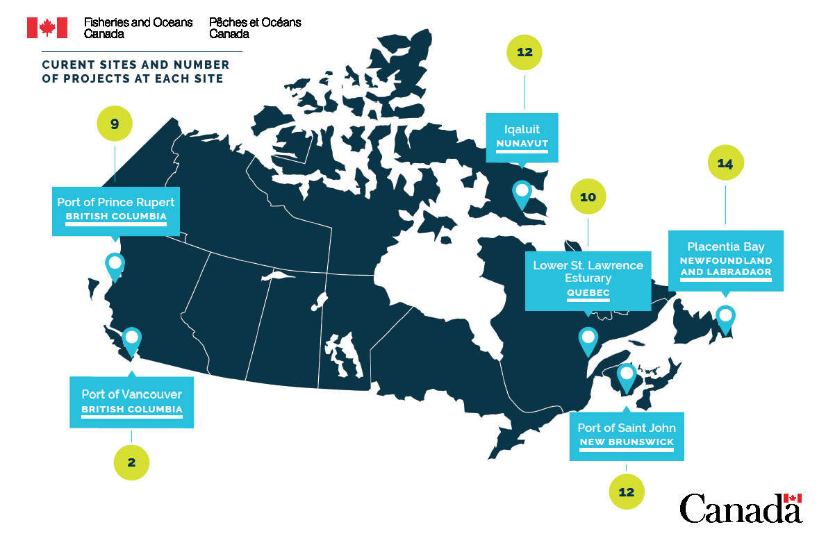
Current sites and number of projects at each site are represented by a map of Canada with the location of each site pinned, along with the name and number of projects:
- Port of Prince Rupert, located on the North Coast of British Columbia, has 9 projects
- Port of Vancouver, located on the south coast of British Columbia, has 2 projects
- Iqaluit, located in Nunavut in the northeast, has 12 projects
- Lower St. Lawrence Estuary, located in southeastern Quebec, has 10 projects
- Port of Saint John, located on the east coast in southern New Brunswick, has 12 projects
- Placentia Bay, located on the far east coast in Newfoundland, has 14 projects
Related link
- Date modified: