
Integrated Management Planning
Placentia Bay, Newfoundland and Labrador
Table of Contents
- Complete Text
- Integrated Management (IM)
- Why Placentia Bay?
- Introduction
- Coastal Landforms (Geomorphology)
- Community Based Coastal Resource Inventories
- Shipping Lanes and Water Depth (Bathymetry)
- Plants and Animals
- Fisheries and Aquaculture
- Ecological Reserves and Special Places
- Industry
- Current Status
- References
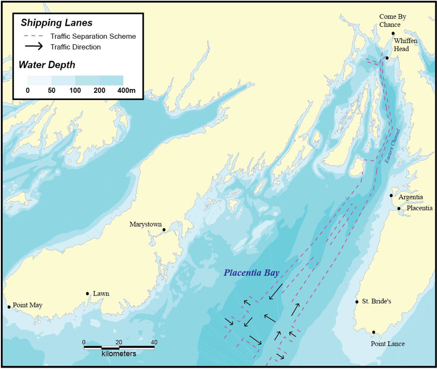
Shipping Lanes and Water Depth (Bathymetry)
The main shipping lane in Placentia Bay is a deep water, two-way route that passes through the Eastern Channel between Long Island and the Avalon Peninsula. All vessels over 20 m entering the bay report to the Canadian Coast Guard's Marine Communications and Traffic Services (MCTS). Traffic in Placentia Bay consists of tankers, ferries, container and bulk carriers, general cargo and fishing vessels. Major ports in the bay are Come By Chance, Whiffen Head, Argentia and Marystown.Footnote 16
The following table represents tanker traffic in and out of Placentia Bay for the years indicated.Footnote 3
| Year | Number of Tankers |
| 1992 | 346 |
| 1993 | 412 |
| 1994 | 185 |
| 1995 | 334 |
| 1996 | 387 |
| 1997 | 490 |
| 1998 | 453 |
| 1999 | 605 |
| 2000 | 718 |
| 2001 | 661 |
| 2002 | 1173 |
| 2003 | 1401 |
| 2004 | 1382 |
| 2005 | 1254 |
- Date modified: