
Integrated Management Planning
Placentia Bay, Newfoundland and Labrador
Table of Contents
- Complete Text
- Integrated Management (IM)
- Why Placentia Bay?
- Introduction
- Coastal Landforms (Geomorphology)
- Community Based Coastal Resource Inventories
- Shipping Lanes and Water Depth (Bathymetry)
- Plants and Animals
- Fisheries and Aquaculture
- Ecological Reserves and Special Places
- Industry
- Current Status
- References
Community-Based Coastal Resource Inventories
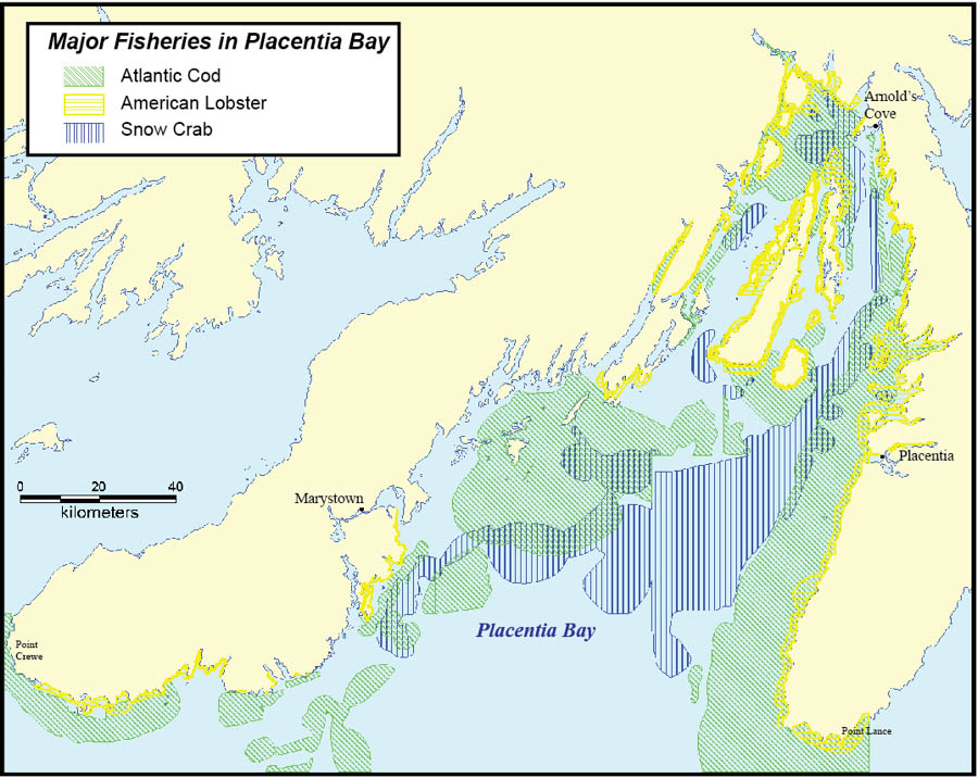
Fisheries and Oceans Canada (DFO) has been working with community groups since 1996 to document coastal fisheries resources as well as other information and data. This information has been collected through direct contact with individuals and stakeholders in coastal communities around the province. Knowledgeable people in the community were interviewed to identify areas where specific resources were known to occur. These areas were mapped on nautical charts and topographical maps. Additional information was collected related to the resources (e.g. season fished, gear used). This information was used to produce Community-Based Coastal Resource Inventories (CCRIs) and has been entered into a Geographic Information System using special computer software. DFO and project sponsors maintain a digital copy of this information.Footnote 14 An example of the information collected is presented in the accompanying map.
Information was collected and prepared through jointly sponsored projects between DFO and Regional Economic Development Boards (Schooner Regional Development Corporation, Avalon Gateway Regional Economic Development Inc.), local Development Associations (Trinity-Placentia Development Association), and educational institutions. Funding partners included Human Resources Development Canada (now known as Services Canada), Atlantic Canada Opportunities Agency, and Environment Canada.
- Date modified: