
Line-P Data 1956-2007
CTD data is Pressure, Temperature, Salinity, Transmissometer, and Oxygen (recent years).
Chemistry data is Oxygen and Nutrients.
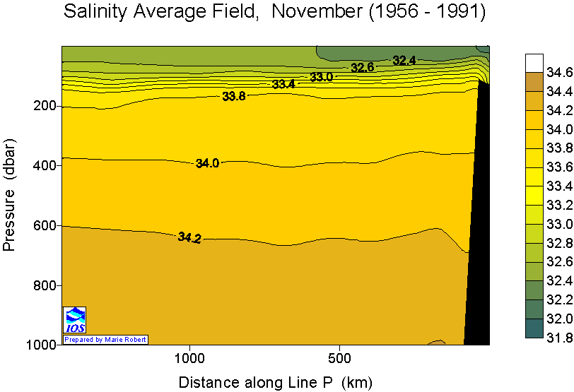
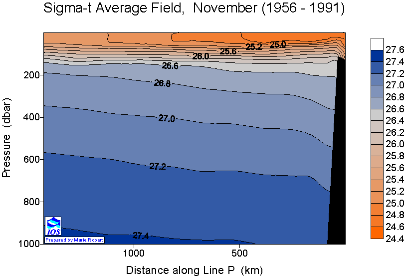
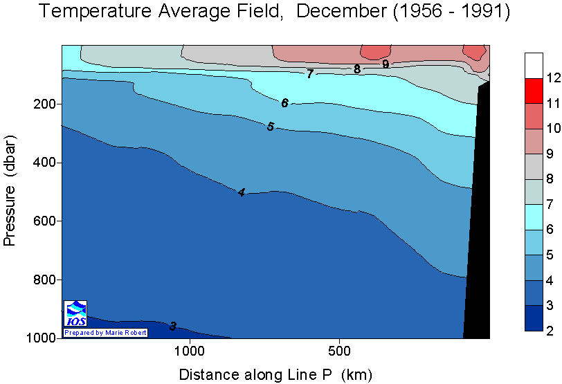
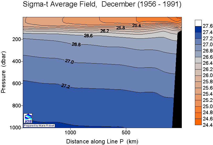
Station map in graphics is the map of stations sampled during that specific cruise. Anomaly plots are calculated from monthly station averages collected between 1956 and 1991. Data available is from 1956 to 2007.
Files are archived for download - all files for each year of data in a single .zip folder.
- 1956
- 1957
- 1958
- 1959
- 1960
- 1961
- 1962
- 1963
- 1964
- 1965
- 1966
- 1967
- 1968
- 1969
- 1970
- 1971
- 1972
- 1973
- 1974
- 1975
- 1976
- 1977
- 1978
- 1979
- 1980
- 1981
- 1982
- 1983
- 1984
- 1985
- 1986
- 1987
- 1988
- 1989
- 1990
- 1991
- 1992
- 1993
- 1994
- 1995
- 1996
- 1997
- 1998
- 1999
- 2000
- 2001
- 2002
- 2003
- 2004
- 2005
- 2006
- 2007
Line P monthly averages
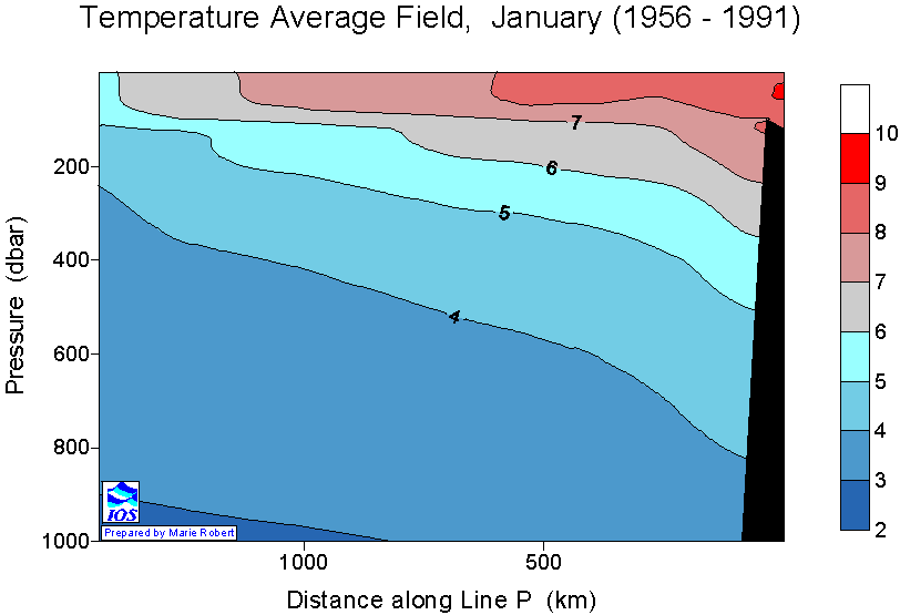
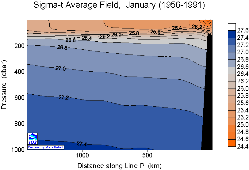
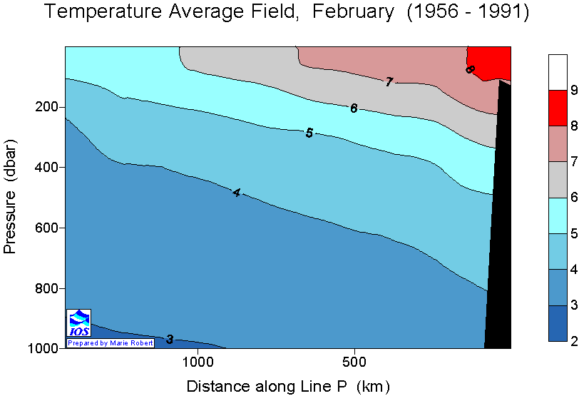
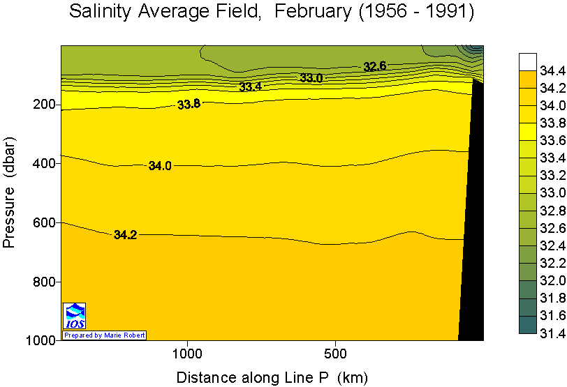
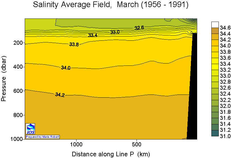
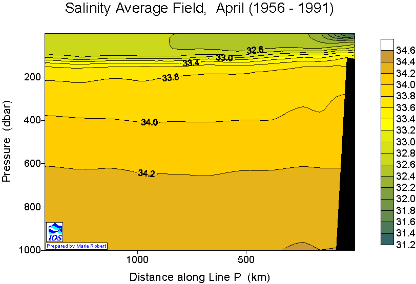
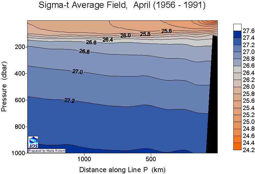
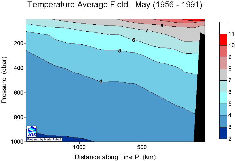
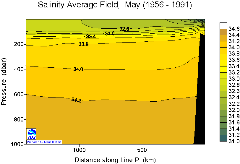
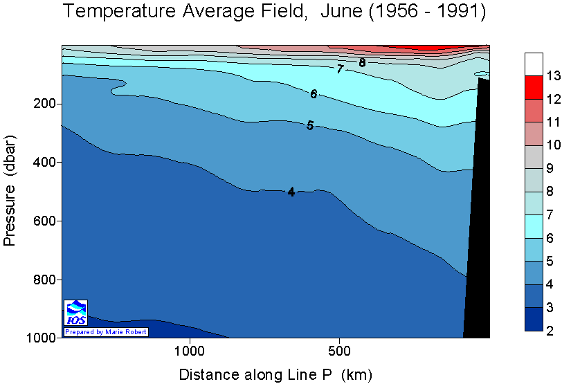
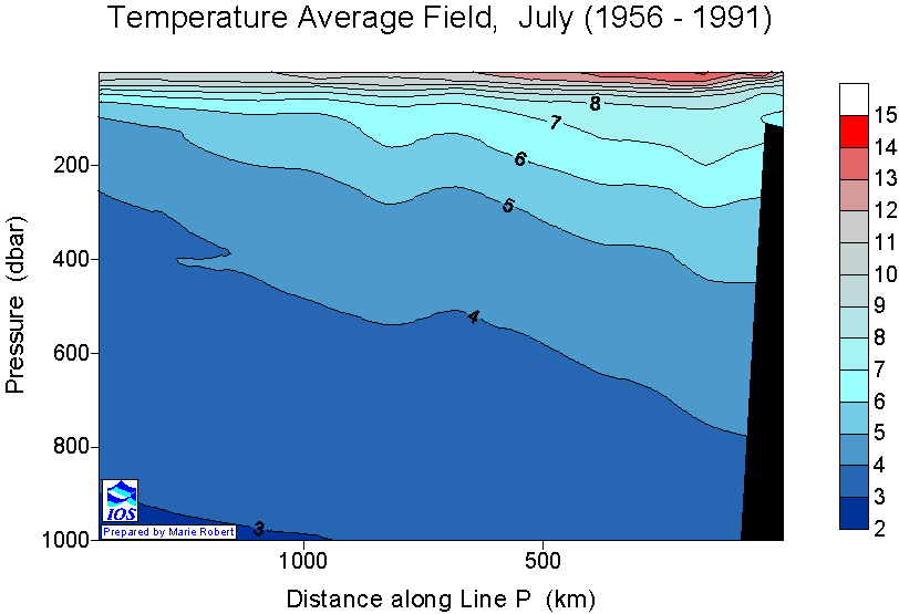
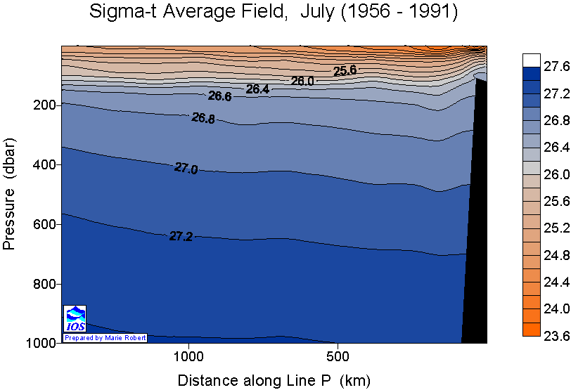
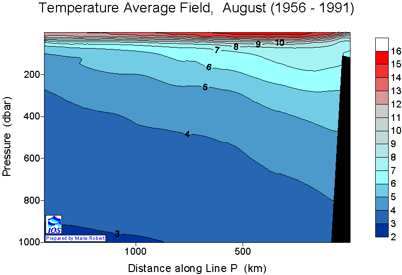
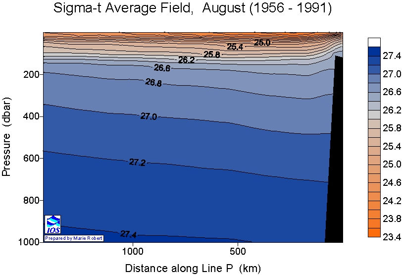
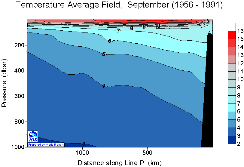
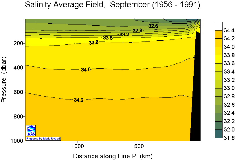
The following buttons allow you to display plots of temperature, salinity and sigma-t (density) averaged over all data gathered from 1956 to 1991.
| January | Temperature | Salinity | Sigma-t |
| February | Temperature | Salinity | Sigma-t |
| March | Temperature | Salinity | Sigma-t |
| April | Temperature | Salinity | Sigma-t |
| May | Temperature | Salinity | Sigma-t |
| June | Temperature | Salinity | Sigma-t |
| July | Temperature | Salinity | Sigma-t |
| August | Temperature | Salinity | Sigma-t |
| September | Temperature | Salinity | Sigma-t |
| October | Temperature | Salinity | Sigma-t |
| November | Temperature | Salinity | Sigma-t |
| December | Temperature | Salinity | Sigma-t |
Line P Temperature Anomaly data
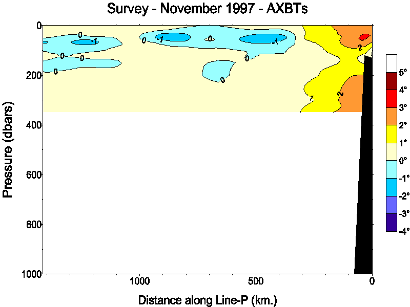
| AXBT Survey 97-52 - November 22,1997 |
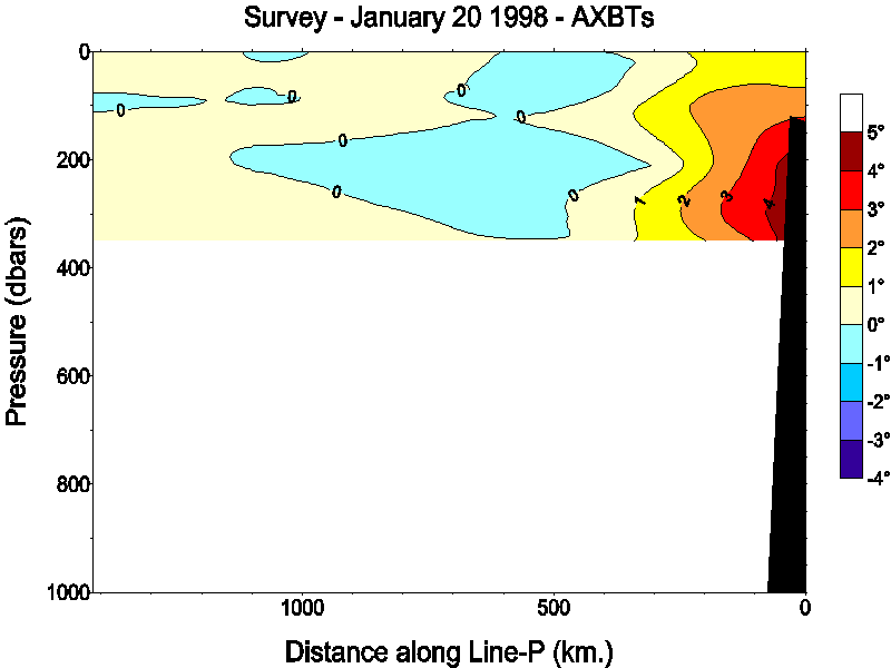
| AXBT Survey 98-32 - January 20,1998 |
Note: Temperature anomalies are calculated by subtracting the monthly mean values (calculated over the period 1956 to 1981) from the observed temperature values. Over the period of record, there is a trend to increased temperatures along Line P. As a result these plots tend to show a small positive temperature anomaly.
- Date modified: